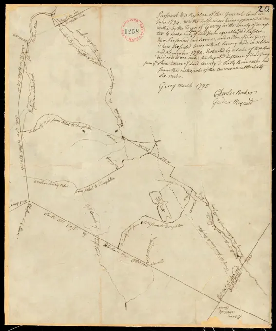
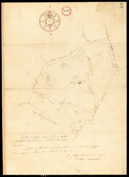
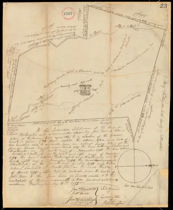
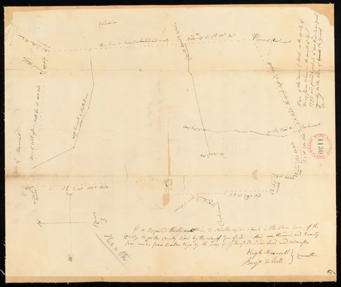
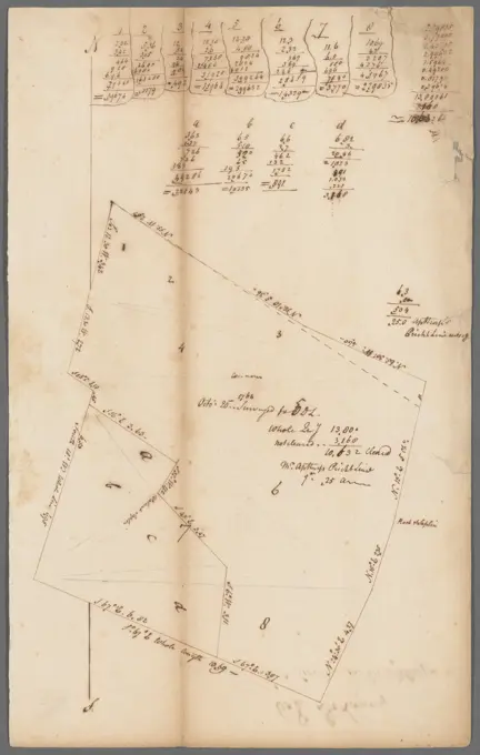
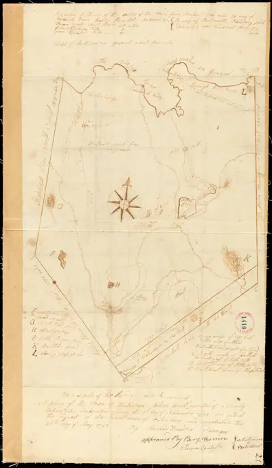
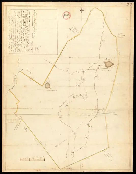
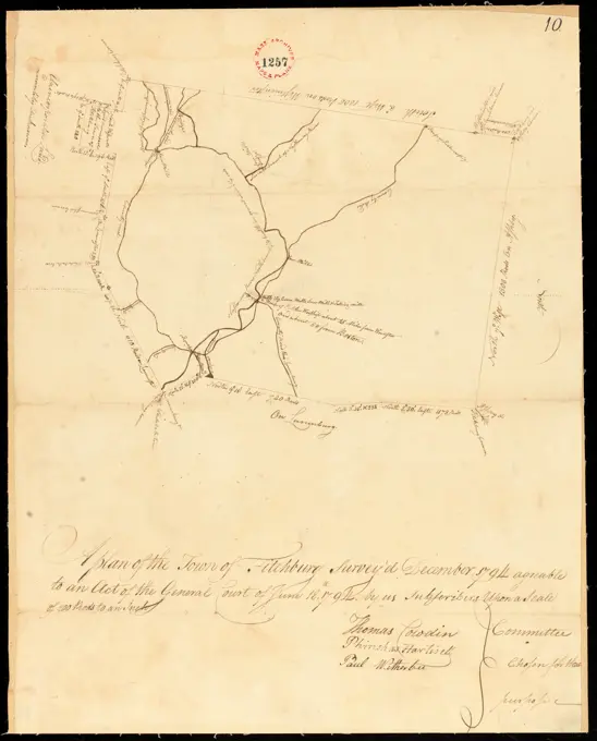
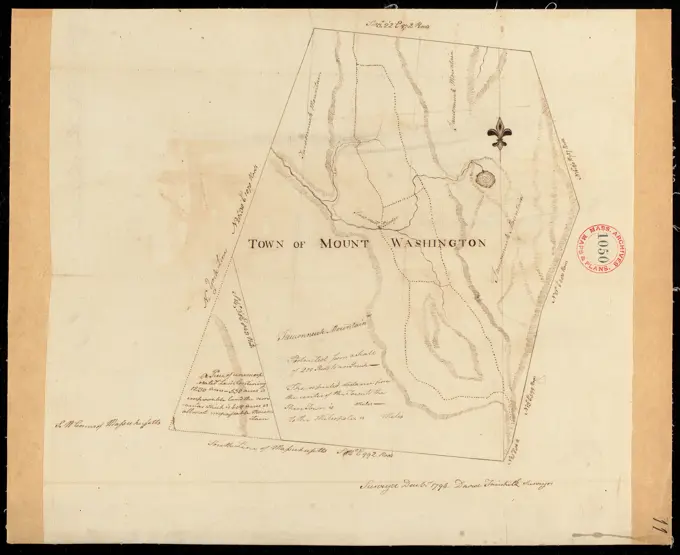
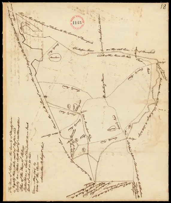
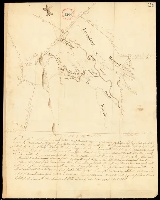
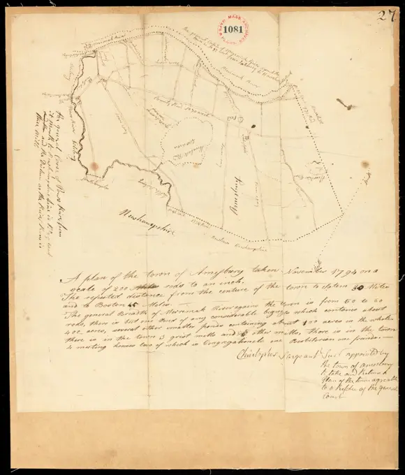
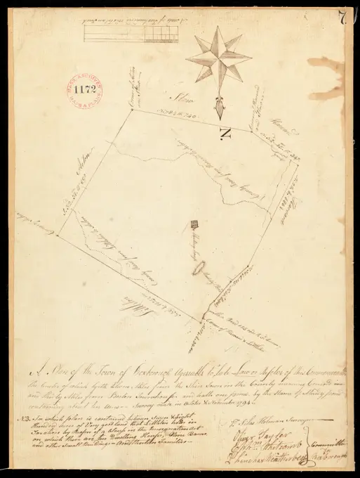
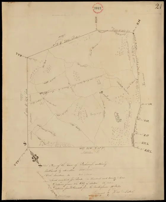
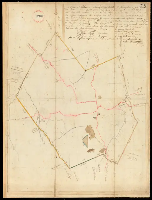
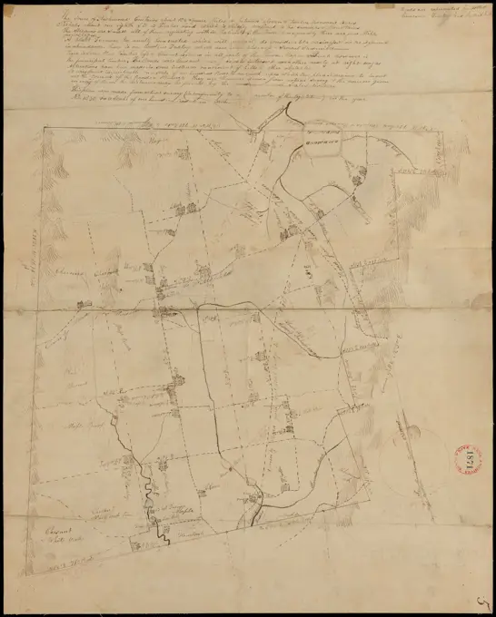
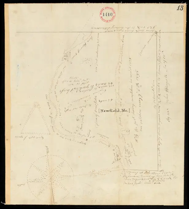
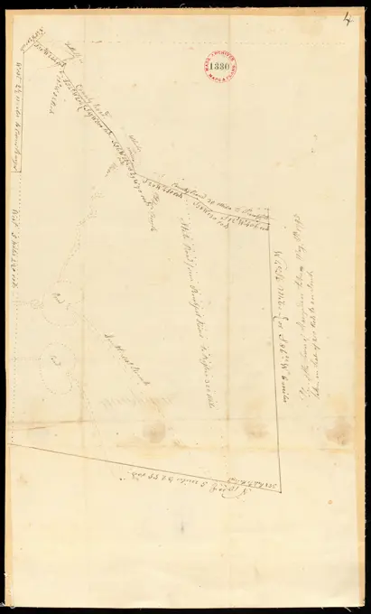
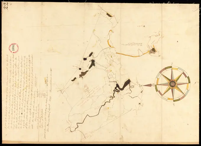
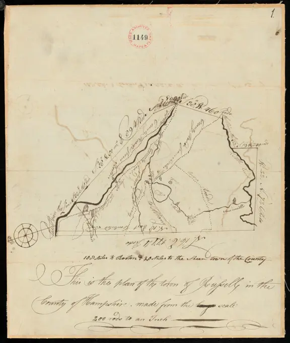
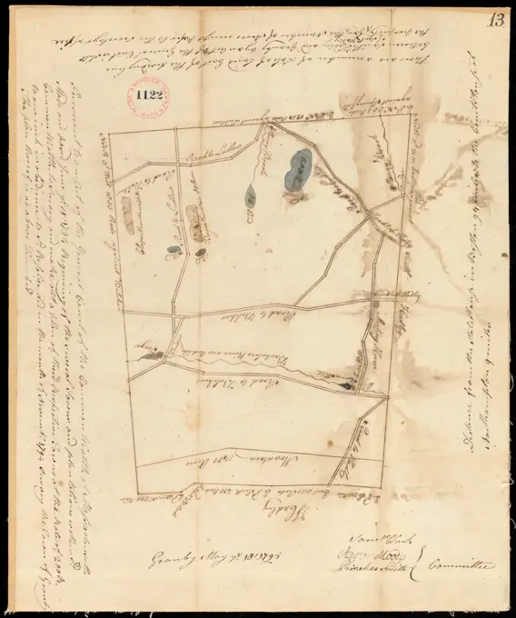
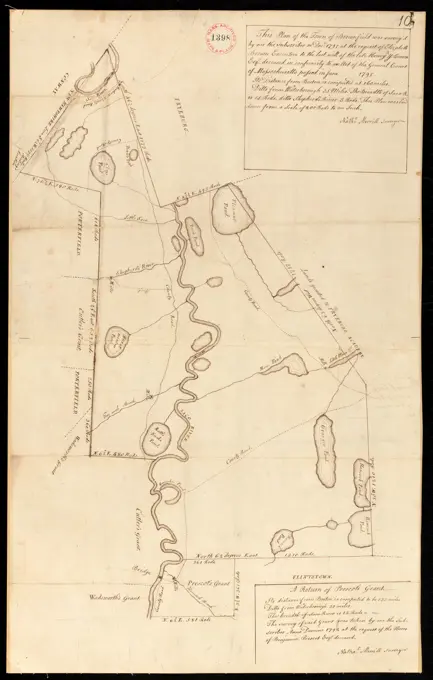
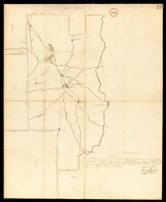
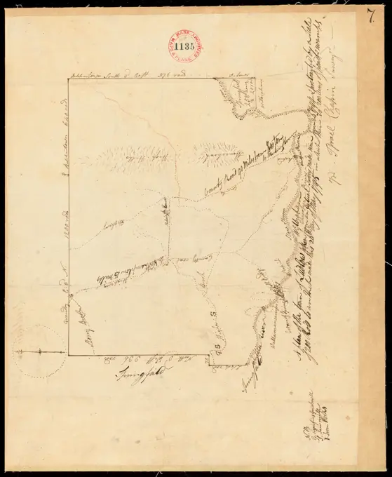
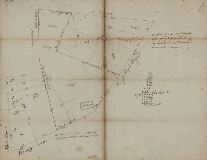
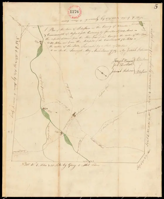
Early American Survey MapsHistorical surveys and plans of various towns in 18th-century Massachusetts and Maine, showing land divisions and geographic details. Plan of Marlborough, made by Andrew Peters, dated November 1794. ,. Massachusetts. Office of the Secretary of State 264 assets in this story6145-542686286145-542684376145-542684366145-505111086145-505117176145-487127646145-505629656145-505114976145-559555566145-487131766145-505628906145-542688976145-542685566145-505744056145-505628316145-505113766145-487129246145-559598826145-559558186145-487128456145-513864326145-505629066145-505113346145-487130776145-487129746145-542687636145-505113106145-505628576145-487132276145-505112936145-559162586145-487131446145-559162656145-487131916145-542687576145-505112216145-542687696145-551674096145-505115946145-505628066145-542686206145-487129136145-542687046145-487129806145-505114486145-551673906145-505111716145-505629536145-551674786145-542690366145-487132786145-513923976145-505629526145-542694736145-559552506145-559550176145-505115496145-485593126145-487128336145-505114916145-513862136145-551675806145-542688516145-485593616145-505116036145-487130416145-542687906145-505113606145-487130066145-505113226145-505628866145-487131136145-551674546145-505111896145-542685266145-485593596145-559163446145-551673986145-559557636145-559553866145-487131276145-487130756145-487129986145-559554256145-487128926145-559555896145-542684636145-542690486145-505112006145-505114416145-542689206145-487128854443-754672546145-559599116145-438183486145-487128436145-559557356145-505629396145-505116086145-55955626 PREVIOUS of 3 NEXT