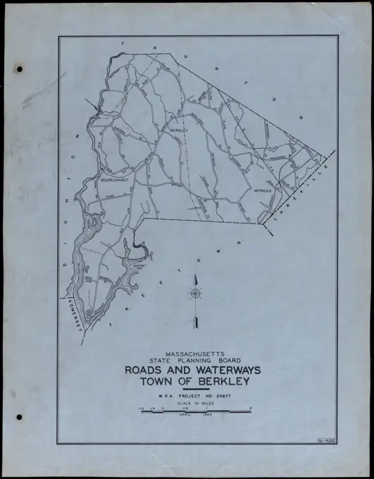
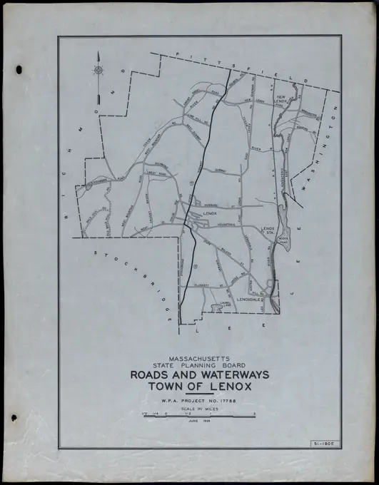
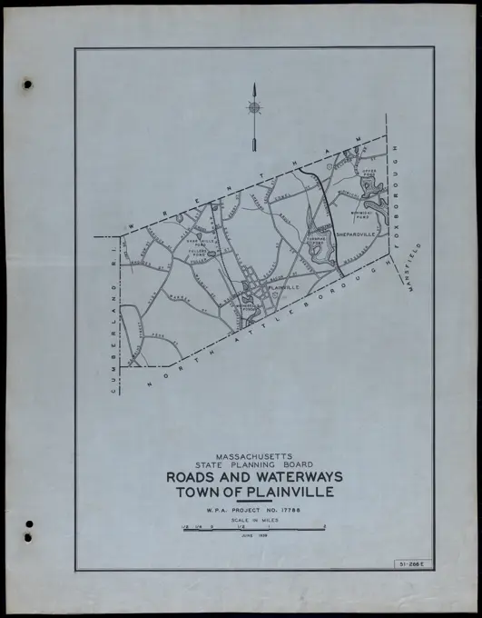
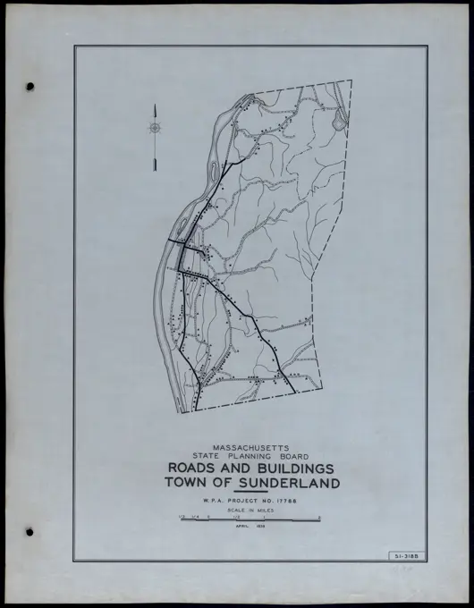
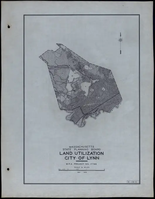
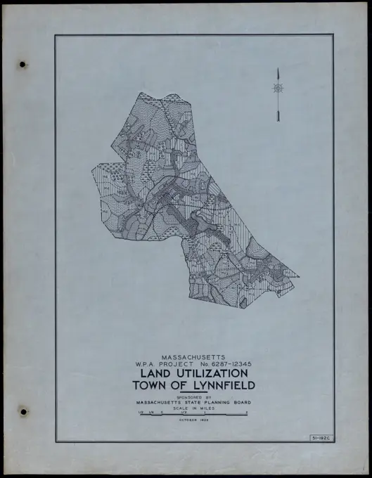
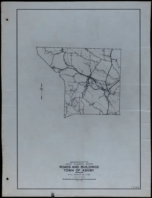
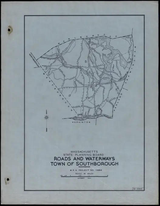
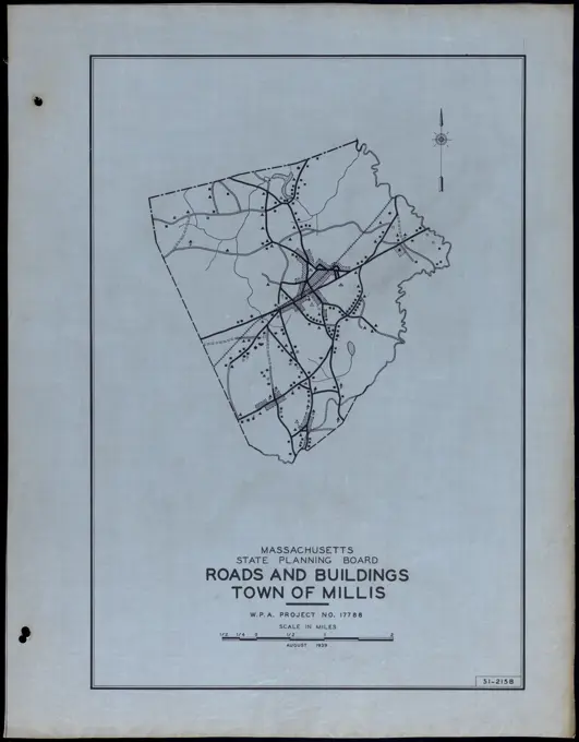
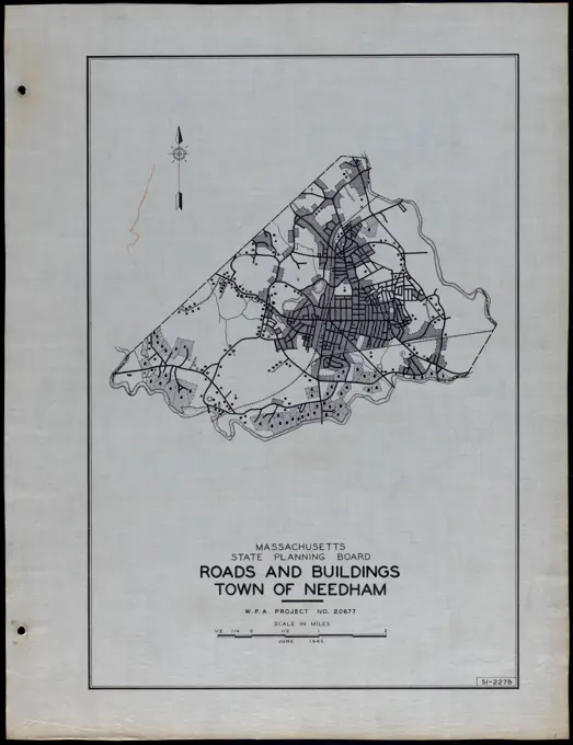
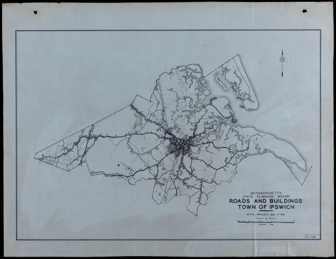
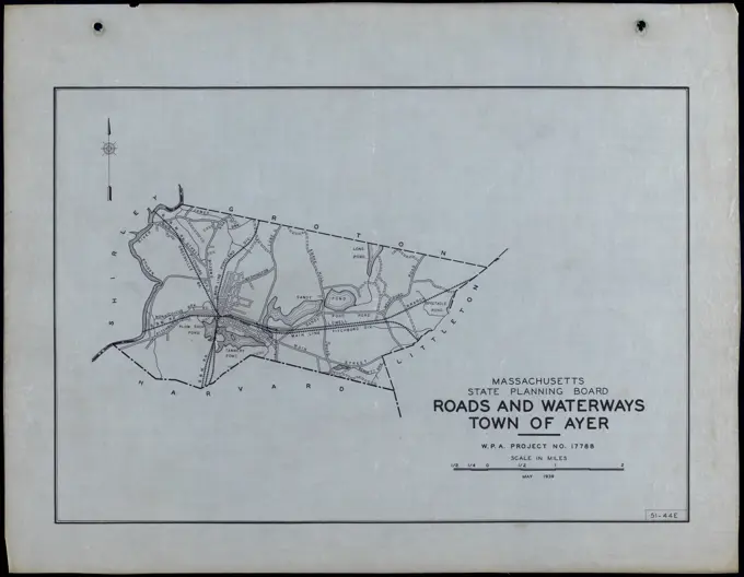
Historical Land Use MapsDetailed maps showing roads and land utilization for various towns in Massachusetts, highlighting historical urban planning and development. Roads and Buildings Town of Plymouth. Roads and Buildings Town of Plymouth 304 assets in this story6145-505633966145-513942116145-505156676145-588932086145-588920136145-588931536145-505637526145-588931046145-588940026145-513877586145-513884556145-505156386145-505637716145-588939416145-505633216145-505633056145-505504776145-505156166145-513871336145-588919776145-505632876145-513941656145-505632446145-505154946145-505630836145-505631486145-513870636145-513871516145-505633026145-588940066145-588920546145-505156666145-505633016145-513871306145-505236316145-513885556145-513870876145-505156446145-505632116145-588931796145-513877306145-505156046145-588920586145-505631976145-505154326145-505154746145-505156566145-513884796145-505631206145-505633616145-505156926145-505631966145-505639036145-513941006145-513885146145-588940396145-505639756145-588930666145-505633946145-588930726145-588920396145-505156896145-513870626145-505634186145-513870646145-588931236145-588920016145-513941956145-505632636145-505640336145-513871546145-505635336145-505640606145-505631046145-588920486145-505638926145-505156516145-588930586145-513884896145-505156116145-588940266145-588931356145-588932306145-513940806145-505630586145-505640586145-505504666145-513941736145-505155936145-588940366145-505195426145-505638776145-513942046145-513871116145-505629756145-505632256145-513871066145-588920156145-588932076145-51387100 PREVIOUS of 4 NEXT