Fine ArtVintageFootageSubscriptionBoardsFree ResearchPricing
  • Fine Art
  • Vintage
  • Footage
  • Subscription
  • Boards
  • Free Research
  • Pricing

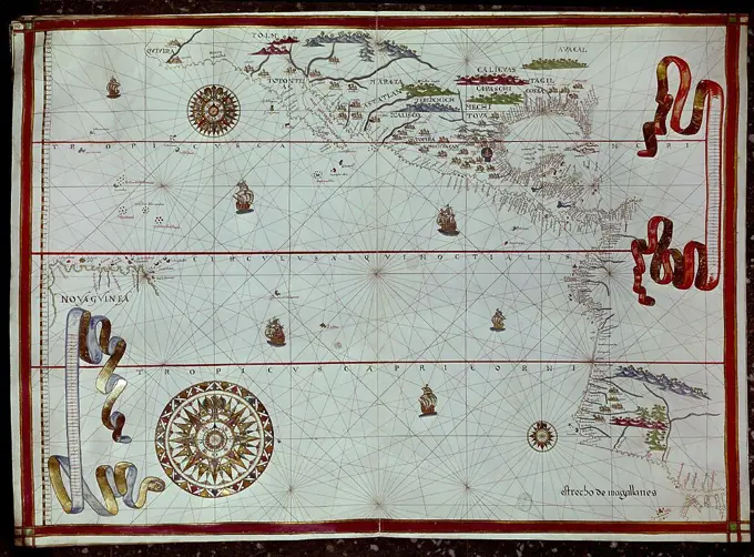
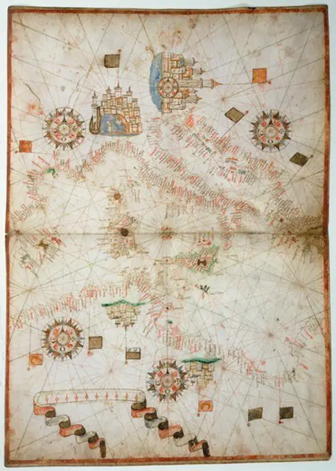
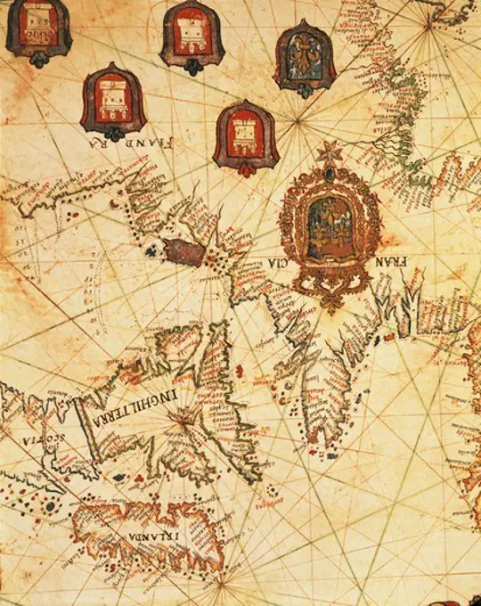
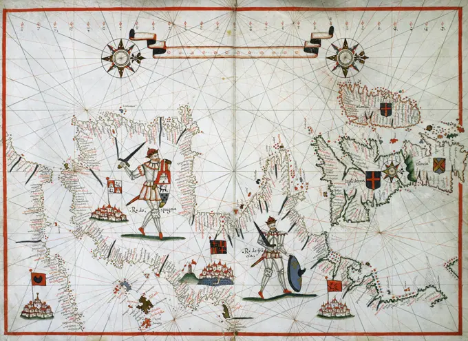
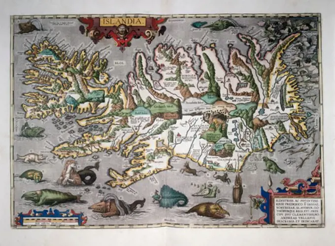
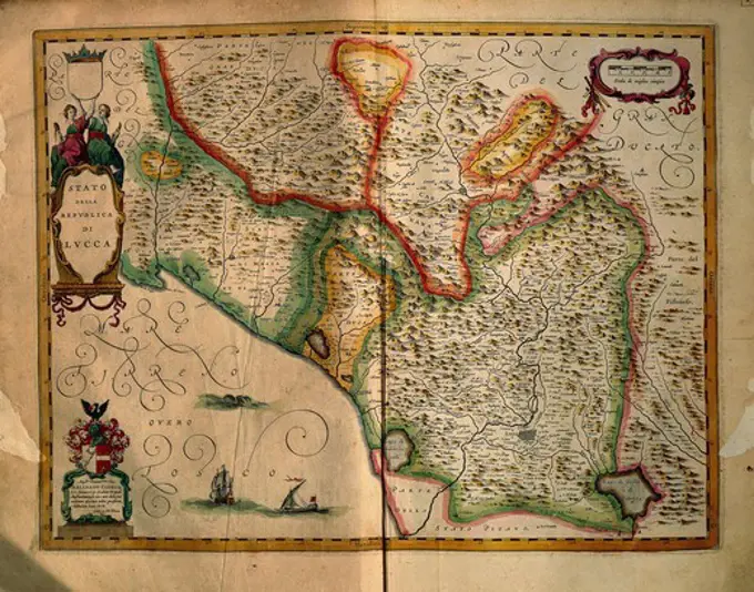
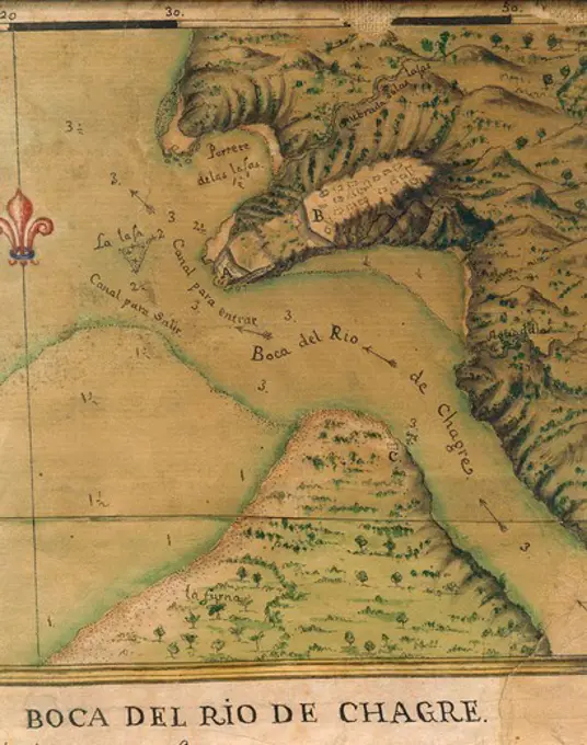
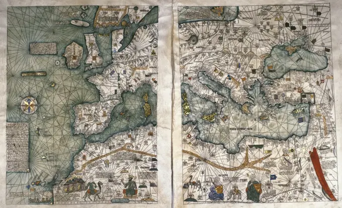
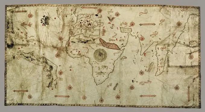
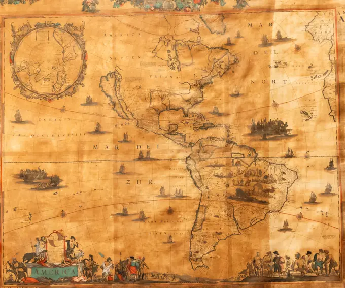
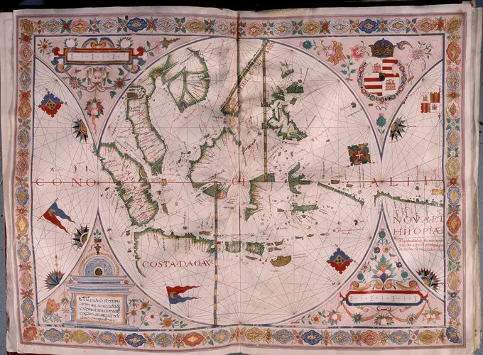
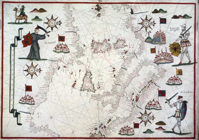
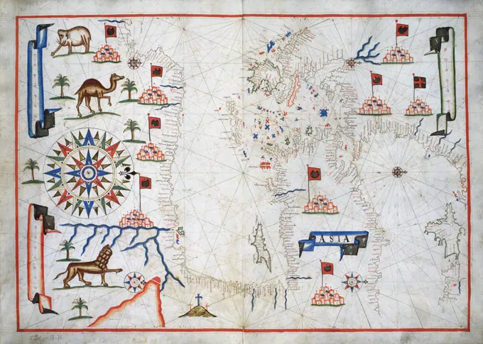
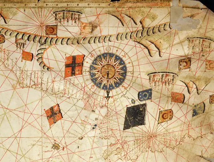
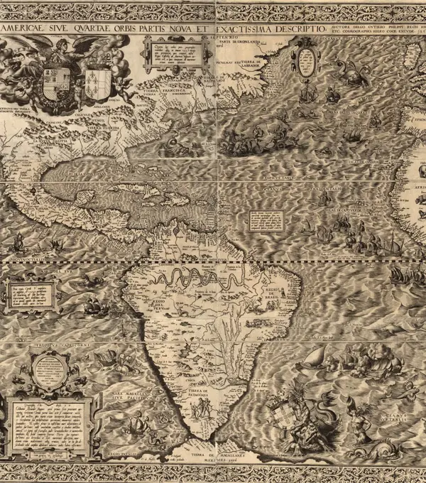
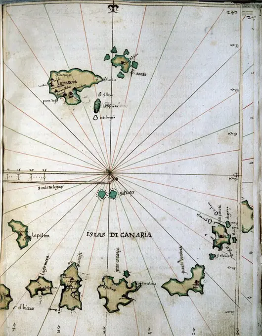
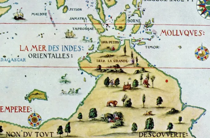
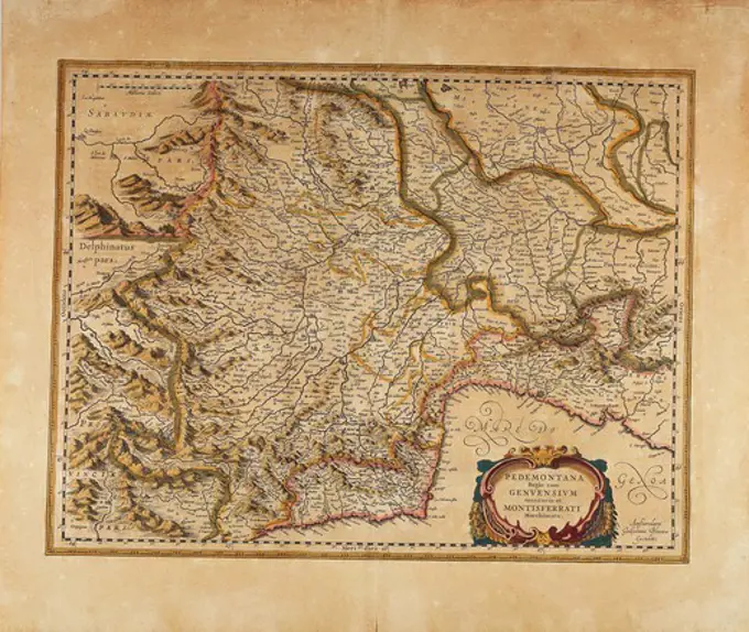
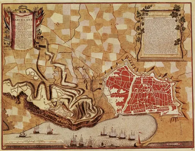
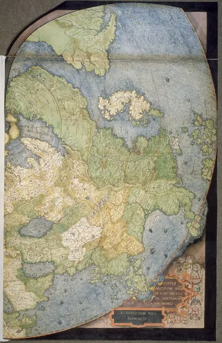
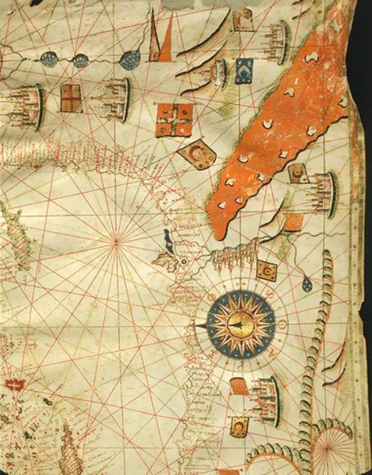
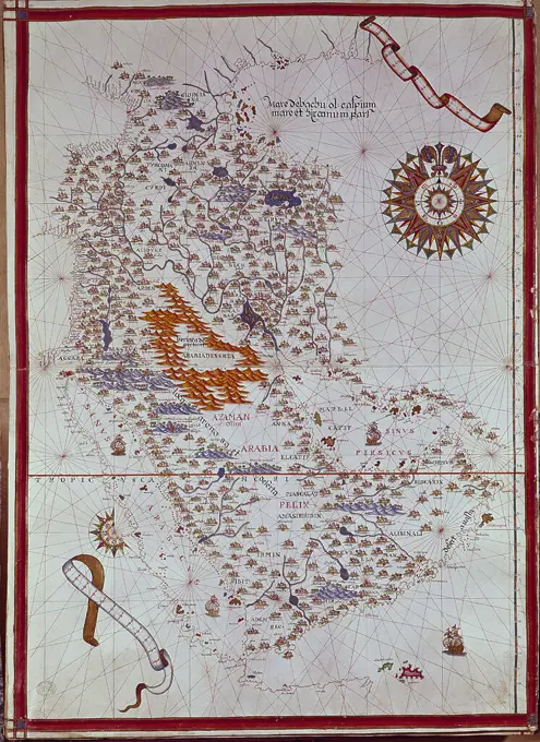
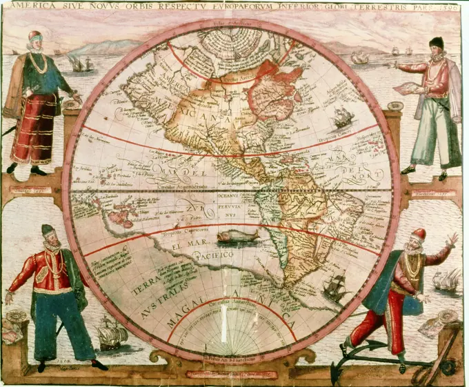
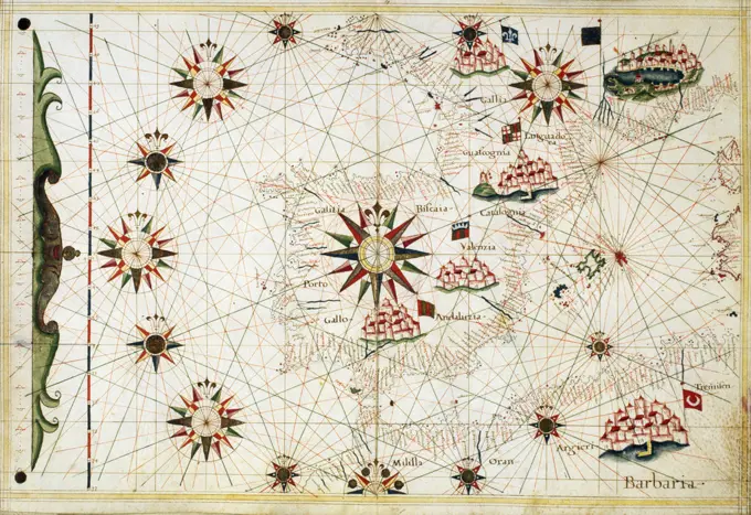
Historical Maritime Maps

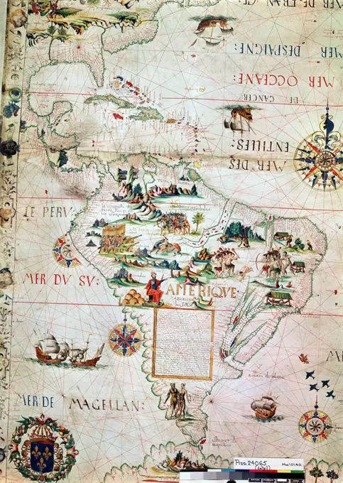
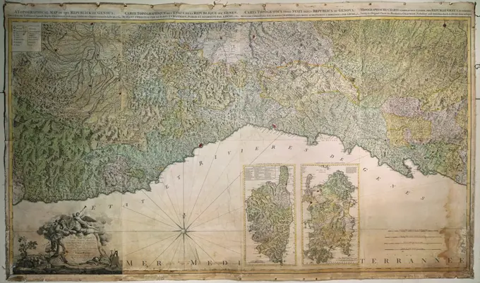
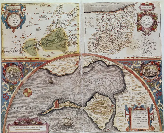
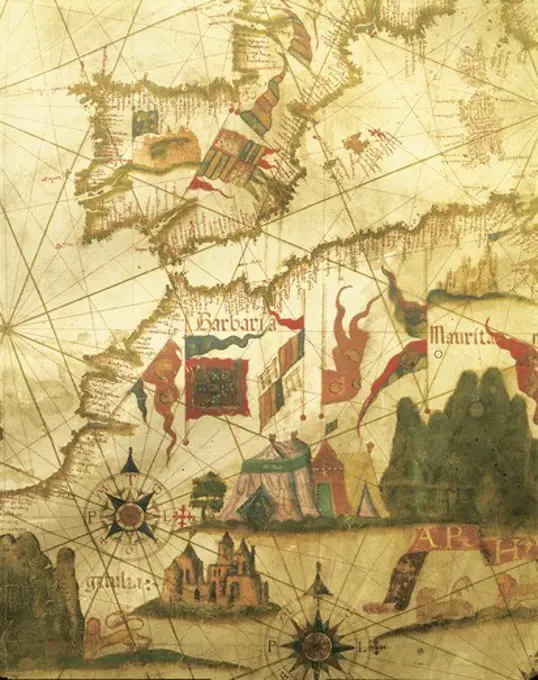
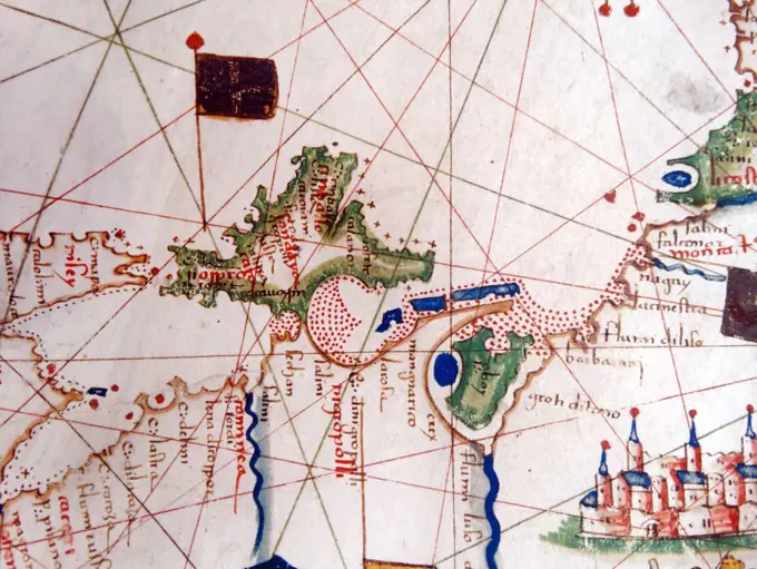
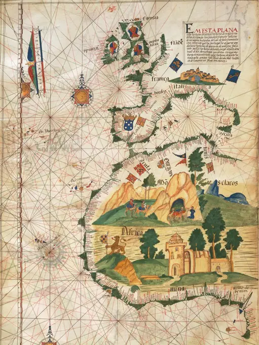
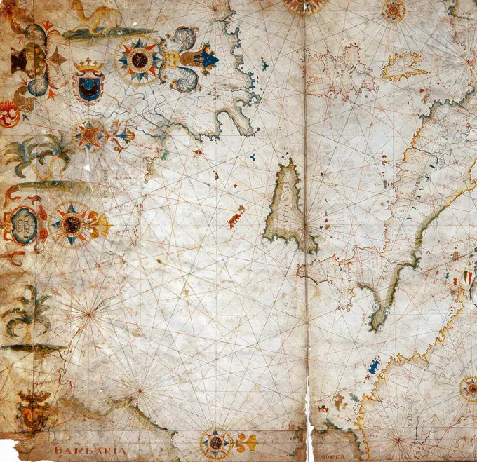
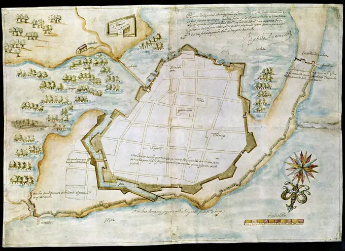
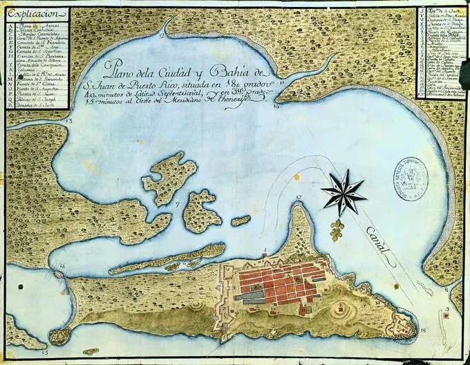
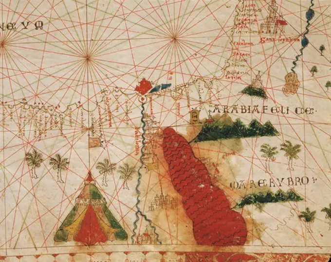
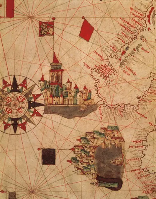
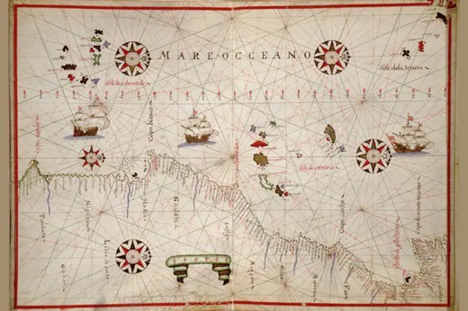
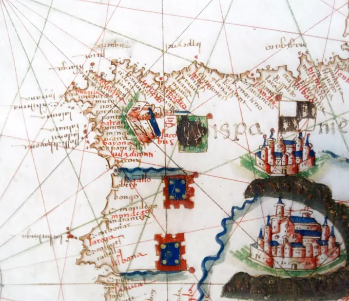
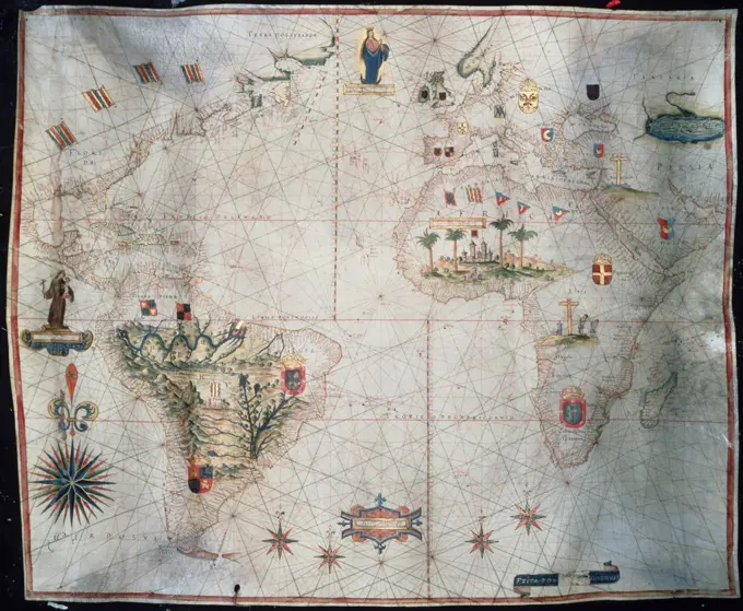
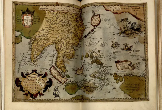
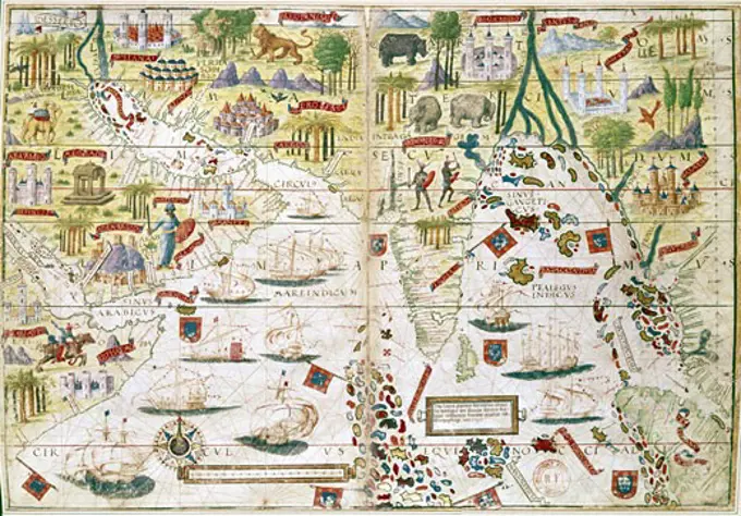
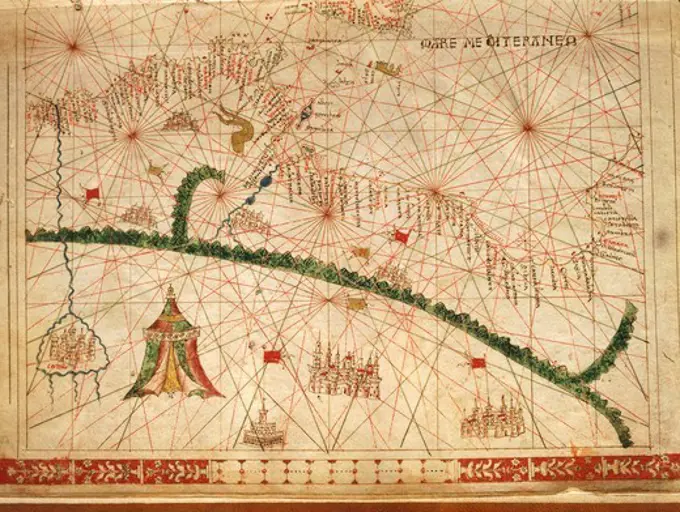
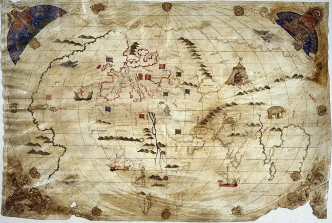
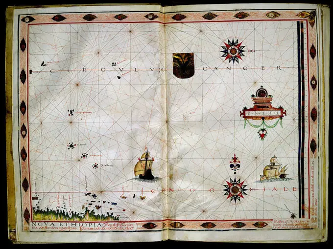
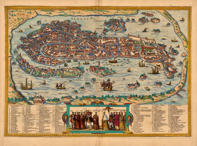
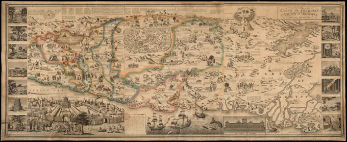
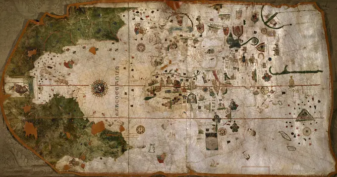
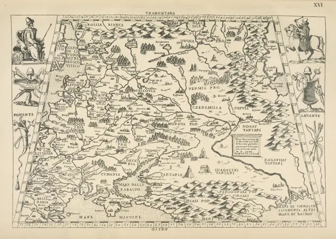
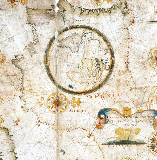
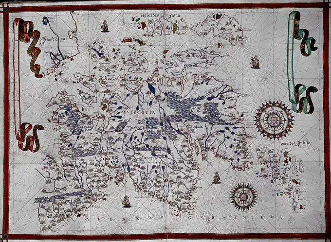
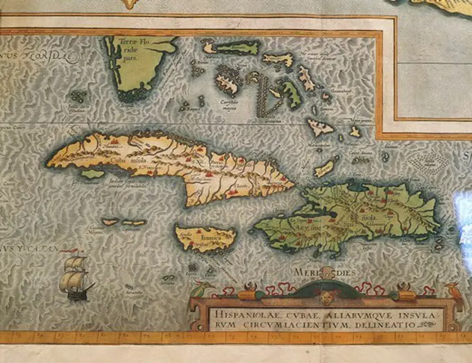
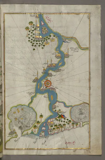
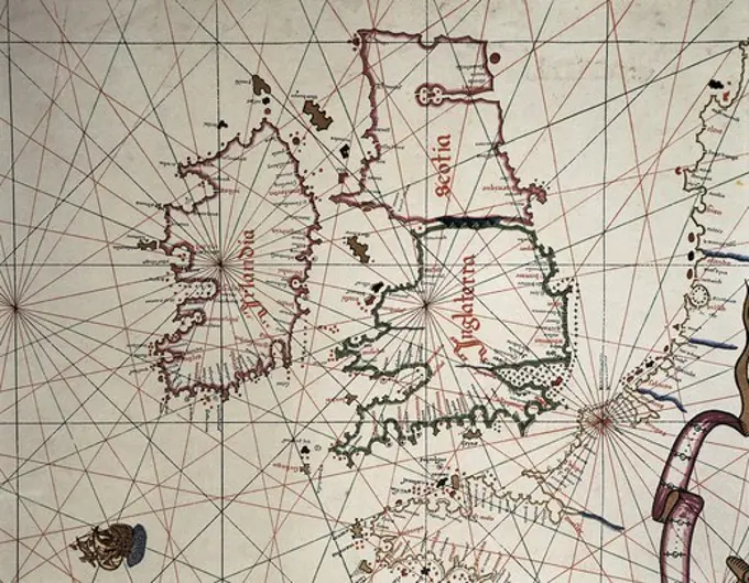
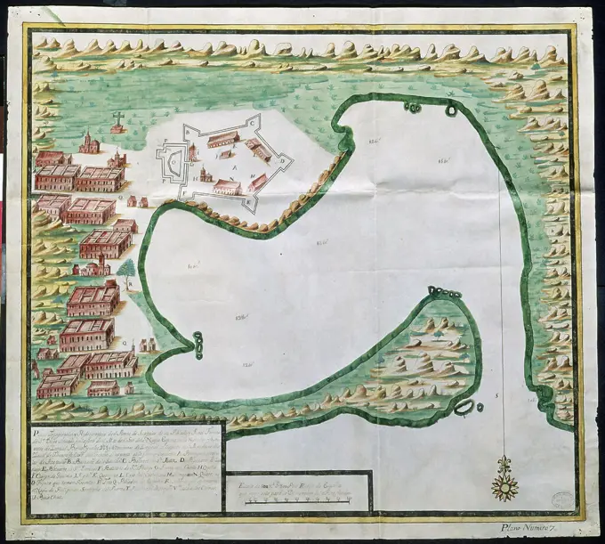
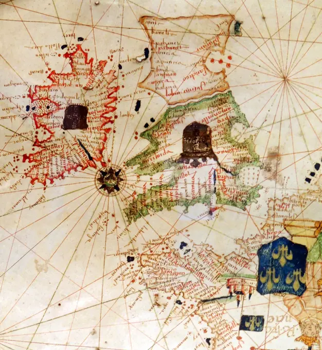
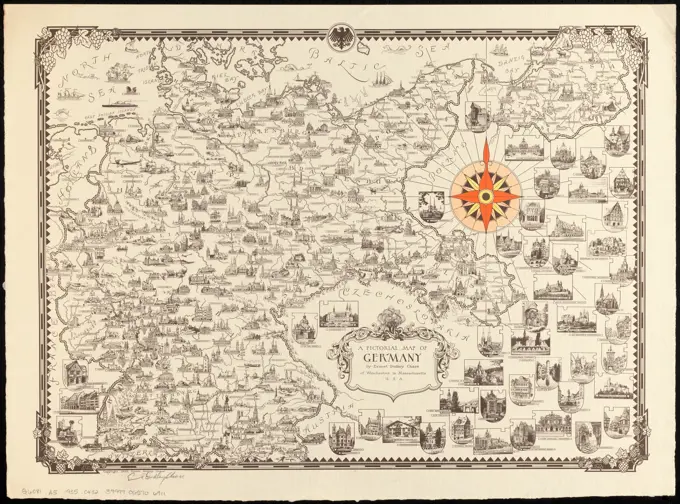
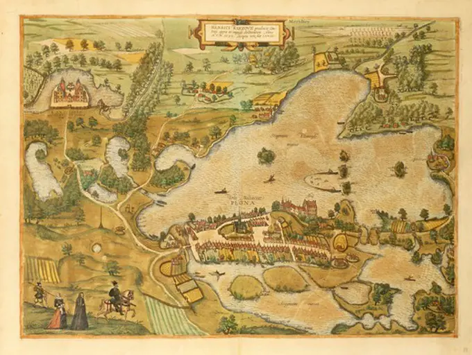
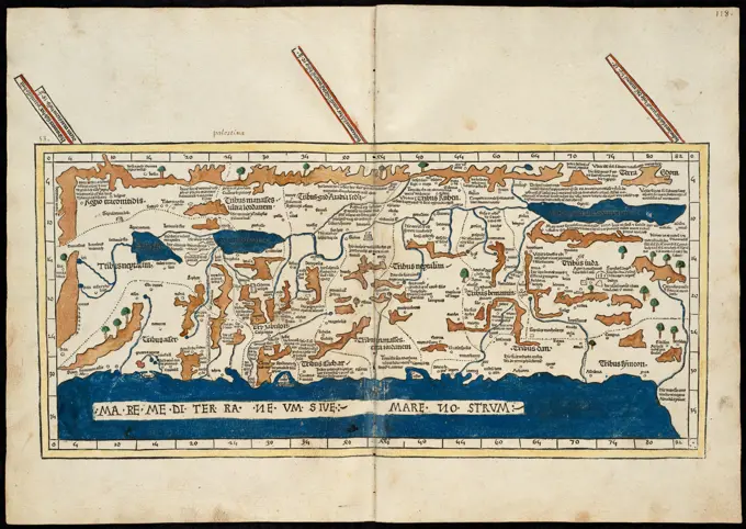
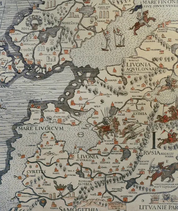
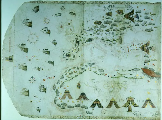
A collection of antique nautical maps depicting coastal areas, sea routes, and geography of the Americas and Europe from the 16th to 18th centuries.

Portolan naval map or chart of the Mediterranean and adjacent seas by Jacopo Malgiolo 1561 with kings of Tartary Turks etc
212 assets in this story
4409-17276150
ATLAS PORTULANO - 1568. Author: FERNAO VAZ DOURADO (1520-1580). Location: PRIVATE COLLECTION. MADRID. SPAIN.
4069-412
Portolan naval map or chart of the Mediterranean and adjacent seas by Jacopo Malgiolo 1561 with kings of Tartary Turks etc
1746-19629628
French map of Central and South America, showing Florida, Gulf of Mexico, Caribbean Islands and Antilles, River Plate, Conquistadors in Peru, Cannibals, Gold Mines, Parrots, etc. 1550. British Museum
1899-17317022
Map of Belgium, France and Luxembourg. Made by Michaelis Tramezini, 1558. Printed by Iacobus Bossius. (Photo by: PHAS/UIG)
1788-35776
Cartography, Italy, 18th century. Republic of Genoa. Map by Andrew Dury, London 1764. Copper engraving.
4409-5031
MAPA DE LA BAHIA DE CADIZ GUIPUZCOA Y MADRID 1584. Author: ABRAHAM ORTELIUS (1527-1598). Location: SERVICIO GEOGRAFICO DEL EJERCITO. MADRID. SPAIN.
1746-19628966
Amazon and the River Plate. From a Spanish map of South America 1582.
1899-17317036
Europe. Map. 15th century. Conde Museum. Chantilly, France.
1788-35147
Cartography, 16th century. Map of Spain and Morocco coast, from a portolan chart by Diego Homen, 1557.
1746-21115841
Renaissance map of Europe, Jacopo Russo, 1528, detail of north African coast
7155-70381347
Planisphere map of the World by Sanches, Portugal, 1623.
1788-38572
Cartography, 17th century. Nautical chart of Aegean Sea, the Island of Lemnos. Third chart, from a nautical atlas of the Mediterranean Sea in three charts, by Pietro Giovanni Prunus, 1651. Cm 41.6x28.
1788-35145
Cartography, 16th century. Map of Western Africa. From the Atlas by Lazaro Luis, 1563.
6176-66908634
Map of attack of Spanish Armada on England and their defense, 1588
4409-28604844
Francesc Oliva / Carta naútica del mediterráneo, 1658. Museu Marítim de Barcelona.
6145-55181910
Americae pars, nunc Virginia dicta : primum ab Anglis inuenta, sumtibus Dn. Walteri Raleigh, Equestris ordinis Viri, Anno Dni. MDLXXXV regni Vero Sereniss. nostrae Reginae Elisabethae XXVII, hujus vero Historia peculiari Libro descripta est, additis etiam Indigenarum Iconibus White, John, active 1585-1593. Cartographic. Maps. 1590. Lionel Pincus and Princess Firyal Map Division. Virginia, North Carolina, North Carolina , Maps , Early works to 1800, Roanoke Colony , Maps , Early works to 1800, Virginia , Maps , Early works to 1800
6145-55917833
Carta universal en que se contiene todo lo que del mundo se ha descubierto fasta agora. In lower margin: The second Borgian map by Diego Ribero, Seville 1529. "Reproduced from the original in the Museum of the 'Propaganda' in Rome, lent by His Holiness Pope Leo XIII, by W. Griggs, London." Includes illustrations of windheads, ships, plants, animals, and coats-of-arms... Second Borgian map. Second Borgian map, World
4409-17304
PLAN OF CARTAGENA DE INDIAS AND ITS FORTIFICATIONS 18/4/1584 - 420x590 mm. Author: ANTONELLI BAUTISTA. Location: Archivo General de Indias. Sevilla. Seville. SPAIN.
1788-38573
Cartography, 16th century. Ireland and Great Britain. From a Portolan atlas in three charts, by John Xenodocos from Corfu, 1520, cm. 32 x 22.3.
1746-19674257
Detail from an illustrated navigational map of Europe, from 1528. Made by Jacopo Russo. In Messina, Sicily.
4409-20917132
ATLAS PORTULANO DE LA COSTA AMERICANA DEL PACIFICO - PRIMERAS COSTAS DE AMERICA - SIGLO XVI. Author: JUAN MARTINEZ (-1591) CARTOGRAFO. Location: BIBLIOTECA NACIONAL-COLECCION. MADRID. SPAIN.
1788-38194
The Mediterranean Sea, by Joan Martines taken from a nautical atlas, 1571. Detail.
1788-35339
Cartography, 16th century. Map of Ireland and coasts of France, Flanders and Great Britain, from a portolan chart by Ioannes Superantius.
1095-249
The Western Mediterranean, The European Coast To Denmark, And The British Isles From "Portolan Atlas Of Six Charts" 1594 Maps Newberry Library, Chicago, Illinois, USA
1060-753
Map of Islandia (Iceland) Theatrum Orbis Terrarum Abraham Ortelius (1527-1598 Netherlandish) The Huntington Library
1788-35441
Cartography, Italy, 17th century. The state of Lucca. From Regionum Italiae by Willem Blaeu.
4409-20917305
PORTULANO DEL SIGLO XVI - ESPAÑA Y OCEANO ATLANTICO-PAGINAS 3 Y 4. Author: JUAN ORTIZ VALERO (S XVI). Location: SERVICIO GEOGRAFICO DEL EJERCITO. MADRID. SPAIN.
4409-3946
ATLAS PORTULANO - EL CANAL DE LA MANCHA - VIT20. INGLATERRA Y GALES 1587. Author: JUAN MARTINEZ (-1591) CARTOGRAFO. Location: BIBLIOTECA NACIONAL-COLECCION. MADRID. SPAIN.
1899-20225094
England's North East Coast, 1588, Waghenaer.
6145-50558184
Octava Europae tabula , Europe, Eastern, Maps, Early works to 1800, Ukraine, Maps, Early works to 1800 Norman B. Leventhal Map Center Collection
1788-36685
Cartography, 17th century. Nautical chart of the limits of the North Sea, created by Hessel Gerritsz.
1788-35937
Cartography, 17th century. Map of Panama, 1744. Detail: The mouth of the Chagre River.
4409-20924780
ATLAS PORTULANO - 1568. Author: FERNAO VAZ DOURADO (1520-1580). Location: PRIVATE COLLECTION. MADRID. SPAIN.
6145-59229814
Topographic map of Holland, Salomon Rogiers, After Balthasar Florisz. Van Berckenrode, 1629 - 1635 print Topographic map of the province of Holland with at the top of the North Sea and the Wapen van Holland. At the top left a cartouche with the weapon of Amsterdam and a dedication (to the regents of Amsterdam). Bottom left a cartouche with the title, and at the top right of a fish shower decorated with fish with the Wadden Islands. At the bottom right the scale. Amsterdam paper etching / engraving maps of separate countries or regions Holland
1899-17317565
The Catalan Atlas, 1375. Attributed to the Majorcan Jewish cartographers Abraham and Jehuda Cresques, was service of King of Aragon. National Library of France, Paris.
4435-3042
The Caverio Map or Caveri Map, circa 1505. This map was one of the primary sources used to make the WaldseemŸller map. Miniature Painting. FRANCE. ëLE-DE-FRANCE. Paris. National Library.
6188-66495842
Antike Kartographie. Authentische alte Karte. Exploration, Geographie, Vintage Hintergrund. Antike Kartographie. Authentische alte Karte. Exploration, Geographie, Vintage Hintergrund. Copyright: xZoonar.com/PaoloxGallox 22613172
4409-17276151
ATLAS PORTULANO - 1568. Author: FERNAO VAZ DOURADO (1520-1580). Location: PRIVATE COLLECTION. MADRID. SPAIN.
1095-126
Eastern Mediterranean from Portolan Atlas,  1546,  USA,  Chicago,  Newberry Library
1899-20226959
Chart of the South Atlantic 1558.
1899-19188523
Thomas Fuller (1608-1661) was an English churchman, historian and writer. Born in Aldwinker St Peter's, Northamptonshire, his father was rector of the community. He was admitted to Queens' College in Cambridge and did well academically. Fuller was a prolific author, one of the first English writers to live by his pen. He is particularly remembered for his Worthies of England, published in 1662 after his death.
4409-17276450
MAP OF THE CITY AND BAY OF SAN JUAN DE PUERTO RICO. Location: ARCHIVO HISTORICO MILITAR. MADRID. SPAIN.
1788-38563
Cartography, 16th century. The Red Sea and Arabia Felix. From a Portolan atlas in three charts, by John Xenodocos from Corfu, 1520, cm. 32 x 22.3.
1788-35489
Cartography, Italy, 16th century. Venice and Genoa. From a portolan chart by Francesco Oliva, 1566
4408-14203
Portolan map of the African Coast, Portolan Maps
1746-21115833
Renaissance map of Europe, Jacopo Russo, 1528, North, East and central Spain (detail)
866-3330
Portolan Chart of the Atlantic Ocean  Joao Teixeira Albernazi (active 1620-1640) Christie's, London
6239-70845499
India | Library of Congress
1746-1168
16th century Portugese map of the Indian Ocean, Persian Gulf, India and North Africa. Miller. B.N., Paris
1788-38513
Cartography, 16th century. The Indian Ocean and part of Asia and Africa: the Indian Peninsula, from Atlas of the World in thirty-three Maps, by Battista Agnese, 1553
6188-63307743
Pirate treasure map Old treasure map used by pirates to find hidden treasure ,property released Copyright: xZoonar.com/PaulxFleetx 8828343 ,model released, Symbolfoto ,property released
1788-38580
Cartography, 17th century. Nautical chart of Northern Africa. Detail from the third chart, from a nautical atlas of the Mediterranean Sea in three charts, by Pietro Giovanni Prunus, 1651. Cm 41.6x28.
1095-220
Figura Totius Orbe Thexora Universale  Hargonio, Fra Bona(- ) Newberry Library, Chicago, Illinois, USA
4409-18170462
MAPA Nº11 - ATLAS PORTULANO 1568 - NUEVA ETIOPIA, DESCUBIERTA POR MAGALLANES. Author: FERNAO VAZ DOURADO (1520-1580). Location: PRIVATE COLLECTION. MADRID. SPAIN.
1095-269
Asia From "Portolan Atlas Of Four Charts" 1612 Maps Newberry Library, Chicago, Illinois, USA
1788-38490
Cartography, 16th century. Nautical chart of the Central-Eastern Mediterranean Sea, detail with coast of Tunisia, by Giorgio Sideri called Callapoda or Calopodio da Candia (Crete).
6145-55913999
Indie interioris civitates decima Asia tabula continet India int. Gangem. Title from verso. Map of India, west of the Ganges. Relief shown by brown coloring. Engraved on wood with place names in moveable type. Includes names of places and natural features. In margin: notes on latitude. Descriptive text within ornamental borders on verso. Appears in the author's Geographia. Ulm : Lienhart Hol, 16 July 1482. Text in Latin. Cataloging, conservation, and digitization made possible in part by The National Endowment for the Humanities: Exploring the human endeavor... Decima Asia tabula continet India int. Gangem. Decima Asia tabula continet India int. Gangem, India
1788-38496
Cartography, 17th century. Alexandria, Egypt, from a portolan atlas consisting of six charts, by Placido Caloiro and Francesco Oliva, 1646. Parchment.
1899-20225803
Map of SE South America 1547.
4048-5291
1562 map of North and South America by Spaniard, Diego Gutiérrez. Map features not only the Amazon River system, Lake Titicaca, and an erupting volcano in central Mexico. Place name of  California' is used for the first time. The decorative map includes fanciful images of parrots, monkeys, mermaids, huge sea creatures, Brazilian cannibals, and Patagonian gi
4409-20882241
SANTA CRUZ , ALONSO DE. NAVEGANTE Y COSMOGRAFO ESPAÑOL. SIGLOS XV-XVI. " ISLARIO GENERAL " , MAPA DE LAS ISLAS CANARIAS.
1899-18711934
Supervised by Spanish-born Pope Alexander VI, the Treaty of Tordesillas in 1494 divided the world in halfinto Spanish and Portuguese territories. Following Portuguese navigator Vasco da Gama's success in discovering a sea route around Africa to India in 1498, King Manuel I commissioned Pedro Alvares Cabral to lead a second voyage of 13 ships and 1,500 men to India. Although he intended to stay close to the west coast of Africa, Cabral sailed far off course and accidentally chanced upon the coast of South America. According to the Treaty of Tordesillas of 1494, any land falling within 370 leagues [2.060 km west of the Cape Verde Islands was to belong to Portugal, whereas any land discovered west of this meridian would be Spanish territory, as decreed by Spanish-born Pope Alexander VI. The coastline of Brazil therefore fell within the Portuguese sphere of influence and was colonized by Manuel I. However, following Portugal’s discovery of the Spice Islands of the Moluccas in 1512, Spain
1746-21102134
Detail from the 'Dauphin' map by Desceliers, 1546, for Henri II, by order of Francis I
1788-35712
Cartography, Italy, 17th century. Piedmont, Monferrato and Liguria Regions. Map by Gerhard Kremer, from Regionum Italiae, 1628. Copper engraving.
6145-50568406
Nona Asie tabula continet Ariam & Paropanisadas & Drangianam & Arachosia & Gedrosiam , Iran, Maps, Early works to 1800, Afghanistan, Maps, Early works to 1800, Pakistan, Maps, Early works to 1800 Norman B. Leventhal Map Center Collection
4409-151378
HISTORIA DE CATALUÑA. GUERRA DE SUCESION ESPAÑOLA (1701-1715). Siglo XVIII. MAPA DE LA CIUDAD DE BARCELONA durante el asedio francés de 1706, entre los meses de abril y mayo. En 1706 la ciudad padeció un asedio de la flota francesa, coincidiendo con la convocatoria de las Cortes Catalanas por el Archiduque Carlos de Austria, llamado rey Carlos III.
4409-14764
MAPAMUNDI REALIZADO POR EL CARTOGRAFO REAL DE FELIPE II EN 1588. Author: CHRISTIAN SGROOTEN (1525-1603). Location: BIBLIOTECA NACIONAL-COLECCION. MADRID. SPAIN.
6145-55914534
Map of Massachusetts, Rhode-Island & Connecticut : compiled from the latest authorities. Prime meridian: Washington D.C. and Greenwich. Shows roads, railroads, mills, factories and churches. Includes illustrations. Insets: Norwich, Conn. and factories -- Fall River, Mass. and factories -- New-Haven -- Salem -- City of Lowell -- New Britain, Conn. manufactories -- New-York -- North Adams, Mass. manufactories -- Boston -- Canton factories, Mass. -- Warwick & Coventry factories, R.I. -- Pawtucket and Central Falls manufactories -- Hartford -- Woonsocket Falls, R.I. & factories -- Providence... Map of Massachusetts, Rhode Island and Connecticut. Map of Massachusetts, Rhode Island and Connecticut, Massachusetts New England  ,area  Rhode Island Connecticut
1788-36654
Cartography, Brazil, 16th century. Map of Rio de Janeiro on canvas by Jacques Van de Claye.
1788-34710
Cartography, Italy, 15th century. Portolan chart of Venice and Genoa.
6176-66093243
Venice, Italy  on an etching by Franz Hogenberg circa 1575.  Vintage 16th Century Illustrative city Plan and Map.
6145-51397438
A new map of the Land of Promise and the holy city of Jerusalem describing the most important events in the Old & New Testaments , Geography, Maps, Jerusalem, Maps, Palestine, Maps Norman B. Leventhal Map Center Collection
4409-21355143
Map of the Old and New Worlds - ca. 1500. Author: Juan de la Cosa (c. 1450-1510). Location: MUSEO NAVAL / MINISTERIO DE MARINA, MADRID, SPAIN. Also known as: MAPA DE 1500-PERFIL COSTERO DE AMERICA-PORTULANO DEL SIGLO XVI.
6145-55181638
Karta Rossii Gerbershteina, gravirovannaia na miedi Ia.Gastal'do v 1566g. Tekst str.7 A map of Russia by Gerbershtein, engraved on copper by Ia. Gastaldo in 1556. Text p.7 Cartographic. Maps. 1899. General Research Division. Cartography , Russia , History, Russia
4409-28604846
Francesc Oliva / Carta naútica del mediterráneo, 1658. Museu Marítim de Barcelona.
4409-20917129
ATLAS PORTULANO ESCOCIA - SIGLO XVI - VIT 20. Author: JUAN MARTINEZ (-1591) CARTOGRAFO. Location: BIBLIOTECA NACIONAL-COLECCION. MADRID. SPAIN.
1788-34514
Cartography, 17th century. Map of the Mediterranean Sea by Francois Ollive, Marseille, 1664.
6176-66908742
Map of Florida and Cuba, circa 1588
1788-35148
Cartography, 16th century. Map of the Antilles Islands.
4409-20886043
SANTA CRUZ , ALONSO DE. NAVEGANTE Y COSMOGRAFO ESPAÑOL. SIGLOS XV-XVI. " ISLARIO GENERAL " , MAPA DE LA ISLA DE CUBA.
4409-17490592
Map of the River Nile From Its Estuary South. Date/Period: Ottoman. Illuminated manuscripts; folios (leaves); maps. Ink and pigments on laid European paper ink and pigments on laid European paper. Height: 35.80 mm (1.40 in); Width: 65.50 mm (2.57 in). Author: PIRI REIS.
4409-17274453
FASCIMIL - PLANISFERIO DE 1154 - DETALLE DE LA DERECHA: EUROPA Y AFRICA. Author: AL-IDRISI.
6176-61904632
Map of Canada 1546 by Pierre Desceliers, (fl. 1537-1553) was a French cartographer of the Renaissance and an eminent member of the Dieppe School of Cartography. He is considered the father of French hydrography.
1788-38487
Cartography, 16th century. Nautical chart of the Central-Eastern Mediterranean Sea, detail with Egypt and Red Sea, by Giorgio Sideri called Callapoda or Calopodio da Candia (Crete).
6145-59568049
Map of Flanders and Hainaut, 1555, 1555 print Map of Flanders and Hainaut. At the bottom right a cartouche with the title, below the passer with bowls. At the top left the imperial weapon with the Golden Fleece. All inscriptions in Latin.  paper engraving maps of separate countries or regions Flanders. Hainaut
4409-3947
ATLAS PORTULANO ORIENTE MEDIO VIT 20 - PENINSULA DE ARABIA. Author: JUAN MARTINEZ (-1591) CARTOGRAFO. Location: BIBLIOTECA NACIONAL-COLECCION. MADRID. SPAIN.
463-3223
Map of Americas with Columbus,  Vespucci,  Magellan and Pizarro,  (1594-1996),  USA,  New York City,  New York Public Library
1095-243
The Western Mediterranean From "Portolan Atlas Of Six Charts" 1636 Maps Newberry Library, Chicago, Illinois, USA
1788-36650
Cartography 16th-17th centuries. Turkish portolan chart by Seyued Nuh Efendi
4435-3036
Portolan chart, 1582. The Eastern Mediterranean (the Aegean Sea, the Black Sea and Turkey). Made in Messina. Miniature Painting. SPAIN. MADRID (AUTONOMOUS COMMUNITY). Madrid. National Library.
4409-18665
ACAPULCO-PLANO TOPOGRAFICO-1730-MEXICO 125. Location: Archivo General de Indias. Sevilla. Seville. SPANIEN.
4409-18019
FACSIMIL-PLANISFERIO DE 1154-DET CENTRAL EUROPA. Author: AL-IDRISI.
1746-19687064
England and Ireland depicted in Jacopo Russo Map of the world 16th century circa 1528 from the 'Carte Geografiche' (vellum)
6145-50568188
A pictorial map of Germany , Germany, Maps Norman B. Leventhal Map Center Collection
6145-58841954
Map of Stralsund, Anonymous, 1735 Map of Stralsund. Bottom left a soldier who writes on a tablet. Part of an atlas with 223 maps of countries and cities and war scenes in Europe in the period ca. 1690-1735. print maker: Northern Netherlandspublisher: Amsterdam paper etching / engraving / lacquering  Stralsund Map of Stralsund. Bottom left a soldier who writes on a tablet. Part of an atlas with 223 maps of countries and cities and war scenes in Europe in the period ca. 1690-1735. print maker: Northern Netherlandspublisher: Amsterdam paper etching / engraving / lacquering  Stralsund
1788-36416
Cartography, Germany, 16th century. Map of Plon. From Civitates Orbis Terrarum by Georg Braun (1541-1622) and Franz Hogenberg (1540-1590), Cologne. Engraving
6145-51397891
Palestina , Palestine, Maps, Early works to 1800, Israel, Maps, Early works to 1800 Norman B. Leventhal Map Center Collection
6145-55915919
Palestina. Title supplied by cataloger. Map of Palestine. Oriented with north to the left. Relief shown by brown coloring. Engraved on wood with place names in moveable type. Includes names of places and natural features. In margin: notes on latitude. Appears in the author's Geographia. Ulm : Lienhart Hol, 16 July 1482. Like all the modern maps of Palestine added to the early printed editions of Ptolemy, this was copied from Petrus Vesconte's map of Palestine first published by Marino Sanuto, ca. 1320. One of 5 'modern' maps of non-Ptolemaic design, executed by Pietro Vesconte for Marino sanudo's "Liber secretorum fidelium crucis" early in the 14th century. Text in Latin. Cataloging, conservation, and digitization made possible in part by The National Endowment for the Humanities: Exploring the human endeavor.... , State of Palestine Israel
4409-29042552
Map of Livonia. 16th century. Marine Chart of Olaus Magnus (1490-1557). Fragment of a reproduction. Venice, 1539. Latvian War Museum. Riga. Latvia.
1788-38494
Cartography, 17th century. The Mediterranean Sea, from a portolan atlas of six charts, by Placido Caloiro and Francesco Oliva, 1646. Parchment.
PREVIOUS
of 3
NEXT
2401 S. Ervay, Suite 206
Dallas, Texas 75215
United States
Browse
CategoriesGalleriesFree Research
For Creators
License Your ContentSuperStock For StudentsFrame of Mind BlogContributor PortalNew Image SpotlightLicense AI Imagery
Resources
About UsLicensingTerms & ConditionsAPI AccessPrivacyPricing
Contact
+1 866 236 0087help@superstock.com Contact form
©2026 SuperStock. All Rights Reserved. -A
This site is protected by reCAPTCHA and Google Privacy Policy and Terms of Service apply.