Fine ArtVintageFootageSubscriptionBoardsFree ResearchPricing
  • Fine Art
  • Vintage
  • Footage
  • Subscription
  • Boards
  • Free Research
  • Pricing

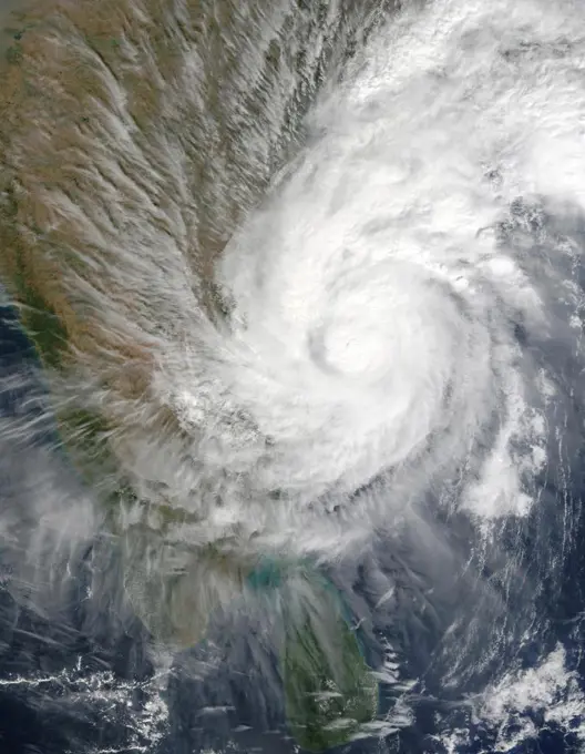
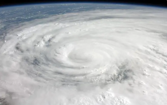
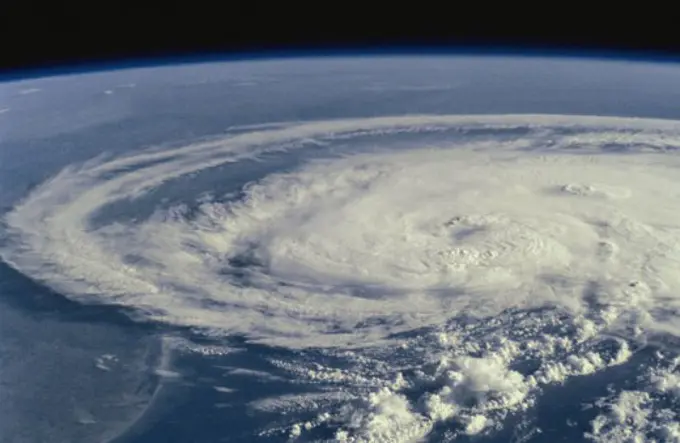
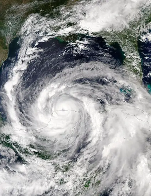
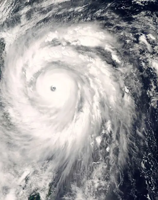
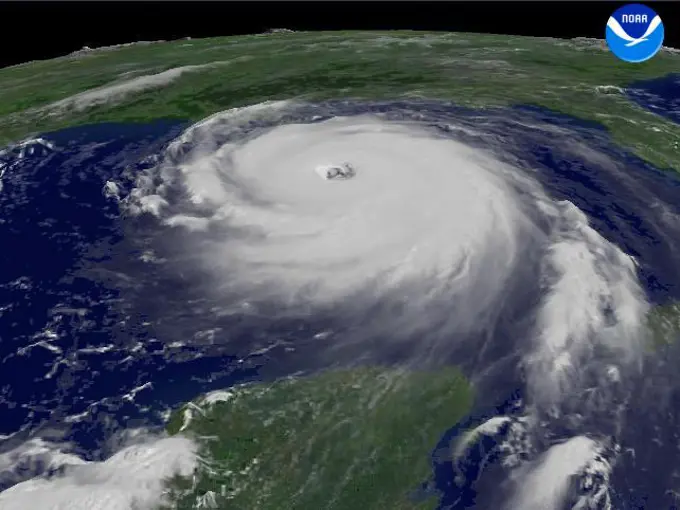
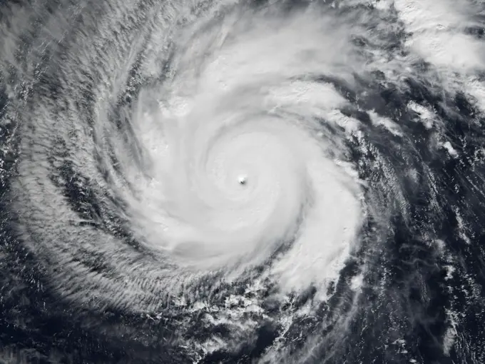
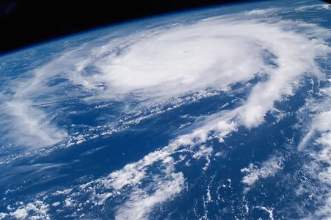
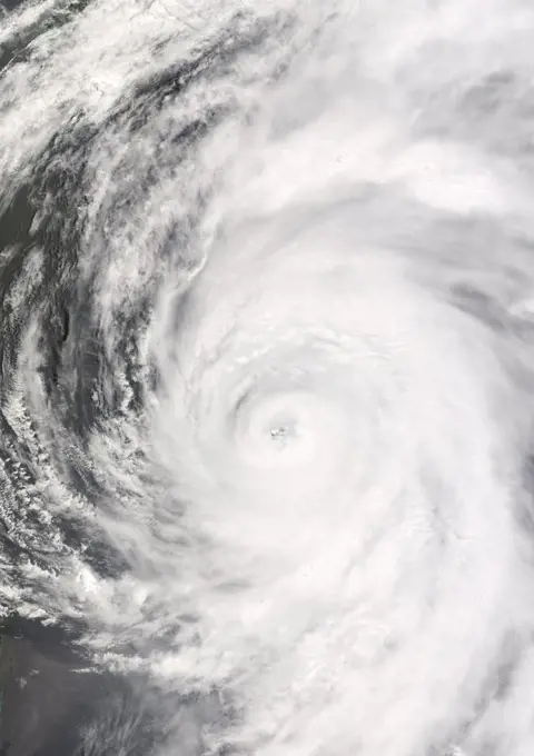
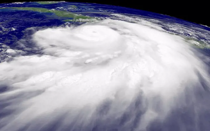
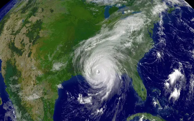
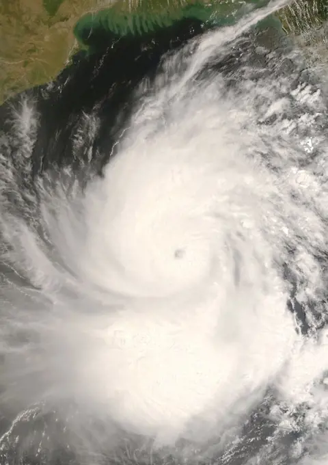
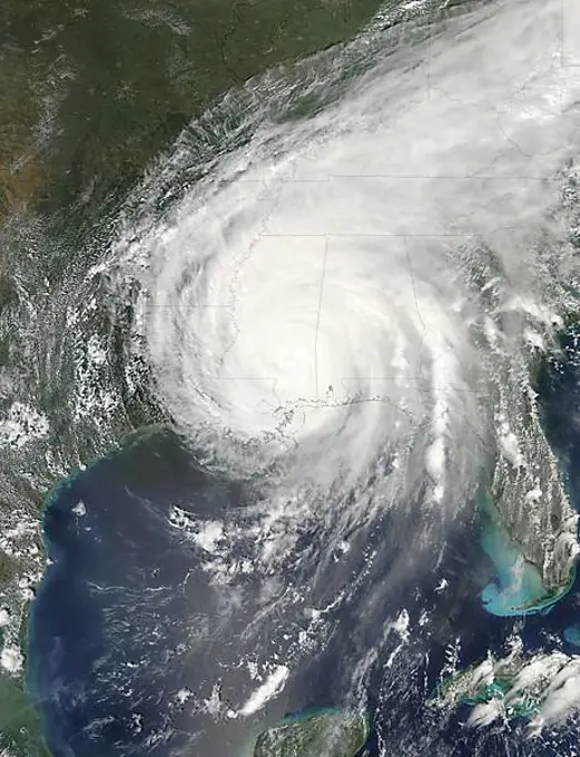
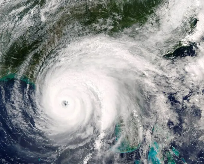
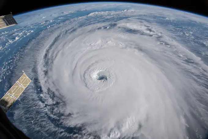
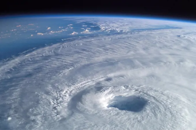
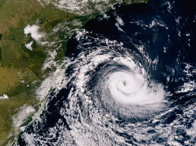
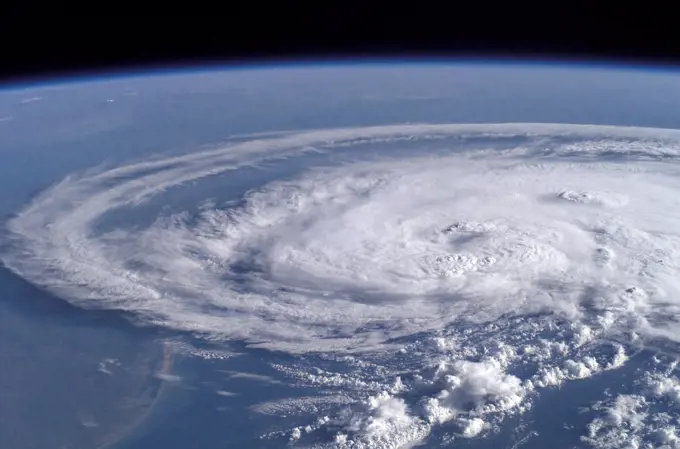
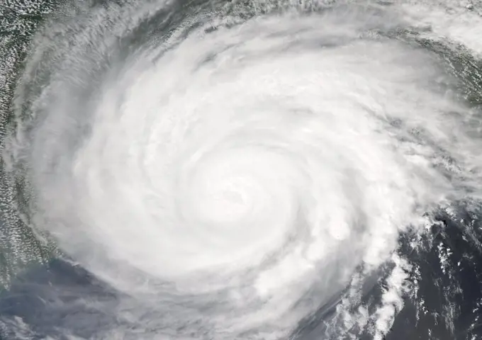
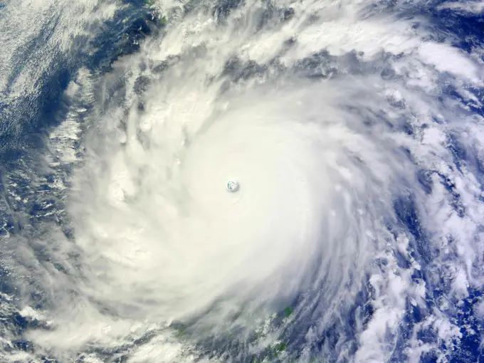
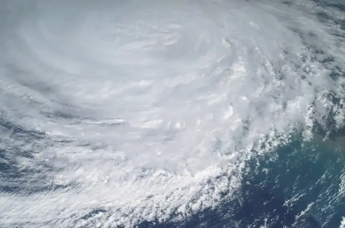
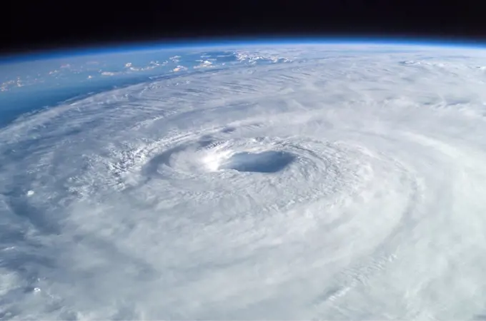
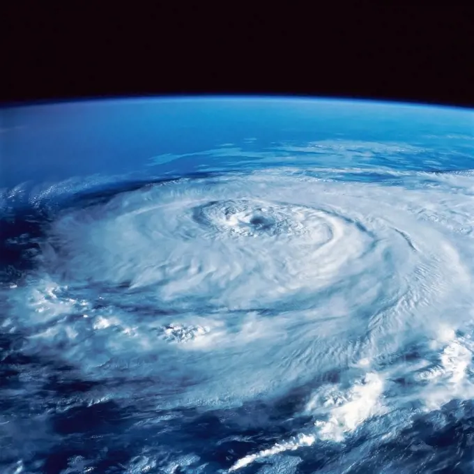
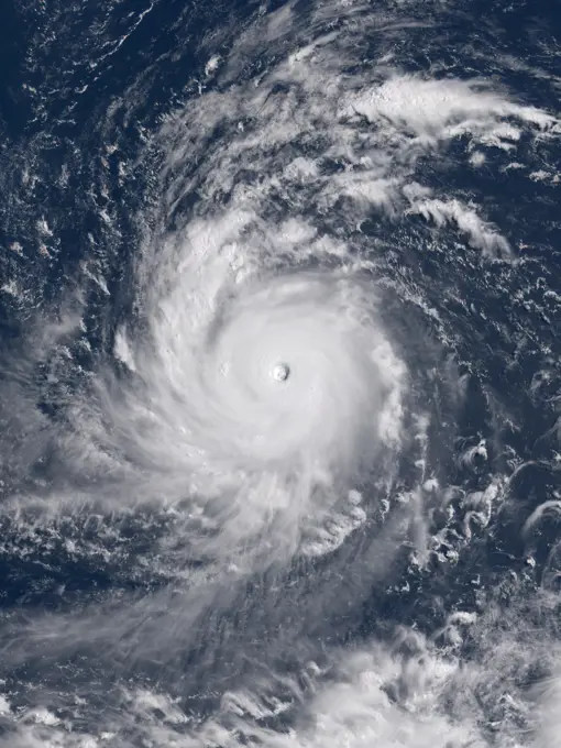
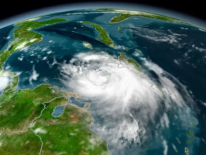
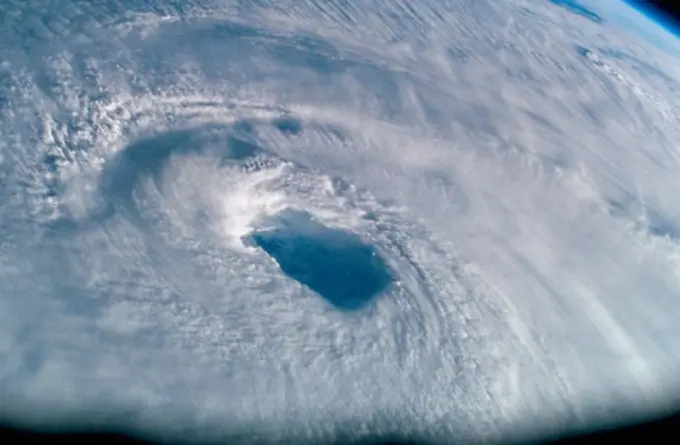
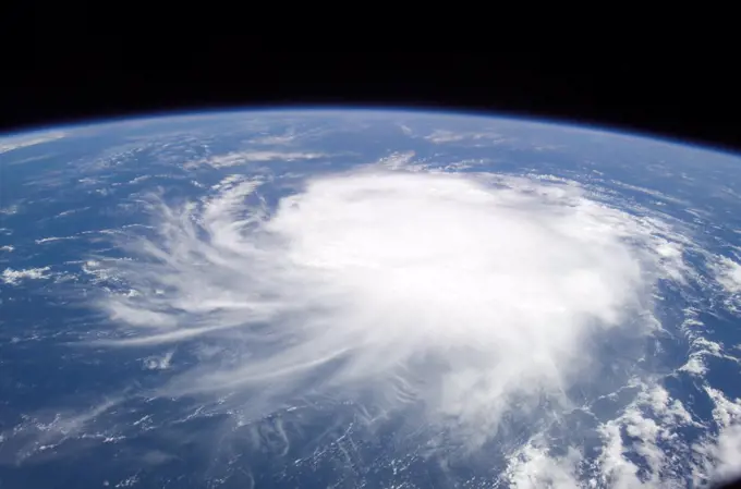
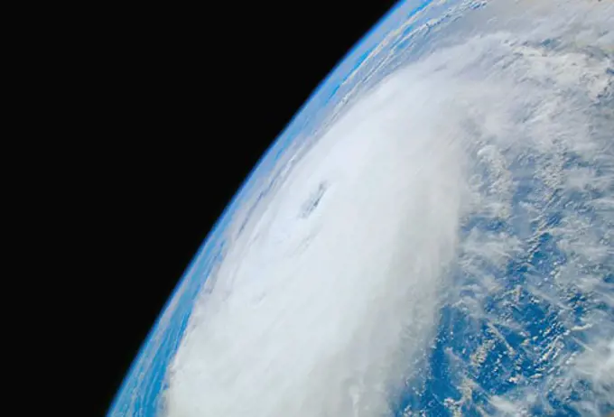
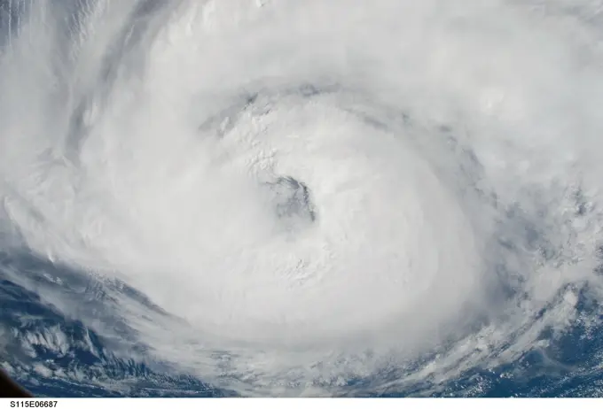
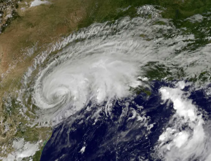
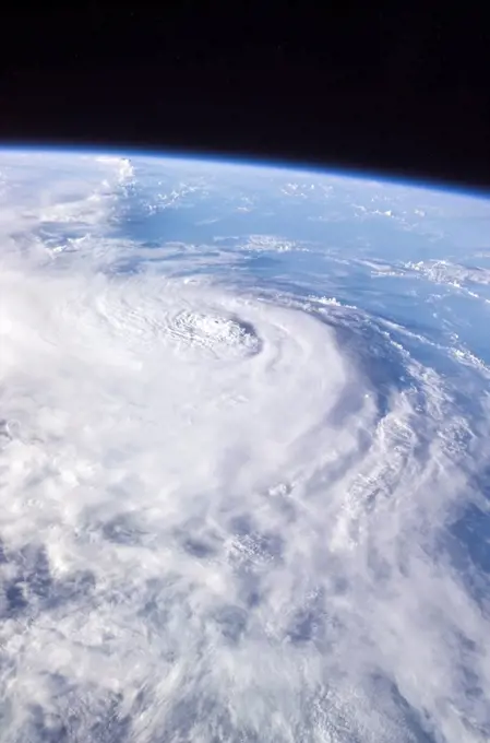
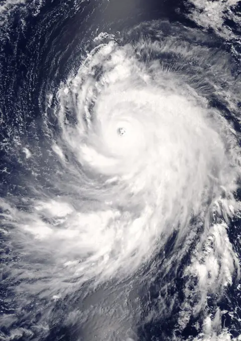
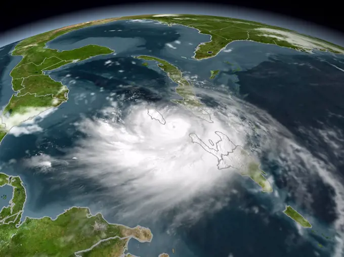
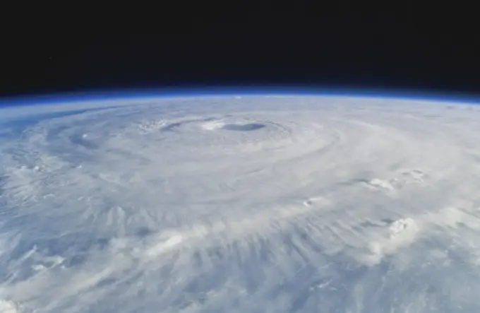
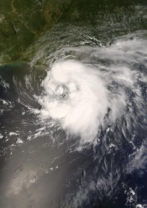
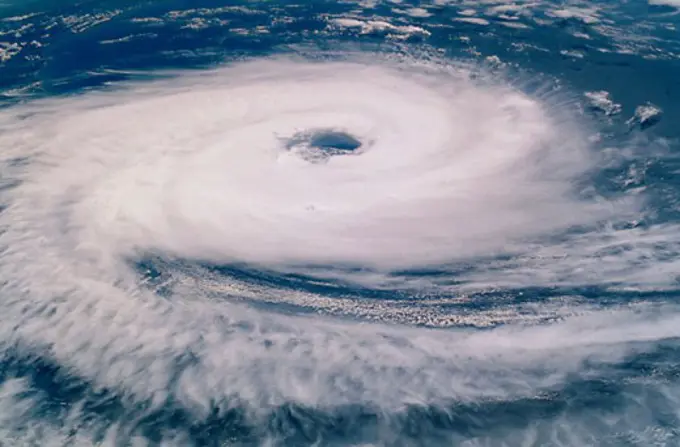
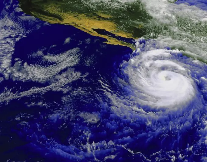
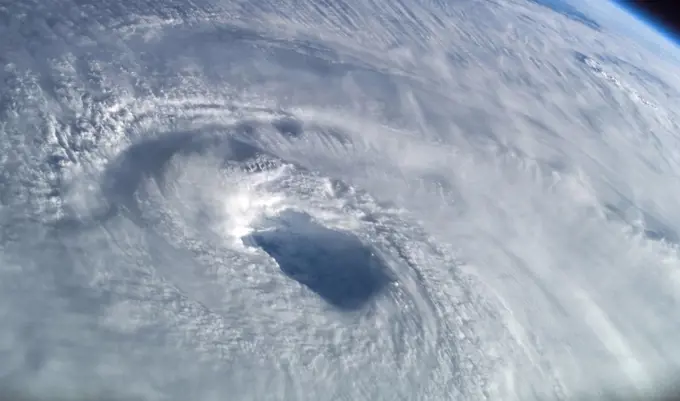
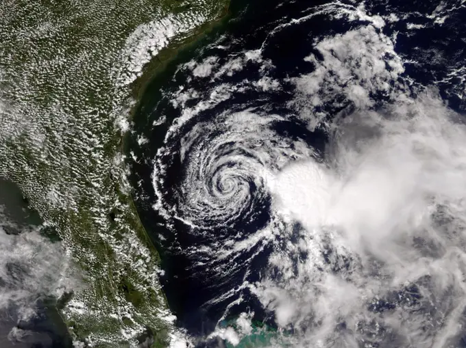
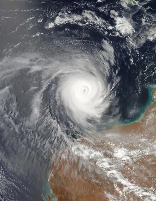
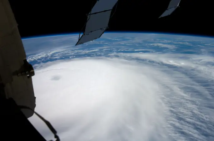
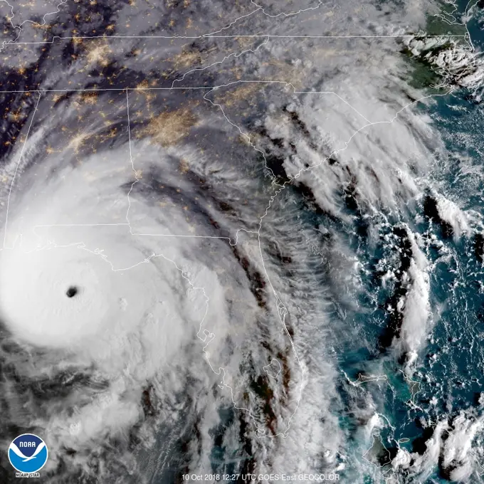
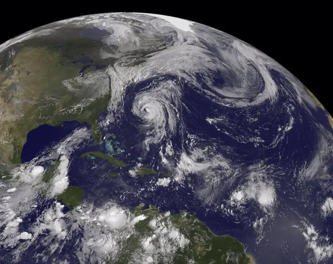
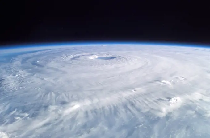
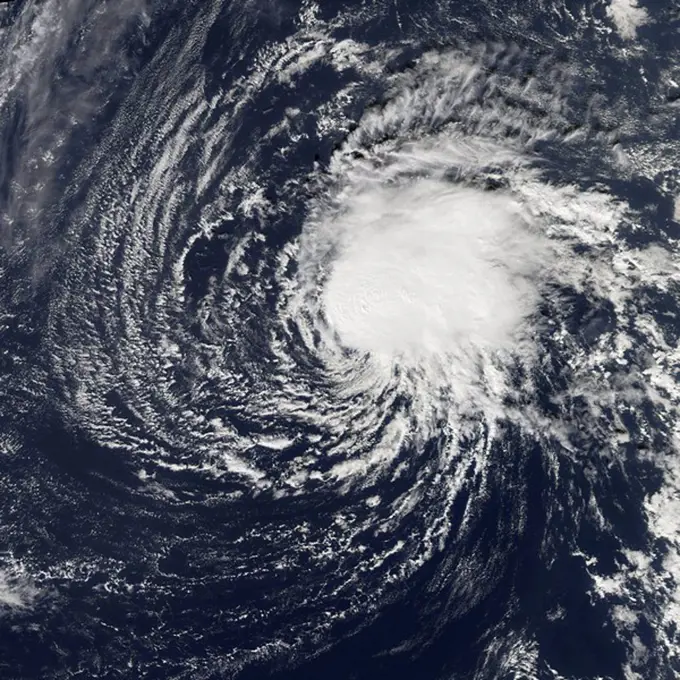
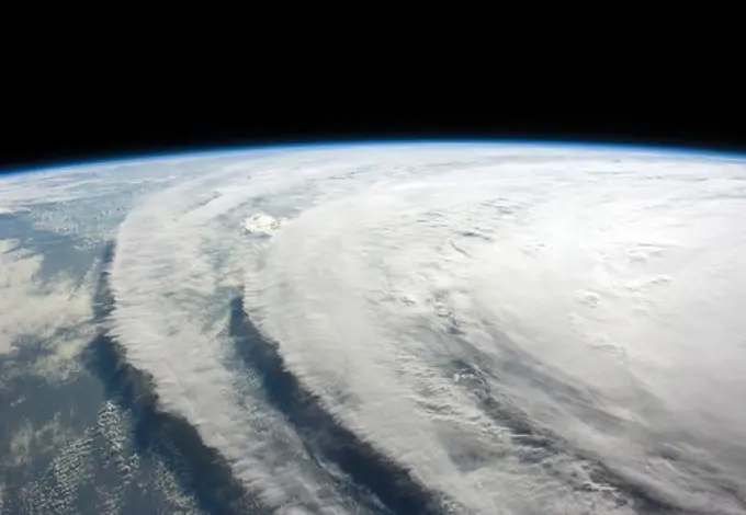
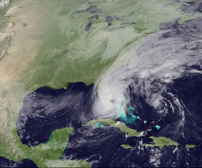
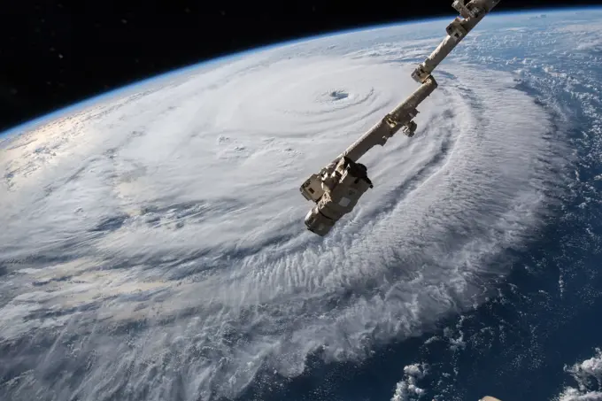
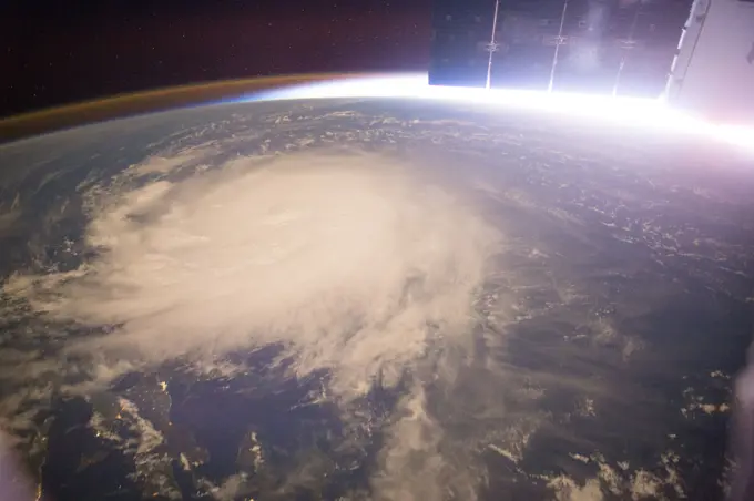
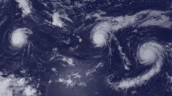
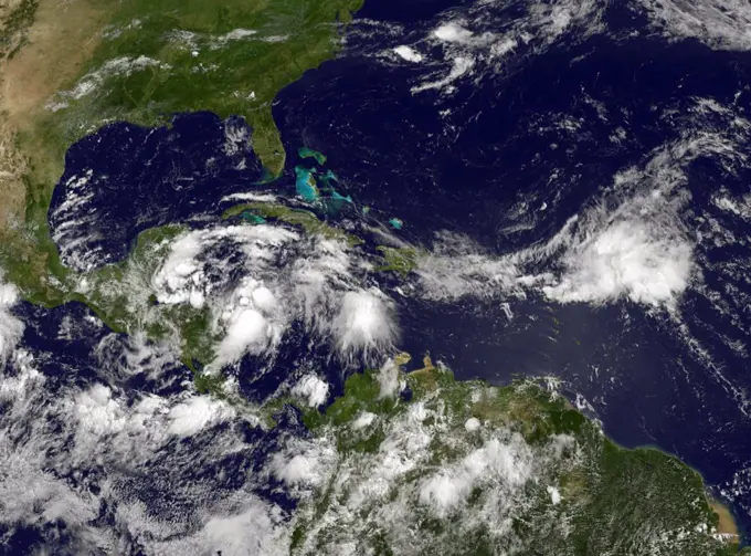
Hurricane Impact Imagery

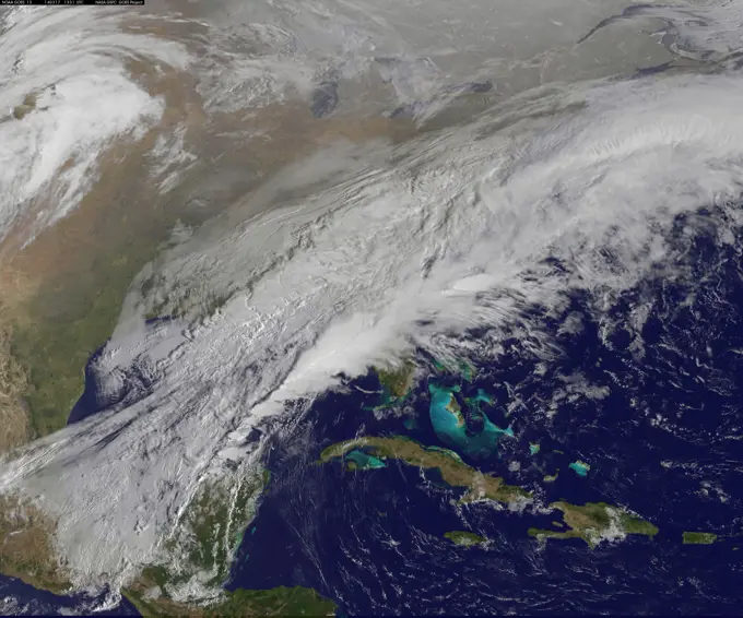
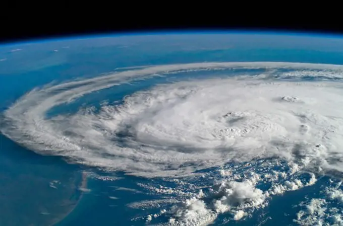
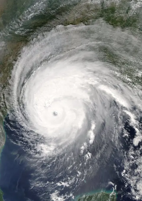
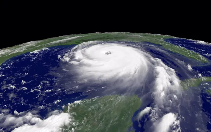
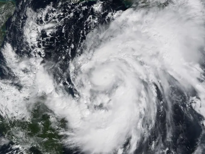
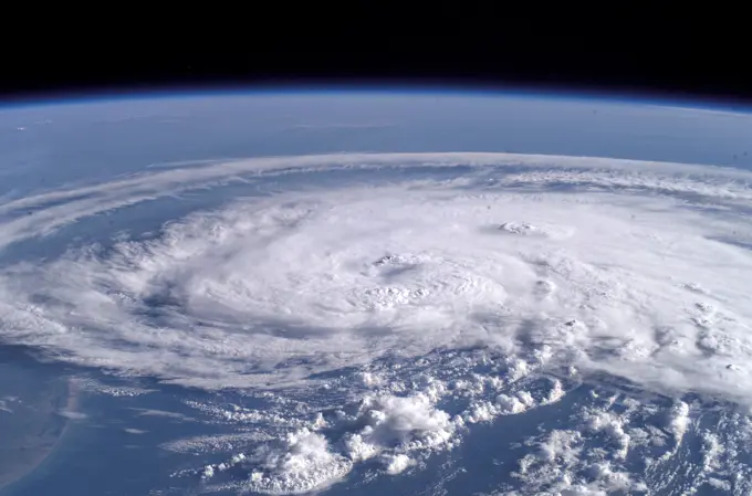
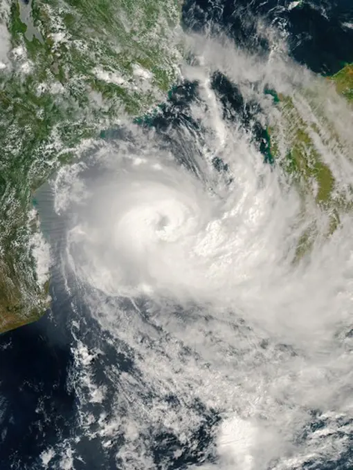
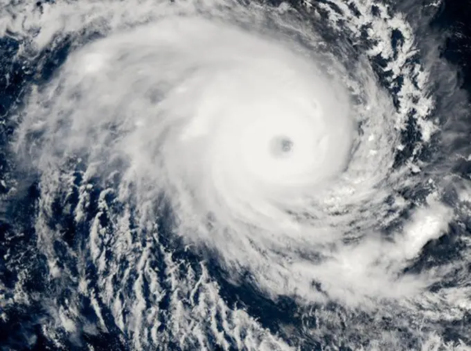
Satellite images showcasing hurricanes over the ocean, illustrating the immense power of nature and its effects on the environment.

Hurricane Claudette
Hurricane Claudette
143 assets in this story
1899-35740
Hurricane Rita, Gulf Of Mexico, On 23/09/2005, True Colour Satellite Image. Hurricane Rita on 23 September 2005 over the Gulf of Mexico. True-colour satellite image using MODIS data.
4239R-20480131
August 28, 2005 - Hurricane Katrina regional imagery.
1899-17949
Southeast Indian State of Andhra Pradesh raked by Tropical Cyclone 03B in early 16 December 2003. The storm's winds, heavy rains, and cool temperatures, forced nearly 20,000 people to flee their homes. Credit NASA.
1457R-1188
Hurricane Ike
1574R-015332
Tropical Storm Claudette
6145-52075406
Satellite - 26-HK-336-29. Hurricane Katrina
6145-45142682
On Aug. 24, the National Hurricane Center noted that Hurricane Harvey was quickly strengthening and is forecast to be a category 3 Hurricane when it approaches the middle Texas coast. In addition, life-threatening storm surge and freshwater flooding expected. On Aug. 24, many warnings and watches were in effect A Storm Surge Warning is in effect from Port Mansfield to San Luis Pass Texas. A Storm Surge Watch is in effect from south of Port Mansfield Texas to the mouth of the Rio Grande River and from north of San Luis Pass to High Island, Texas. A Hurricane Warning is in effect from Port Mansfield to Matagorda, Texas. A Tropical Storm Warning is in effect from north of Matagorda to High Island, Texas and south of Port Mansfield, Texas to the Mouth of the Rio Grande. A Hurricane Watch is in effect from south of Port Mansfield, Texas to the Mouth of the Rio Grande. A Tropical Storm Watch is in effect from south of the mouth of the Rio Grande to Boca de Catan, Mexico. GOES-16 captured thi
1457-1099
Hurricane Isidore is just skirting the coast of the Yucatan Peninsula
6145-45257137
Captured on Friday, July 3, 2014 at 12 20 PM EDT. The National Hurricane Center in Miami says Arthur is centered about 260 miles southwest of Cape Hatteras, North Carolina, and about 110 miles south-southwest of Cape Fear. It's moving north at 14 mph. Satellite Terra
4389-1047
Hurricane Claudette
1574R-34941
Typhoon Jangmi off Taiwan and the Philippines
6145-52075399
Satellite - 26-HK-336-22. Hurricane Katrina
1746-28998733
Typhoon Faxai was a Category 5, super typhoon which lasted between December 13  25 the 2001. Its' peak intensity was 195 km/h (120 mph) (10-min) 915 hPa (mbar) over the open waters of the West Pacific.
1457R-247
Aerial view of a hurricane in Atlantic Ocean, Hurricane Frances, September 2004
1746-30016593
image of Hurricane Florence on Sept 12 2018, from the International Space Station. Hurricane Florence is currently a strong tropical cyclone over the Atlantic Ocean, threatening the South-eastern United States and the U.S. Mid-Atlantic states. The sixth named storm, third hurricane and the first major hurricane of the 2018 Atlantic hurricane season, Florence originated from a strong tropical wave that emerged off the west coast of Africa on August 30.
1899-35733
Hurricane Katrina, Louisiana, Us, On 29/08/2005, True Colour Satellite Image. Hurricane Katrina on 29 August 2005 over southeast Louisiana, US. True-colour satellite image using MODIS data.
6145-45077581
ISS041-E-078247 (16 Oct. 2014) --- One of the crew members aboard the International Space Station took this picture of Hurricane Gonzalo on Oct. 16, 2014. The storm's eye appears in the center of the frame. Gonzalo hit Bermuda on the following day, as a powerful Category 2 storm, with winds estimated at 110 miles per hour.
6145-45178083
iss056e162187 (Sept. 12, 2018) --- Cameras outside the International Space Station captured a stark and sobering view of Hurricane Florence the morning of Sept. 12 as it churned across the Atlantic in a west-northwesterly direction with winds of 130 miles an hour. The National Hurricane Center forecasts additional strengthening for Florence before it reaches the coastline of North Carolina and South Carolina early Friday, Sept. 14.
6145-52075413
Satellite - 26-HK-336-35. Hurricane Katrina
6145-52077462
Aerial and Satellite Images - 26-HK-19-9. Hurricane Katrina
1899-35749
Typhoon Man-Yi, Western Pacific, In 2007, True Colour Satellite Image. Typhoon Man-yi in July 2007 over the Western Pacific nearing Japan. True-colour satellite image using MODIS data.
4239R-20480128
Hurricane Dennis regional imagery.
4239R-20480130
Hurricane Katrina regional imagery.
1899-35709
Cyclone Nargis, Myanmar, In 2008, True Colour Satellite Image. Tropical Cyclone Nargis on May 1st 2008 off the coast of Burma (Myanmar). True-colour satellite image using MODIS data.
1746-28998736
Hurricane Wilma was the most intense tropical cyclone ever recorded in the Atlantic basin, and was the most intense tropical cyclone recorded in the western hemisphere until Hurricane Patricia in 2015It became a Category 5 hurricane, and second-most destructive hurricane of the 2005 season.
6145-44599296
Aboard the International Space Station (ISS), Expedition Seven crew members, Cosmonaut Yuri I. Malenchenko, and Astronaut Edward T. Lu, had an outstanding opportunity to observe tropical storm Claudette as she turned into a hurricane and came ashore to their Houston home and other Texas areas. The storm produced winds of 80-85 mph gusting to 104 mph.
6145-44979774
ISS037-E-028930 (9 Nov. 2013) --- When one of the Expedition 37 crew members aboard the International Space Station took this photograph on Nov. 9, 2013, Typhoon Haiyan had already made landfall and was rapidly weakening over the west-central Philippines, with winds estimated at 110  miles per hour and estimated position near 15.0 degrees north latitude and 112.3 degrees east longitude.
6145-52075402
Satellite - 26-HK-336-26. Hurricane Katrina
6145-52075398
Satellite - 26-HK-336-20. Hurricane Katrina
4389-1081
Tropical Cyclone Jokwe
4389-1066
Tropical Cyclone Hondo
1848-49597639
Hurricane Katrina was sprawled across all or part of 16 states at 2:15 p.m. CDT on August 29, 2005, when the Moderate Resolution Imaging Spectroradiometer (MODIS) on NASAOs Aqua satellite captured this image. After nearly eight hours over land, Katrina was still a Category 1 storm, with winds of 150 kilometers per hour (95 miles per hour) and stronger gusts. In this image, Katrina measures about 1, 260 kilometers (780 miles) from east to west and about the same distance from north to south across its cente
4128R-5330
Hurricane Ivan
6145-52075407
Satellite - 26-HK-336-27. Hurricane Katrina
6145-45178220
iss056e162190 (Sept. 12, 2018) --- Cameras outside the International Space Station captured a stark and sobering view of Hurricane Florence the morning of Sept. 12 as it churned across the Atlantic in a west-northwesterly direction with winds of 130 miles an hour. The National Hurricane Center forecasts additional strengthening for Florence before it reaches the coastline of North Carolina and South Carolina early Friday, Sept. 14.
4239R-20480157
Close-up view of the eye of Hurricane Isabel.
6145-52075403
Satellite - 26-HK-336-23. Hurricane Katrina
6145-45077580
ISS041-E-078241 (16 Oct. 2014) --- One of the crew members aboard the International Space Station photographed this oblique scene of Hurricane Gonzalo on Oct. 16, 2014. The storm's eye is barely visible just above the center of the frame. Gonzalo hit Bermuda on the following day, as a powerful Category 2 storm, with winds estimated at 110 miles per hour.
1457R-251
Aerial view of a hurricane, Hurricane Catarina, Brazil, March 26, 2004
1574R-019483
Tropical Cyclone Brazil March 26, 2004
4239R-20480155
Tropical Storm Claudette
1899-35720
Hurricane Gustav, Louisiana, Us, In 2008, True Colour Satellite Image. Hurricane Gustav on 1st September 2008 over the coast of Louisiana, US. True-colour satellite image using MODIS data.
1746-28998740
Typhoon Megi known in the Philippines as Super Typhoon Juan, was one of the most intense tropical cyclones on record. Megi, which means catfish in Korean, was the only super typhoon in 2010. Early on October 18, Megi made its first landfall over Luzon. By passing Luzon, Megi weakened but gradually regained strength in the South China Sea, before weakening and losing its eye wall in the Taiwan Strait.
1457-1100
Hurricane Lili reached Hurricane 4 status on October 2, 2002
4239R-20480207
Hurricane Jeanne
6145-45257462
On June 15 at 19 15 UTC (3 15 p.m. EDT) the MODIS instrument aboard NASA's Aqua satellite captured a visible image of Tropical Storm Bill approaching Texas and Louisiana. Powerful thunderstorms circled the center in fragmented bands. At 11 a.m. CDT on June 16, a Tropical Storm Warning was in effect from Baffin Bay to High Island Texas as Bill was making landfall. The National Hurricane Center noted that Bill is expected to produce total rain accumulations of 4 to 8 inches over eastern Texas and eastern Oklahoma and 2 to 4 inches over western Arkansas and southern Missouri, with possible isolated maximum amounts of 12 inches in eastern Texas. In eastern Texas and far western Louisiana today and tonight, isolated tornadoes are also possible, as with any landfalling tropical storm. Tropical storm conditions are expected to continue into the evening in the warning area. Along the coasts, the combination of a storm surge and the tide will cause normally dry areas near the coast to be floode
6145-44967862
ISS036-E-017957 (11 July 2013) --- One of the Expedition 36 crew members aboard the International Space Station  photographed this image of Typhoon Soulik  just east of northern Taiwan in the Pacific Ocean. Editor?s update:  Thousands of people were evacuated in Taiwan; and the entire island was declared an "alert zone," as Typhoon Soulik made landfall early on July 13 (local time), pounding the country with powerful winds and heavy rain.
4239R-20480158
Hurricane Isabel
6145-44878751
ISS028-E-034022 (27 Aug. 2011) -- One of the Expedition 28 crew members aboard the International Space Station photographed this panoramic view of Hurricane Irene looking northeastward from Florida over the open Atlantic on the afternoon of the day before it struck the Cape Hatteras, North Carolina area as a Category 2 storm.
4239R-20480241
September 1, 1985 - Eye of Hurricane Elena in the Gulf of Mexico.
1899-21989940
Satellite image of Hurricane Harvey in 2017 over the Gulf of Mexico. Image taken on August 24, 2017.
1746-28998751
Typhoon Soudelor, known in the Philippines as Typhoon Hanna, was the second most intense tropical cyclone worldwide in 2015 as well as the strongest tropical cyclone of the 2015 Pacific typhoon season. Soudelor had severe impacts in the Northern Mariana Islands, Taiwan, and eastern China, resulting in 40 confirmed fatalities
1457-1120
Tropical Storm Dennis spanned from the northern tip of Venezuela to the southern half of the island of Hispaniola, July 6, 2005
1899-35731
Hurricane Katrina, Louisiana, Us, On 25/08/2005, True Colour Satellite Image. Hurricane Katrina on 25 August 2005 crossing southern Florida, US. True-colour satellite image using MODIS data.
6145-51995121
Satellite photograph of Hurricane Isabel east of the Bahamas. North Carolina Hurricane Isabel. Photographs Relating to Disasters and Emergency Management Programs, Activities, and Officials
1457R-250
Aerial view of a hurricane in Atlantic Ocean, Hurricane Isabel, September 2003
1574R-019482
Hurricane Isabel September 2003
1746-28998741
Typhoon Nanmadol, known in the Philippines as Typhoon Mina, was the strongest tropical cyclone in 2011 to hit the Philippines and also the first of the year to directly impact Taiwan and the rest of the Republic of China (ROC). It was the eleventh named storm, the seventh severe tropical storm and the fourth typhoon of the 2011 Pacific typhoon season
1574R-019481A
Hurricane Frances September 2004
4239R-20480399
August 2, 2006 - Tropical Storm Chris was located to the east of Puerto Rico and the Leeward Islands at at 9:29 a.m. (CDT).
1889R-27917
Hurricane
6145-52075394
Satellite - 26-HK-336-16. Hurricane Katrina
6145-44658666
S115-E-06687 (17 Sept. 2006) --- Hurricane Gordon was captured at 18:17:13 GMT, Sept. 17, 2006 with a digital still camera, equipped with a 20-35mm lens, by one of the crewmembers aboard the Space Shuttle Atlantis. The center of the storm was located near 34.0 degrees north latitude and 53.0 degrees west longitude, while moving north-northeast. At the time the photo was taken, the sustained winds were 70 nautical miles per hour with gusts to 85 nauticalmiles per hour.
6145-52075400
Satellite - 26-HK-336-21. Hurricane Katrina
1746-30016592
NOAA's GOES-East satellite captured this visible image of Hurricane Harvey in the western Gulf of Mexico on Aug. 26 at 6:45 p.m. The widespread and catastrophic effects of Hurricane Harvey resulted in one of the costliest natural disasters in United States history. An estimated 300,000 structures and 500,000 vehicles were damaged or destroyed in Texas alone. The National Oceanic and Atmospheric Administration estimated total damage at $125 billion, with a 90% confidence interval of $90-160 billion. The scope of flooding in areas with low National Flood Insurance Program (NFIP) participation lends to the large uncertainty in the damage total. This ranks Harvey as the costliest tropical cyclone on record in the country alongside Hurricane Katrina in 2005
6145-45257649
Tropical Cyclone Glenda took a five day tour of the Southern Indian Ocean in late February, 2015. The storm formed from a low pressure system, System 90S on February 24, when maximum sustained winds reached 40 mph (64 km/h). The Moderate Resolution Imaging Spectroradiometer (MODIS) aboard NASAs Aqua satellite captured this true-color image of Tropical Storm Glenda on February 25 at 08 55 UTC (3 55 a.m. EST). At that time bands of thunderstorms wrapped into the low-level center of circulation. An eye was beginning to form. At 0900 UTC (4 a.m. EST) on February 25, Glenda's maximum sustained winds were near 63.2 mph (102 km/h). It was centered near 17.6 south latitude and 69.1 east longitude, about 760 miles (1,224 km) south-southwest of Diego Garcia. Glenda was moving to the west-southwest at 8 mph (13 km/h). At that time, the Joint Typhoon Warning Center expect Glenda to strengthen to near 109 mph (176 km/h) before beginning to weaken. However, strong wind shear began to affect the sto
4239R-20480202
Hurricane Charley
1899-35726
Hurricane Ioke, Pacific Ocean, On 31/08/2006, True Colour Satellite Image. Hurricane Ioke on 31 August 2006 in the northwest Pacific ocean. True-colour satellite image using MODIS data.
6145-45232920
NASA's Terra satellite passed over Tropical Storm Isaac on Aug. 24 at 15 20 UTC (11 20 a.m. EDT) as it continued moving through the eastern Caribbean Sea. The MODIS instrument onboard Aqua captured this visible image. At 2 p.m. EDT on Aug. 24, Isaac's maximum sustained winds were near 60 mph (95 kmh). The National Hurricane Center noted that Isaac could strengthen later before reaching the coast of Hispaniola tonight, Aug. 24. Hispaniola is an island that contains the Dominican Republic and Haiti. Isaac is located about 135 miles (215 km) south-southeast of Port au Prince, Haiti, near latitude 16.8 north and longitude 71.4 west. Isaac is now moving toward the northwest near 14 mph (22 kmh). Isaac is expected to reach hurricane status over the weekend of Aug. 25-26 and NASA satellites will continue providing valuable temperature, rainfall, visible and infrared data. Text
6145-45260444
Hurricane Gonzalo is moving toward the northwest near 12 mph. A turn toward the north-northwest and then north is expected during the next day or so, followed by a north northeastward acceleration by late Thursday. Maximum sustained winds are near 130 mph making Gonzalo a Category 4 hurricane on the Saffir-Simpson Hurricane Wind Scale. Tropical storm conditions are possible on Bermuda by late Thursday night, with hurricane conditions possible on Friday. Large swells generated by Gonzalo will reach much of the U.S. east coast and Bermuda on Thursday. These swells are likely to cause life-threatening surf and rip current conditions. This image was taken by GOES 13 at 1607 UTC on October 16, 2014. Caption NOAA
6145-45259165
In early June, Tropical storm Yagi developed from Tropical Depression 03W in the Western North Pacific Ocean. The Moderate Resolution Imaging Spectroradiometer (MODIS) aboard NASAs Terra satellite captured this true-color image on June 10 at 1 55 UTC (9 55 P.M.) as the storm was spinning near 25.0 north and 135.2 east, or about 396 miles (637 km) west of Iwo Jima, Japan. At that time, the storm had maximum sustained winds 51.7 mph (83.3 km/h). The image shows a tightly-wrapped circulation, a clouded eye and storm bands reached furthest out in the northeast quadrant. The tropical depression first formed on June 6 east of the Philippines, and intensified on the weekend of June 8-9, when it was given the name of Yagi. Also known as Dante, the storm reached the maximum wind speeds on June 10 and 11, after which it began to weaken as it moved into cooler waters. On June 14, Yagis remnants passed about 200 miles south of Tokyo, and brought soaking rains to the coastline of Japans Honshu I
4239R-20480469
July 7, 2005 at 15:50 (UTC) - Hurricane Dennis threads its way between Jamaica and Haiti on a direct course for Cuba. In this image, Dennis was just below a Category 3 hurricane, with winds of 175 kilometers per hour (110 miles per hour) and stronger gusts.
1574R-34765
Tropical Cyclone Gael off Madagascar
1574R-015335
Hurricane Isabel
1899-35745
Tropical Storm Edouard, Gulf Of Mexico, In 2008, True Colour Satellite Image. Tropical storm Edouard on 4 August 2008 in the Gulf of Mexico off Louisana, US. True-colour satellite image using MODIS data.
1457R-253
Aerial view of a hurricane, Hurricane Catarina, Brazil, March 2004
1574R-011279
Hurricane Nora September 22, 1997
4239R-20480188
Close-up view of the eye of Hurricane Isabel.
4239R-20480470
September 3, 2002 - Close-up view of Tropical Storm Edouard off the coast of Florida.
6145-45258928
This GOES-West satellite image shows four tropical cyclones in the North Western, Central and Eastern Pacific Ocean on September 1, 2015. In the Western Pacific (far left) is Typhoon Kilo. Moving east (to the right) into the Central Pacific is Hurricane Ignacio (just east of Hawaii), and Hurricane Jimena. The eastern-most storm is Tropical Depression 14E in the Eastern Pacific.
1457R-1247B
Tropical Cyclone Billy off Australia
1899-21989942
Satellite image of Hurricane Harvey in 2017 over Southeastern Texas, United States. Image taken on August 26, 2017.
6145-44723967
ISS017-E-015170 (4 Sept. 2008) --- Hurricane Ike was still a Category 4 storm on the morning  of Sept. 4 when this photo was taken from the International Space Station's vantage point of 220 miles above the Earth. The season's ninth named storm was churning west-northwestward through the mid-Atlantic Ocean sporting winds of 120 nautical miles per hour with gusts to 145.
6145-44366528
GULF OF MEXICO (Oct. 10, 2016) A GOES-16 East Geocolor satellite image of Hurricane Michael shows the storm at approximately 7:27 a.m. EDT in the Gulf of Mexico as it approaches the Florida Panhandle. Hurricane Michael's center has a maximum sustained wind of 145 mph and a minimum central pressure of 933 milibars. The center of the storm is about 90 miles southwest of Panama City moving north at 13 mph.
4239R-20480717
September 8, 2011 - Tropical cyclones Katia, Lee, Maria and Nate in the Atlantic Ocean. Hurricane Katia in the western Atlantic between Bermuda and the U.S. East coast; Tropical Storm Lee's remnants affecting the northeastern U.S.; Tropical Storm Maria in the central Atlantic; and newborn Tropical Storm Nate in the Bay of Campeche, Gulf of Mexico.
4239R-20480159
Hurricane Isabel
4128R-3656
Tropical storm Zeta, 2nd January 2006
1525-25770173
Planet Earth weather. 3d rendering. Planet Earth weather. Elements of this image furnished by NASA. 3d rendering. Planet Earth weather. 3d rendering
6145-52075405
Satellite - 26-HK-336-24. Hurricane Katrina
1457R-1189
Hurricane Ike
6145-45072764
At about 10 45 p.m. Mountain Daylight Time (MDT) on September 14, 2014, Hurricane Odile made landfall as a Category 3 storm near Cabo San Lucas, Mexico. According to the U.S. National Hurricane Center, Odile arrived with wind speeds of 110 knots (204 kilometers or 127 miles per hour). The storm tied Olivia (1967) as the strongest hurricane to make landfall in the state of Baja California Sur in the satellite era. The Moderate Resolution Imaging Spectroradiometer (MODIS) on NASAs Terra satellite acquired this natural-color view of the storm at about noon MDT on September 14, when it was still southeast of the Baja California peninsula. Unisys Weather reported that the Category 4 storm had maximum sustained wind speeds of 115 knots (213 kilometers per hour) at the time. Odile had weakened to a Category 2 hurricane by 6 a.m. MDT on September 15. The storm was expected to continue weakening as it moved up the peninsula and over the areas rough terrain, according to weather blogger Jeff M
6145-45260667
NASA image acquired acquired October 28, 2012 b For the latest info from NASA on Hurricane Sandy go to a href= http //1.usa.gov/Ti5SgS rel= nofollow 1.usa.gov/Ti5SgS /a /b At noon Eastern Daylight Time (16 00 Universal Time) on October 28, 2012, the Moderate Resolution Imaging Spectroradiometer (MODIS) on NASAs Terra satellite acquired this image of Hurricane Sandy off the southeastern United States. At 11 a.m. local time (one hour before the image was captured), the U.S. National Hurricane Center reported that the storm was located at 32.5° North and 72.6° West, about 250 miles (400 kilometers) southeast of Cape Hatteras, North Carolina, and 575 miles (930 kilometers) south of New York City. Maximum sustained winds were 75 miles (120 kilometers) per hour, and the central pressure was 951 millibars (28.08 inches). Forecasters predicted that the storm would continue heading north-northeast until the morning of October and then take a hard turn to the northwest into the coastaline of De
4239R-20480082
Hurricane Wilma Crosses Florida
6145-45178017
iss056e162175 (Sept. 12, 2018) --- Cameras outside the International Space Station captured a stark and sobering view of Hurricane Florence the morning of Sept. 12 as it churned across the Atlantic in a west-northwesterly direction with winds of 130 miles an hour. The National Hurricane Center forecasts additional strengthening for Florence before it reaches the coastline of North Carolina and South Carolina early Friday, Sept. 14.
6145-45255611
NASA image March 30, 2010Tropical Cyclone Paul spanned the ocean waters between Australia and New Guinea on March 29, 2010. The MODIS on NASAs Terra satellite captured this natural-color image the same day. The center of the cyclone is along the coast of Northern Territorys Arnhem Land. Clouds run counter-clockwise across the Gulf of Carpentaria and Cape York Peninsula, over New Guineas Pulau Dolok, and over the Arafura Sea.On March 29, 2010, the U.S. Navys Joint Typhoon Warning Center (JTWC) reported that Tropical Cyclone Paul storm had maximum sustained winds of 60 knots (110 kilometers per hour) and gusts up to 75 knots (140 kilometers per hour). The storm was located roughly 315 nautical miles (585 kilometers) east of Darwin. The storm had moved slowly toward the southwest over the previous several hours. The JTWC forecast that the storm would likely maintain its current intensity for several more hours before slowly dissipating over land.
6145-45093114
ISS043E183985 (05/08/2015) --- Typhoon Noul from a camera aboard the International Space Station taken by the Expedition 43 crew led by Commander Terry Virts, NASA astronaut.  Noul originated in the tropical Western Pacific, brushing the island of Yap before strengthening rapidly and clipping the northern Philippines as a super typhoon, winding up on the Pacific coast of Japan reduced to a tropical storm.
6145-45261719
. Hurricanes Kilo, Ignacio and Jimena Surround Hawaii
4239R-20480697
June 25, 2010 - System 93L (large area of clouds far left) in the western Caribbean Sea which will later become Hurricane Alex. Visible to the far right is a second area of cloudiness and showers east of the Leeward Islands that is being watched for tropical development.
6145-52075401
Satellite - 26-HK-336-28. Hurricane Katrina
6145-45256921
The green of St. Patrick's Day in the Mid-Atlantic was covered by white snow as a result of a late winter snow storm. The covering of the green was captured in a movie made at NASA using NOAA's GOES satellite data. The winter storm dropped snow totals from 6" to 12" of snow from Baltimore, Md. to Richmond, Va. The storm arrived during the evening of March 16 and continued through March 17. As of 1 p.m. EDT, light bands of snow continued to fall throughout the Washington, D.C. area. NOAA's GOES-East satellite captured the path the storm took through the Mid-Atlantic as it moved in from the west on March 15 and dropped snow March 16 and 17. NOAA's GOES-East satellite sits in a fixed orbit in space and captures visible and infrared imagery of all weather over the eastern U.S. and Atlantic Ocean. As of 1 p.m. EDT on March 17, the National Weather Service still maintained a Winter Storm Warning from Cecil County in northeastern Maryland that stretched west to Frederick County. The
PREVIOUS
of 2
NEXT
2401 S. Ervay, Suite 206
Dallas, Texas 75215
United States
Browse
CategoriesGalleriesFree Research
For Creators
License Your ContentSuperStock For StudentsFrame of Mind BlogContributor PortalNew Image SpotlightLicense AI Imagery
Resources
About UsLicensingTerms & ConditionsAPI AccessPrivacyPricing
Contact
+1 866 236 0087help@superstock.com Contact form
©2026 SuperStock. All Rights Reserved. -A
This site is protected by reCAPTCHA and Google Privacy Policy and Terms of Service apply.