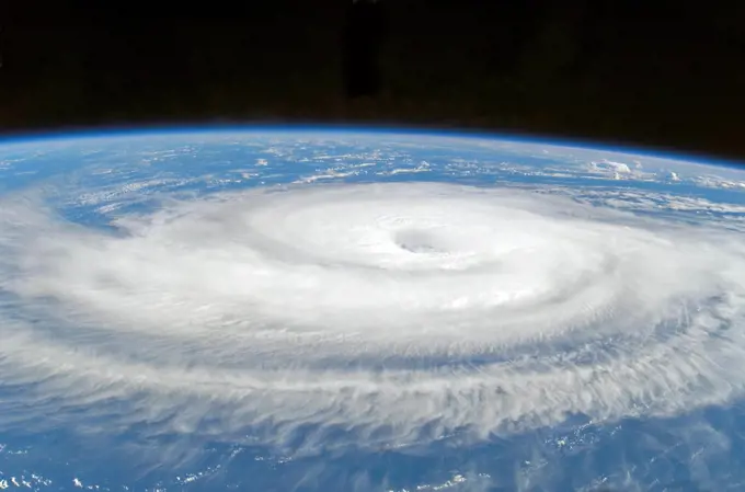
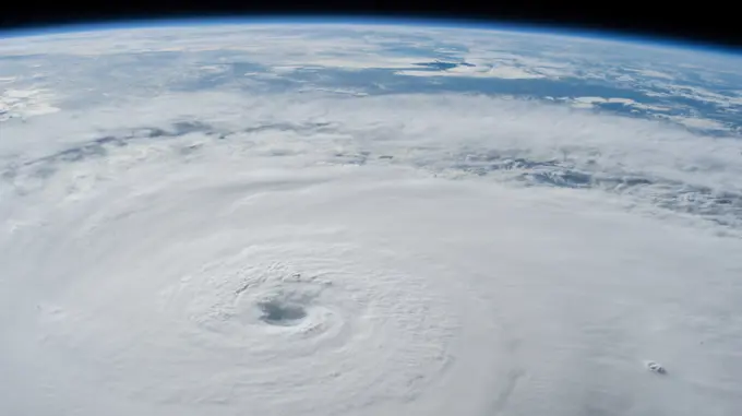
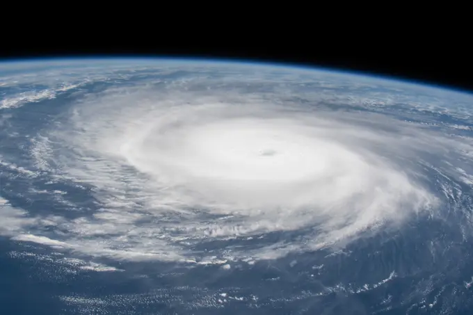
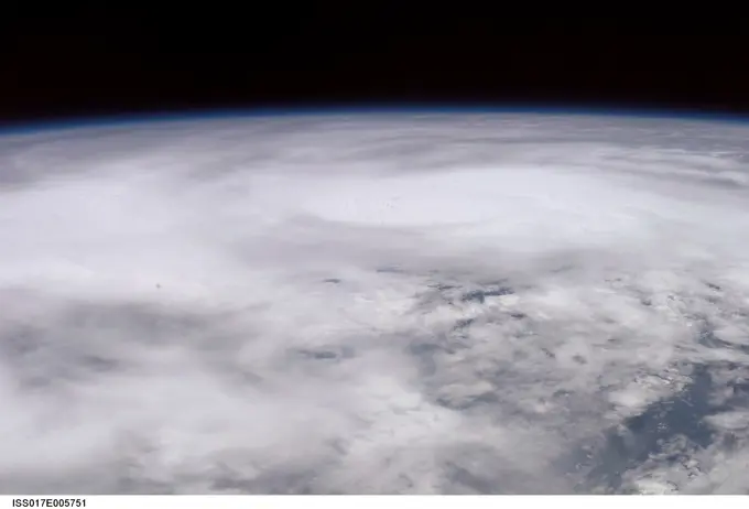
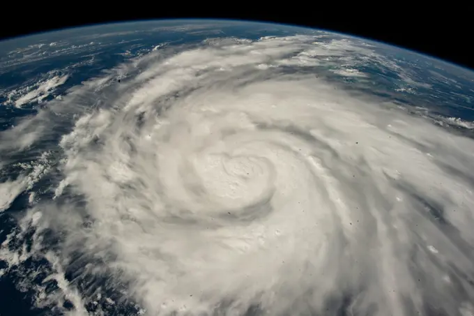
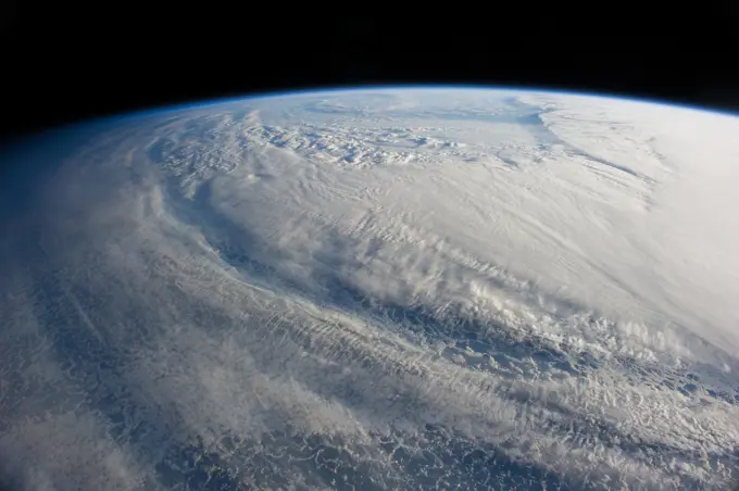
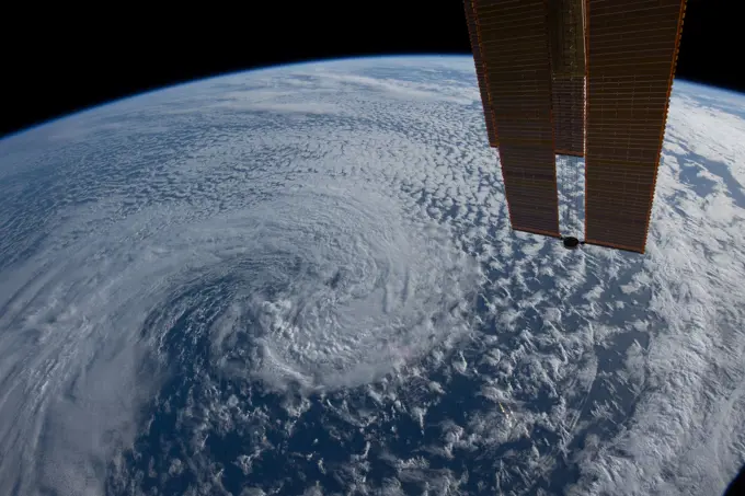
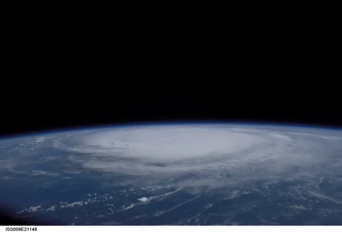
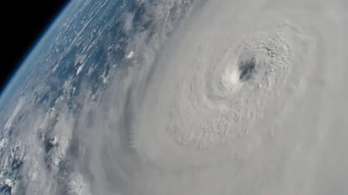
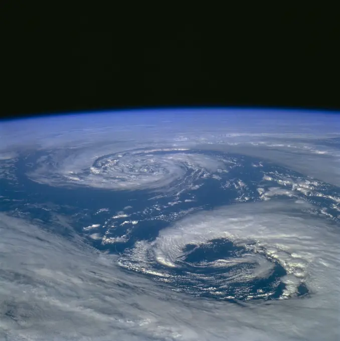
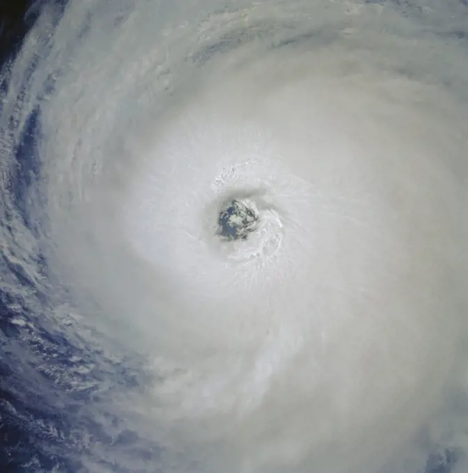
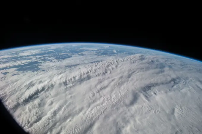
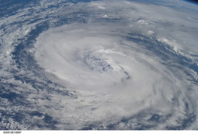
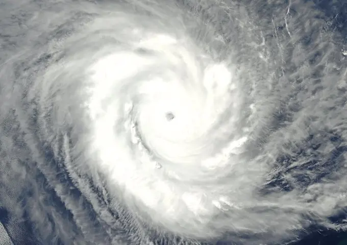
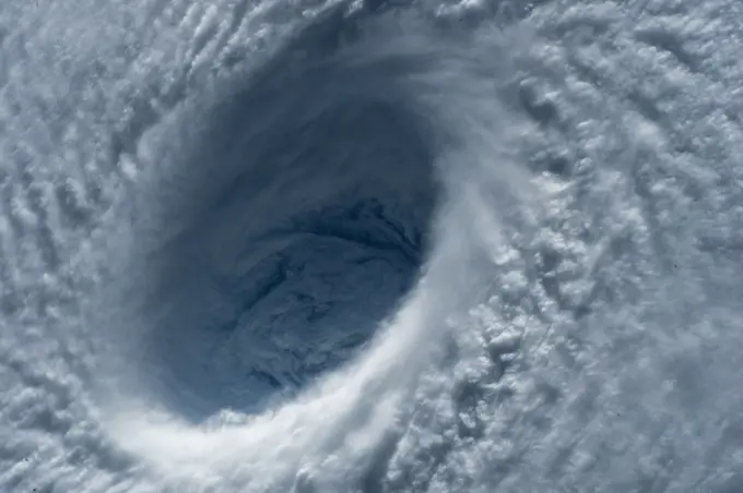
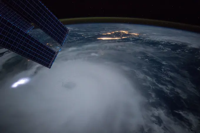
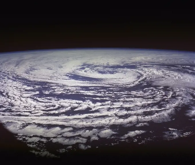
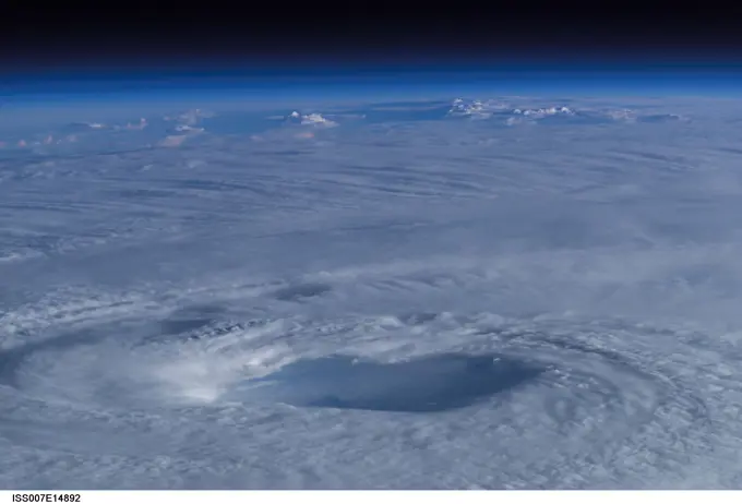
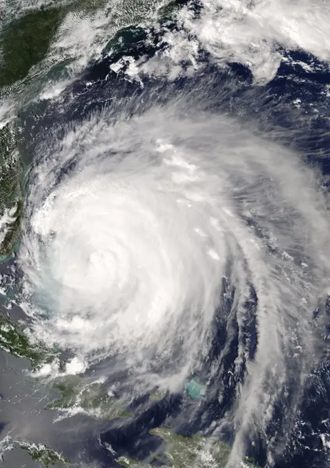
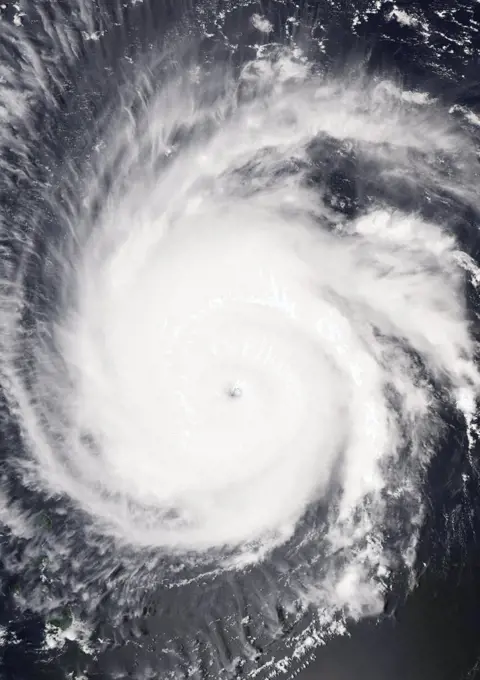
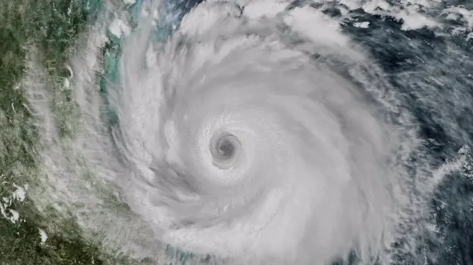
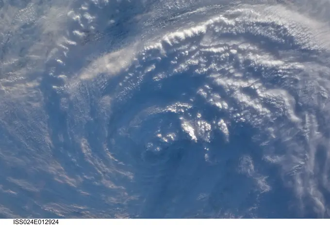
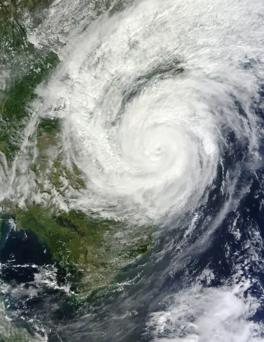
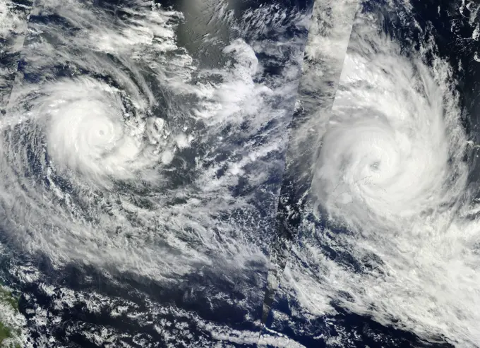
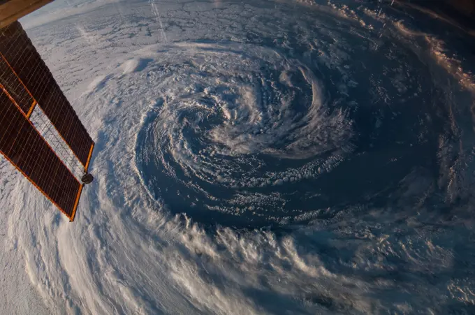
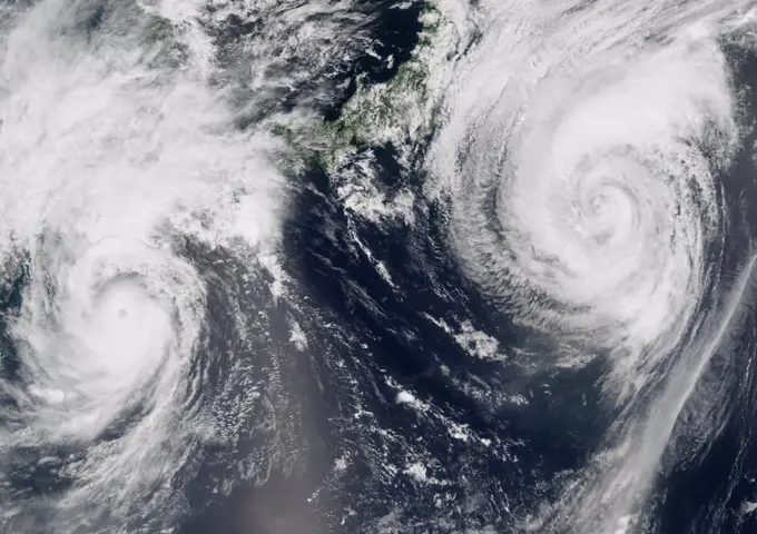
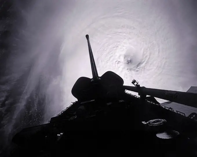
Fine ArtVintageFootageSubscriptionBoardsFree ResearchPricing
  • Fine Art
  • Vintage
  • Footage
  • Subscription
  • Boards
  • Free Research
  • Pricing

Hurricanes from Space

Dramatic views of hurricanes captured from space, illustrating swirling clouds and well-defined eyes against a backdrop of deep blue ocean.

Satellite image of Hurricane-Gordon-Atlantic-Ocean
68 assets in this story
6145-45176291
iss056e150297 (Aug. 21, 2018) --- Hurricane Lane, with its well-defined eye, was pictured as a category 5 storm southwest of the Hawaiian Islands as the International Space Station orbited almost 252 miles above the Pacific Ocean.
6145-45174830
iss056e129864 (Aug. 7, 2018) --- Hurricane Hector was pictured by an Expedition 56 crew member as the International Space Station orbited 250 miles above the Pacific Ocean almost due south of the big island of Hawaii which anchors the Hawaiian island chain.
6145-44546074
STS073-E-5313 (3 Nov. 1995) --- Typhoon Angela packed winds of 115 knots when this shot was taken with an Electronic Still Camera (ESC) from the Earth-orbiting space shuttle Columbia. It subsequently increased to speeds of 155 nautical miles, making it a supertyphoon, heading due west toward Luzon in the Philippines.
6145-44489284
. iss067e382116 (Sept. 28, 2022) --- Hurricane Ian is pictured approaching the west coast of Florida as a category 4 storm. The International Space Station was orbiting 259 miles above the Gulf of Mexico at the time of this photograph.
6145-45174831
iss056e126638 (Aug. 7, 2018) --- Hurricane Hector was pictured by an Expedition 56 crew member as the International Space Station orbited nearly 250 miles above the Pacific Ocean just south of the Hawaiian island chain.
6145-44703638
ISS017-E-005751 (30 April 2008) --- When this image was photographed by one of the crew members aboard the International Space Station, Tropical Cyclone Nargis was centered near a point located at 15.3 degrees north latitude and 88.2 degrees north longitude and moving northeast at 065 degrees at 8.1 miles per hour. The center was approximately 7 degrees southwest of Burma with sustained winds  of 74.9 miles per hour, gusting to 92.2 miles per hour, forecast to strengthen. Maximum significant wave height was 27 feet.
1746-19662491
Satellite image of Hurricane-Gordon-Atlantic-Ocean
6145-44482856
Hurricane Ian is pictured from the International Space Station as it orbited 258 miles above the Caribbean Sea east of Belize. At the time of this photograph, Ian was just south of Cuba gaining strength and heading toward Florida.
6145-45068050
ISS040-E-088943 (5 Aug. 2014) --- 09 41 16 GMT
6145-45252061
ISS009-E-20622 (28 August 2004) --- This oblique view of the Hurricane Frances was photographed with a digital still camera from the International Space Station at 12:51:44 GMT, August 28, 2004.
6145-45060438
Earth observation taken during a day pass by the Expedition 40 crew aboard the International Space Station. File identifies it as 53P Progress burn up.
1899-35723
Hurricane Humberto, Atlantic Ocean, In 2001, True Colour Satellite Image. Hurricane Humberto on 26 September 2001 over the Atlantic ocean, after passing near the Bermuda islands. True-colour satellite image using MODIS data.
6145-45174833
iss056e129954 (Aug. 7, 2018) --- Hurricane Hector was pictured by an Expedition 56 crew member as the International Space Station orbited nearly 250 miles directly above the storm in the Pacific Ocean just southeast of the Hawaiian island chain.
6145-54683958
. iss069e036524 (July 24, 2023) --- A storm in the southeast Pacific Ocean near the central coast of Chile is pictured from the International Space Station as it orbited 268 miles above.
6145-44636124
ISS011-E-13623 (24 September 2005) --- Hurricane Rita is featured in this image photographed by an Expedition 11 crewmember on the international space station, as it moves over Arkansas.
6145-44830132
ISS024-E-012920  (30 Aug. 2010) --- Photographed by an Expedition 24 crew member on the International Space Station,   this is an oblique view of the eye (just above center frame) of Hurricane Earl (at this time a category 4 but later downgraded to a category 3), centered just north of the Virgin Islands near 19.3 north latitude and 64.7 west longitude packing 115-kilometer winds.  The photo was taken with a digital still camera using a 35mm lens.
6145-45251051
ISS009-E-21148 (1 Sept. 2004) --  Astronaut Edward M. (Mike) Fincke, aboard the International Space Station (ISS) at an altitude of about 230 miles, took this photo of Hurricane Frances early Sept. 1.
6145-45178494
iss056e162819 (Sept. 14, 2018) --- Hurricane Florence is pictured from the International Space Station as a category 1 storm as it was making landfall near Wrightsville Beach, North Carolina.
6145-54684141
. iss069e084548 (Aug. 29, 2023) --- Hurricane Idalia is pictured in the Gulf of Mexico as the International Space Station orbited 261 miles above.
6145-45176290
iss056e150306 (Aug. 21, 2018) --- Hurricane Lane, with its distinct eye, was pictured as a category 4 storm as the International Space Station orbited 251 miles above the Pacific Ocean east of the Hawaiian Islands.
6145-58970864
iss063e078406 (Aug. 26, 2020) --- Hurricane Laura is pictured Wednesday afternoon off the coast of the Texas-Louisiana border as the International Space Station orbited above the Gulf of Mexico.
6145-44658665
S115-E-06692 (17 Sept. 2006) --- Hurricane Helene was captured at 18:20:14 GMT, Sept. 17, 2006 with a digital still camera, equipped with a 20-35mm lens, by one of the crewmembers aboard the Space Shuttle Atlantis. The center of the storm was located near 20.9 degrees north latitude and 49.0 degrees west longitude, while moving northwest. At the time the photo was taken, the sustained winds were 90 nautical miles per hour with gusts to 110 nauticalmiles per hour.
6145-44723966
ISS017-E-015166 (4 Sept. 2008) --- Hurricane Ike was still a Category 4 storm on the  morning  of Sept. 4  when this photo was taken from the International Space Station's vantage point of 220 miles above the Earth. The season's ninth named storm was churning west-northwestward through the mid-Atlantic Ocean sporting winds of 120 nautical miles per hour with gusts to 145.
6145-45064156
ISS040-E-042603 (8 July 2014) --- One of the Expedition 40 crew members aboard the International Space Station photographed a series of images of Typhoon Neoguri in the vicinity of Japan on July 8, 2014. This 24mm focal length oblique image was photographed at 07 41 19 GMT. The astronauts commented that it was difficult to get the entire storm into a single frame.
6145-44828835
STS060-89-000N (3-11 Feb 1994) --- Two areas of low pressure in the Bering Sea were captured on 70mm film by one of the STS-60 crew members on the Space Shuttle Discovery's aft flight deck.
6145-45252069
ISS009-E-22192  (11 September 2004) ---- This image of Hurricane Ivan, one of the strongest hurricanes on record, was taken Saturday from an altitude of about 230 miles by Astronaut Edward M. (Mike) Fincke, NASA ISS science officer and flight engineer, looking out the window of the International Space Station. At the time, Ivan was in the western Caribbean Sea and reported to have winds of 160 mph
6145-44747500
This is a picture of Hurricane Florence at its peak, over the open waters of the North Atlantic. This hurricane never made landfall over the United States, however after the storm became extra-tropical, it's moisture combined with a storm system over parts of Europe and caused large amounts of flooding across Spain and France.
6145-58967251
ISS028-E-035404 (31 Aug. 2011) --- Katia was a tropical storm gathering energy over the Atlantic Ocean when one of the Expedition 28 crew members took this high oblique photo on Aug. 31 from aboard the International Space Station. The picture, taken with a 12-mm focal length, was captured at 14:10:07 GMT. Later in the day Katia was upgraded to hurricane status. Two Russian spacecraft -- a Progress and a Soyuz -- can be seen parked at the orbital outpost on the left side of the frame.
1899-18984980
 (2-11 Aug 1991) --- This view featuring the eye of Hurricane Fefa in the Pacific Ocean was captured on film by one of the STS 43 crewmembers using a 70mm handheld camera..
6145-45097984
iss044e092183 (9/8/2015) --- Earth observation taken during a day pass for the ESA Experiment Thickness from Offbeam Returns (THOR) by the Expedition 44 crew aboard the International Space Station (ISS).
6145-44936426
Earth Observations taken by Expedition 34 crewmember.
6145-44638502
ISS012-E-10097 (3 Dec. 2005)  ---  This view of Hurricane Epsilon in the Atlantic Ocean was photographed at  15:36:18 GMT on Dec. 3, 2005   by one of the crewmembers of Expedition 12 aboard the International Space Station.  The orbital outpost was flying at an altitude of 190 nautical miles.  Center point coordinates are 34.5 degrees north latitude and 44.4 degrees west longitude.
1899-21989945
Satellite image of Cyclone Marcus in 2018 over the South Pacific. The Cyclone passed close to the north and northwest Australian coast. Image taken on March 23, 2018.
6145-44632953
ISS011-E-10258 (9 July 2005)  --- This easterly-looking image from the International Space Station shows Hurricane Dennis after the storm had already crossed Cuba and was heading for the northern Gulf of Mexico. Dennis was a Category 3 storm, packing winds of 115 miles per hour, at the time of exposure and located approximately 385 miles southeast of Biloxi, Mississippi or 280 miles south of Panama City, Florida. The ill-defined eye is in the lower right corner. The black triangle in extreme lower right is part of the Space Station's window.
6145-44658423
S115-E-07167 (18 Sept. 2006) --- A nadir view from the Space Shuttle Atlantis gives a good look at the eye of Hurricane Gordon. At the time the photo was taken, with a digital still camera eqipped with a 28mm lens, the center of Gordon was near 37.5 north latitude and 46.4 west longitude moving west-northwest.  The sustained winds were at 80 nautical miles per hour with gusts to 95 nautical miles per hour.
6145-44581737
ISS005-E-15901 (2 Oct 2002) --- Hurricane Lili over the Gulf of Mexico.
6145-44974728
On Sept. 21, Typhoon Usagi was moving between the northern Philippines and Taiwan when NASA's Aqua satellite passed overhead. NASA's AIRS instrument that flies aboard the Aqua satellite captured this near-infrared image on Sept. 21 at 505 UTC/1 05 a.m. EDT as Usagi. The near-infrared image is similar to how the clouds of the typhoon would appear in the daylight.
6145-44656087
ISS013-E-71348 (28 August 2006) --- The crewmembers aboard the International Space Station took this picture of Ernesto early afternoon on August 28, 2006. The tropical storm's center was located near 20.3 degrees north latitude and 75.7 degrees west longitude when the photo was taken. Movement was toward the northwest at 9 nautical miles per hour. Maximum sustained winds were at 35 nautical miles with gusts to 45 nautical miles.  Ernesto had earlier passed between the east side of the Dominican Republic and Grand Turk Island (the blue area in lower right corner).
6145-45091814
View of Typhoon Maysak taken by the Expedition 43 crew aboard the International Space Station (ISS).
6145-45098972
ISS045E037250 (10/02/2015) --- Hurricane Joaquin as seen from the International Space Station as it approached the Bahamas on Oct. 2, 2015. The intense storm was at Category 4 strength at the time the photo was taken.
6145-45251515
ISS009-E-21151 (1 Sept. 2004) -- Astronaut Edward M. (Mike) Fincke, aboard the International Space Station (ISS) at an altitude of about 230 miles, took this photo of Hurricane Frances at about 9 a.m. EDT Sept. 1 as the storm was centered about 775 miles east-southeast of West Palm Beach, Florida. At the time, Frances was a category 4 hurricane with winds of 140 mph.
6145-45070467
Earth Observation taken during a day pass by the Expedition 40 crew aboard the International Space Station (ISS). Folder lists this as Low Press System North Atlantic.
1574R-018003
Cyclonic Storm By Apollo 9 March 11, 1969
6145-58971458
iss070e008366 (Oct. 22, 2023) --- The International Space Station was orbiting 260 miles above the coast of Somalia on the Indian Ocean as Tropical Cyclone Tej was pictured on the Arabian Sea approaching the coast of Yemen.
4239R-20480394
September 11,  2005, 19:21:12 GMT - Framed by a window on the Destiny lab aboard the Space Station, this image of Hurricane Ophelia was captured by the Expedition 11 crew. The hurricane, located at 31.6 degrees north latitude and 75.8 degrees west longitude, was packing winds of 80 miles per hour when the photo was made.
6145-44601715
ISS007-E-14892 (15 September 2003) --- This close-up view of the eye of Hurricane Isabel was taken by one of the Expedition 7 crewmembers onboard the International Space Station (ISS).
6145-45231872
Major Hurricane Joaquin is shown at the far eastern periphery of the GOES West satellite's full disk extent, taken at 1200Z on October 1, 2015.
1899-35715
Hurricane Frances, Atlantic Ocean, On 03/09/2004, True Colour Satellite Image. Hurricane Frances on 3 September 2004 over the Bahamas north of the Carribean sea. True-colour satellite image using MODIS data.
1899-35716
Hurricane Frances, Atlantic Ocean, On 30/08/2004, True Colour Satellite Image. Hurricane Frances on 30 August 2004 north of the Caribbean sea. True-colour satellite image using MODIS data.
6145-44969048
Earth observation taken during day pass by an Expedition 36 crew member on board the International Space Station (ISS). Per Twitter message South American west coast.
6145-45092075
Earth observation taken by the Expedition 43 crew
6145-44904763
ISS032-E-025605 (9 Sept. 2012) --- Tropical Storm Leslie is clearly seen in the Atlantic Ocean on Sept. 9, 2012, as photographed by one of the Expedition 32 crew members aboard the Cupola of the International Space Station. At the time of the photo, Leslie was centered near 33.4 degrees north latitude and 62.1 degrees west longitude (approximately 175 miles east-northeast of Bermuda) moving northward at 14 miles per hour with winds of 60 miles per hour.
4128-111552848
Hurricane from space, illustration
6145-44830151
ISS024-E-012924 (30 Aug. 2010) --- Tropical Storm Danielle is featured in this Aug. 30 image photographed by an Expedition 24 crew member on the International Space Station.
6145-45259923
Hurricane Joaquin is seen in the Atlantic Ocean north of Bermuda in this image taken by GOES East at 1315 UTC (9 15 a.m. EDT) on October 5, 2015.
6145-44772483
One of the STS-51 astronauts used a fish-eye lens on a 35mm cmaera to photograph this view of Hurricane Kenneth in the Pacific Ocean. The Orbiting Retrievable Far and Extreme Ultraviolet Spectrometer/Shuttle Pallet Satellite (ORFEUS/SPAS) is still in the cargo bay. The Remote Manipulator System (RMS) is extended towards the open payload bay.
6145-45256606
On Nov. 10 at 03 30 UTC/Nov. 9 at 10 30 p.m. EDT, the MODIS instrument aboard NASA's Terra satellite showed the center of Typhoon Haiyan just south of Hainan Island, China in the South China Sea.
6145-44658417
S115-E-07080 (18 Sept. 2006) --- A view from the Space Shuttle Atlantis gives a good look of Hurricane Gordon. At the time the photo was taken, with a digital still camera equipped with a 28mm lens, the center of Gordon was near 37.5 north latitude and 46.4 west longitude moving west-northwest.  The sustained winds were at 80 nautical miles per hour with gusts to 95 nautical miles per hour.
6177-V53842288
6145-45232186
Image acquired March 14 - 15, 2010Two fierce tropical cyclones raged over the South Pacific Ocean in mid-March 2010, the U.S. Navys Joint Typhoon Warning Center (JTWC) reported. Over the Solomon Islands, Tropical Cyclone Ului had maximum sustained winds of 130 knots (240 kilometers per hour, 150 miles per hour) and gusts up to 160 knots (300 km/hr, 180 mph). Over Fiji, Tropical Cyclone Tomas had maximum sustained winds of 115 knots (215 km/hr, 132 mph) and gusts up to 140 knots (260 km/hr, 160 mph).The Moderate Resolution Imaging Spectroradiometer (MODIS) on NASAs Terra and Aqua satellites captured both storms in multiple passes over the South Pacific on March 15, 2010, local time. The majority of the image is from the morning of March 15 (late March 14, UTC time) as seen by MODIS on the Terra satellite, with the right portion of the image having been acquired earliest. The wedge-shaped area right of center is from Aqua MODIS, and it was taken in the early afternoon of March 15 (l
1746-19631732
Hurricane 'Florence' taken from Space Shuttle Atlantis from 165n. miles above earth. NASA
6145-45049960
ISS039-E-005762 (29 March 2014) --- One of the Expedition 39 crew members aboard the International Space Station on March 29 used a 14mm lens on a digital still camera to photograph this pre-winter storm located just off the coast of southwestern Australia. A solar array panel on the orbital outpost is in the left side of the frame.
1899-21289991
Satellite view of Typhoons Goni and Atsani in 2015 over the Pacific Ocean. Image taken on August 24, 2015.
4389-114
View of a Cyclone Behind the Tail of Space Shuttle Columbia in Earth Orbit
1746-28969207
Photograph of a Tornado. Dated 1979
1746-21119108
Photograph of a Tornado. Dated 1981
6145-44475887
A lightning strike was recorded at Launch Complex 39B at NASAs Kennedy Space Center in Florida on June 10, 2022. NASAs Space Launch System (SLS) and Orion spacecraft atop the mobile launcher are on the launch pad in preparation for the Artemis I mission. The lightning strike was recorded by cameras stationed at the pad and mobile launcher using a special filter called a “clear day frame,” which provides an overlay of the raw frame on a reference image. Artemis I will be the first integrated test of the SLS and Orion spacecraft. In later missions, NASA will land the first woman and the first woman of color on the surface of the Moon, paving the way for a long-term lunar presence and serving as a steppingstone on the way to Mars.
6145-44475889
A lightning strike was recorded at Launch Complex 39B at NASAs Kennedy Space Center in Florida on June 10, 2022. NASAs Space Launch System (SLS) and Orion spacecraft atop the mobile launcher are on the launch pad in preparation for the Artemis I mission. The lightning strike was recorded by cameras stationed at the pad and mobile launcher using a special filter called a “clear day frame,” which provides an overlay of the raw frame on a reference image. Artemis I will be the first integrated test of the SLS and Orion spacecraft. In later missions, NASA will land the first woman and the first woman of color on the surface of the Moon, paving the way for a long-term lunar presence and serving as a steppingstone on the way to Mars.
PREVIOUS
of 1
NEXT
2401 S. Ervay, Suite 206
Dallas, Texas 75215
United States
Browse
CategoriesGalleriesFree Research
For Creators
License Your ContentSuperStock For StudentsFrame of Mind BlogContributor PortalNew Image SpotlightLicense AI Imagery
Resources
About UsLicensingTerms & ConditionsAPI AccessPrivacyPricing
Contact
+1 866 236 0087help@superstock.com Contact form
©2026 SuperStock. All Rights Reserved. -A
This site is protected by reCAPTCHA and Google Privacy Policy and Terms of Service apply.