Fine ArtVintageFootageSubscriptionBoardsFree ResearchPricing
  • Fine Art
  • Vintage
  • Footage
  • Subscription
  • Boards
  • Free Research
  • Pricing

Mars Surface Features

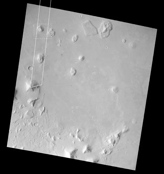
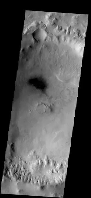
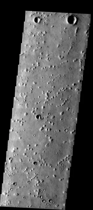
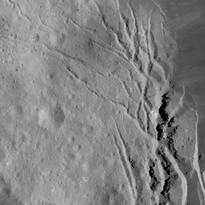
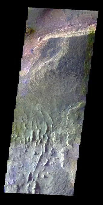
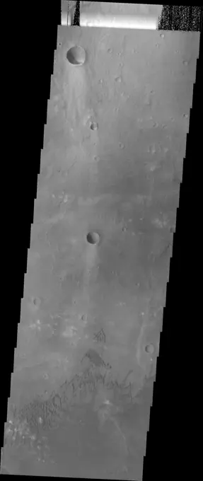
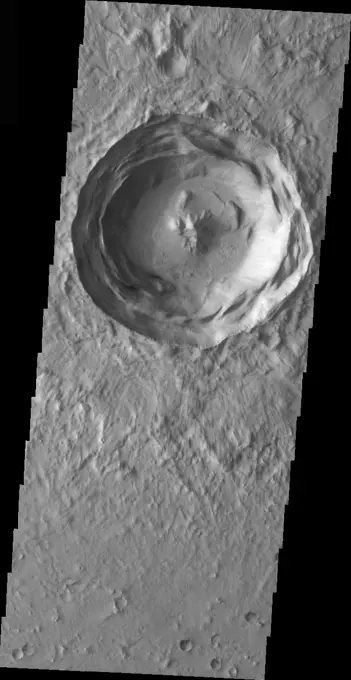
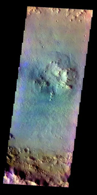
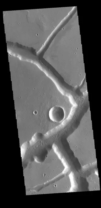
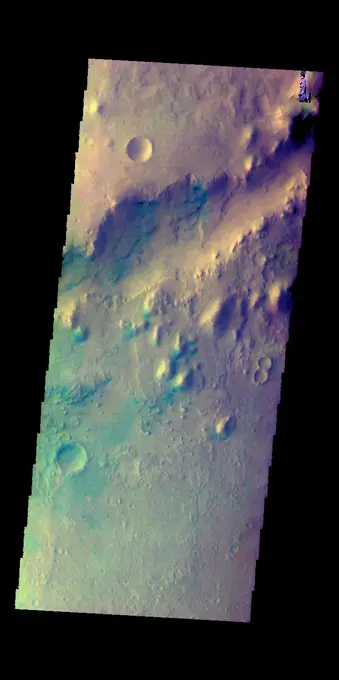
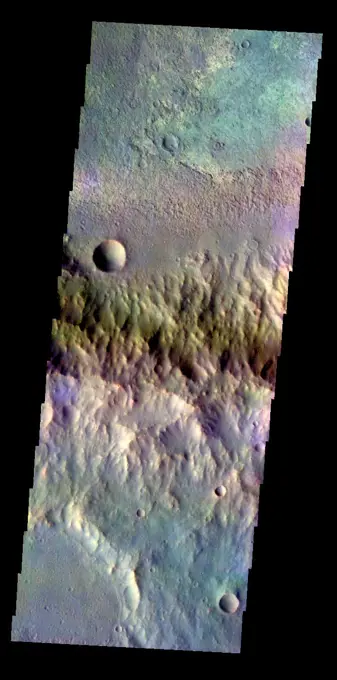
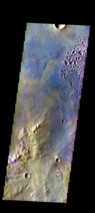
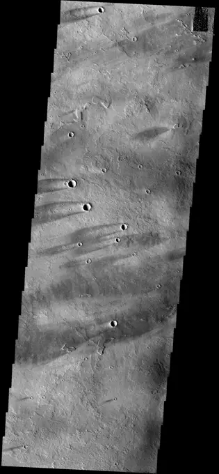
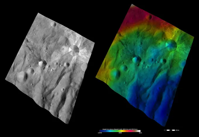
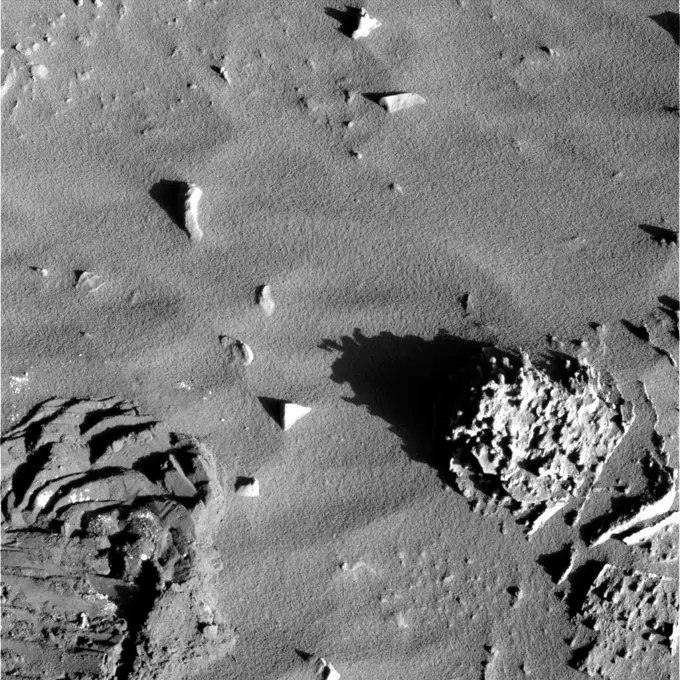
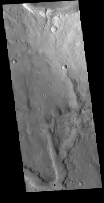
High-resolution images of Martian landscapes showing channels, craters, and geological formations, depicting Mars's complex surface.

Today's VIS image shows part of an unnamed channel in Arabia Terra. Orbit Number 81023 Latitude -5.09236 Longitude 352.53 Instrument VIS Captured 2020-03-20 18 00
353 assets in this story
6145-44964770
These windstreaks are located on Syrtis Major Planum, as shown in this image captured by NASA's 2001 Mars Odyssey spacecraft.
6145-45035480
This image from NASA's 2001 Mars Odyssey spacecraft shows part of the eastern flank of Elysium Mons. The small channels were likely created due to the flow of lava, rather than water.
6145-44565856
Mars Orbiter Camera Views the Face
6145-44659695
Gullies
6145-44665482
Layered Terrain near Mawrth Valles
6145-44598252
Bumps and Humps
6145-45262780
This VIS image shows an unnamed crater in Noachis Terra. The crater is relatively young, with several different structures on the floor and rim still visible. The inner rim of the crater has series of concentric benches, formed by collapse of the impacted surface into the bowl shaped interior. The crater floor is not flat, with several mounds created by rebound of melted material inside the crater. One of the more interesting features is that the crater is not round, as would be expected. The straight rims likely mean the there was a pre-existing tectonic fracture system, where the forces of the blast aligned with the fractures. Orbit Number 72453 Latitude -19.7034 Longitude 317.572 Instrument VIS Captured 2018-04-14 23 14
6145-44667885
Unusual Structure on Crater Rim in West Utopia Planitia
6145-45263545
This image of Occator Crater's southeastern wall and floor was obtained by NASA's Dawn spacecraft on June 17, 2018 from an altitude of about 22 miles (36 kilometers). The center of this picture is located at about 17.4 degrees north latitude and 243.8 degrees east longitude.
6145-45093127
The THEMIS VIS camera contains 5 filters. The data from different filters can be combined in multiple ways to create a false color image. This false color image from NASA's 2001 Mars Odyssey spacecraft shows craters in Terra Cimmeria.
6145-44838179
In this image from NASA's Mars Odyssey the majority of the surface appears uniform with a few small hills, the region of fractured blocks sticks out as 'something different,' perhaps remnants of crater ejecta, or an area of a different type of rock.
6145-44598773
Tader Valles
6145-45292423
Located between the lava plains of Daedalia Planum and Solis Planum, Claritas Fossae is a graben filled highland. Graben are formed by tectonic activity, where extensional forces stretch the surface allowing blocks of material to slide down between paired faults. These linear grabens are termed fossae. This region of Mars had very active tectonism and volcanism, resulting in the huge volcanos like Arsia Mons and deep chasmata of Valles Marineris. Claritas Fossae was formed prior to the large lava flows of the Tharsis region. Orbit Number 84439 Latitude -41.4956 Longitude 272.168 Instrument VIS Captured 2020-12-26 23 43
6145-45089098
The THEMIS VIS camera contains 5 filters. The data from different filters can be combined in multiple ways to create a false color image. This false color image from NASA's 2001 Mars Odyssey spacecraft shows part of Ceti Mensa in Candor Chasma.
6145-44680730
Dust Devil Tracks
6145-44882609
The Avernus region contains several different surface features. These include tectonic fractures, ridges, hills, and regions of chaos within isolated depressions termed cavi. This image was captured by NASA's 2001 Mars Odyssey spacecraft.
6145-44776123
The sand dunes in this image are located on the floor of Herschel Crater.
6145-44626166
Central Peak
6145-44918452
The windstreaks in this image from NASA's 2001 Mars Odyssey spacecraft are located on the southwestern flank of Alba Mons.
6145-45260925
Context image This image shows part of the dune field near Meroe Patera. High resolution imaging by other spacecraft has revealed that the dunes in this region are moving. Winds are blowing the dunes across a rough surface of regional volcanic lava flows. The paterae are calderas on the volcanic complex called Syrtis Major Planum. Dunes are found in both Nili and Meroe Paterae and in the region between the two calderas. The Odyssey spacecraft has spent over 15 years in orbit around Mars, circling the planet more than 69000 times. It holds the record for longest working spacecraft at Mars. THEMIS, the IR/VIS camera system, has collected data for the entire mission and provides images covering all seasons and lighting conditions. Over the years many features of interest have received repeated imaging, building up a suite of images covering the entire feature. From the deepest chasma to the tallest volcano, individual dunes inside craters and dune fields that encircle the north pole, chan
6145-45092585
The THEMIS VIS camera contains 5 filters. The data from different filters can be combined in multiple ways to create a false color image. This image from NASA's 2001 Mars Odyssey spacecraft shows the floor of an unnamed crater in Terra Cimmeria.
6145-45102949
This image captured by NASA's 2001 Mars Odyssey spacecraft shows an unnamed crater near Acheron Fossae. The structure of this crater includes a central pit and several concentric rims.
6145-45266400
The linear depressions in this VIS image were created by tectonic forces. The sides of the depression are faults. Paired faults will allow the block of material between them to slide down during marsquake events, forming the depressions. Orbit Number 77132 Latitude 30.5611 Longitude 285.586 Instrument VIS Captured 2019-05-05 08 37
6145-45264081
This image shows a small section of Nili Fossae. The darker blue tones are usually indications of basaltic sands. The THEMIS VIS camera contains 5 filters. The data from different filters can be combined in multiple ways to create a false color image. These false color images may reveal subtle variations of the surface not easily identified in a single band image. Orbit Number 60318 Latitude 24.7981 Longitude 80.7408 Instrument VIS Captured 2015-07-20 08 53
6145-44892025
This image from NASA's Dawn spacecraft shows an escarpment located in asteroid Vesta's near Rheasilvia quadrangle, near Vesta's south pole.
6145-44600892
Eroded Surfaces
6145-44578314
The ancient sinuous river channel shown in this image by NASA's Mars Odyssey spacecraft was likely carved by water early in Mars history. Auqakuh Valles cuts through a remarkable series of rock layers that were deposited and then subsequently eroded.
6145-45077614
The depression in the center of this image captured by NASA's 2001 Mars Odyssey spacecraft is a graben (fault bounded block of material). This graben is called Mangala Fossa.
6145-45111897
This image captured by NASA's 2001 Mars Odyssey spacecraft shows the inner rim of an unnamed crater on the western margin of Daedalia Planum.
6145-44888106
Abedin in Color
6145-45094391
The THEMIS VIS camera contains 5 filters. Data from different filters can be combined in multiple ways to create a false color image. This image from NASA's 2001 Mars Odyssey spacecraft shows the rim and ejecta of an unnamed crater in Xanthe Terra.
6145-45110053
The THEMIS camera contains 5 filters. The data from different filters can be combined in multiple ways to create a false color image. This image from NASA's 2001 Mars Odyssey spacecraft shows part of the plains of Terra Sirenum.
6145-45094904
The THEMIS VIS camera contains 5 filters. Data from different filters can be combined in multiple ways to create a false color image. This image from NASA's 2001 Mars Odyssey spacecraft shows part of the plains of Noachis Terra north of the Argyre basin.
6145-45051060
This image captured by NASA's 2001 Mars Odyssey spacecraft shows part of Buvinda Vallis, located just outside the northeastern flank of Hecates Tholus.
6145-44931492
This unnamed channel is located east of Baetis Chaos as seen by NASA's 2001 Mars Odyssey spacecraft.
6145-45094395
The THEMIS VIS camera contains 5 filters. Data from different filters can be combined in multiple ways to create a false color image. This image from NASA's 2001 Mars Odyssey spacecraft shows the rim and floor of an unnamed crater in Terra Cimmeria.
6145-44605158
Volcano Near Pavonis Mons
6145-44645599
These rough surfaced lava flows originated at Arsia Mons
6145-45094150
This false color image from NASA's 2001 Mars Odyssey spacecraft shows an unnamed channel on the margin between the higher elevations of Terra Cimmeria and the lower elevations of Elysium Planitia.
6145-45034670
Windstreaks, like the ones in this image from NASA's 2001 Mars Odyssey spacecraft, are a common feature on the plains of Syrtis Major Planum.
6145-45084890
The THEMIS VIS camera contains 5 filters. The data from different filters can be combined in multiple ways to create a false color image. This false color image from NASA's 2001 Mars Odyssey spacecraft shows part of the region near Nili Fossae.
6145-45265930
This VIS image shows part of northern Terra Sabaea. Blue tones in false color images usually indicate basaltic sand. The THEMIS VIS camera contains 5 filters. The data from different filters can be combined in multiple ways to create a false color image. These false color images may reveal subtle variations of the surface not easily identified in a single band image. Orbit Number 61910 Latitude 37.5082 Longitude 57.7093 Instrument VIS Captured 2015-11-28 10 37
6145-45129235
The THEMIS camera contains 5 filters. Data from different filters can be combined in multiple ways to create a false color image. This image from NASA's 2001 Mars Odyssey spacecraft shows part of the plains of Margaritifer Terra.
6145-44621181
Cerberus Fossae
6145-44673778
Scarp and Channels in a Crater in Terra Cimmeria
6145-58971919
The THEMIS VIS camera contains 5 filters. The data from different filters can be combined in multiple ways to create a false color image. These false color images may reveal subtle variations of the surface not easily identified in a single band image. Today's false color image shows part of Ariadnes Colles. The term colles means hills or knobs. In this false color combination the hills stand out against the darker surrounding plains. This difference is due to the amount of dust covering the hills versus the plains. Orbit Number 66840 Latitude -33.9962 Longitude 171.816 Instrument VIS Captured 2017-01-07 11 47
6145-44679418
Windstreaks
6145-44484689
Today's VIS image shows a section of Cerberus Fossae. Located southeast of the Elysium Planitia volcanic complex, the linear graben near the top of the image was created by tectonic forces related to the volcanic activity. The graben are sources of both channels and significant volcanic flows. Cerberus Fossae cuts across features such as hills, indicating the relative youth of the tectonic activity. Graben form where extensional tectonic forces allows blocks of material to subside between paired faults. Orbit Number 89952 Latitude 10.0355 Longitude 157.294 Instrument VIS Captured 2022-03-25 22 57
6145-44620712
Sweeping the Dust Away
6145-45094035
The THEMIS VIS camera contains 5 filters. The data from different filters can be combined in multiple ways to create a false color image. This false color image from NASA's 2001 Mars Odyssey spacecraft shows a portion of the plains in Terra Sabaea.
6145-44705972
Hebrus Valles
6145-44893038
These images from NASA's Dawn spacecraft are located in asteroid Vesta's Urbinia quadrangle, in Vesta's southern hemisphere.
6145-44617848
In the Shadows
PREVIOUS
of 4
NEXT
2401 S. Ervay, Suite 206
Dallas, Texas 75215
United States
Browse
CategoriesGalleriesFree Research
For Creators
License Your ContentSuperStock For StudentsFrame of Mind BlogContributor PortalNew Image SpotlightLicense AI Imagery
Resources
About UsLicensingTerms & ConditionsAPI AccessPrivacyPricing
Contact
+1 866 236 0087help@superstock.com Contact form
©2026 SuperStock. All Rights Reserved. -B
This site is protected by reCAPTCHA and Google Privacy Policy and Terms of Service apply.