Fine ArtVintageFootageSubscriptionBoardsFree ResearchPricing
  • Fine Art
  • Vintage
  • Footage
  • Subscription
  • Boards
  • Free Research
  • Pricing

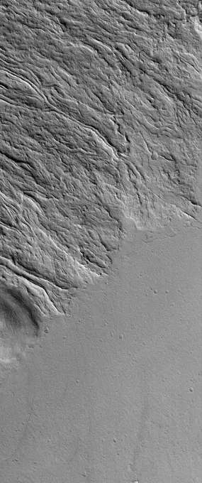
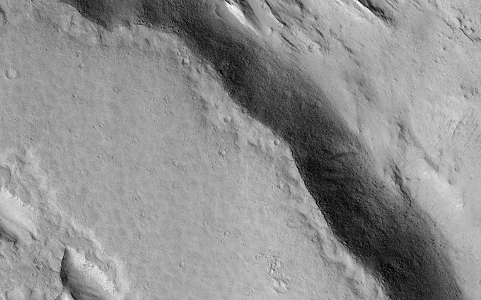
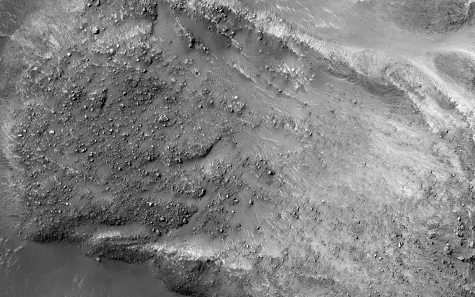
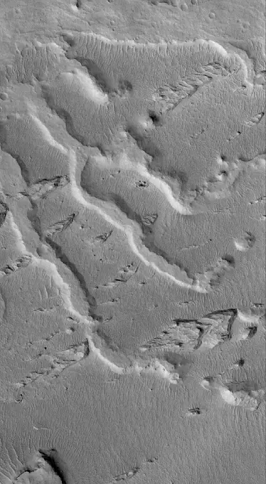
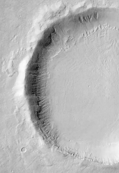
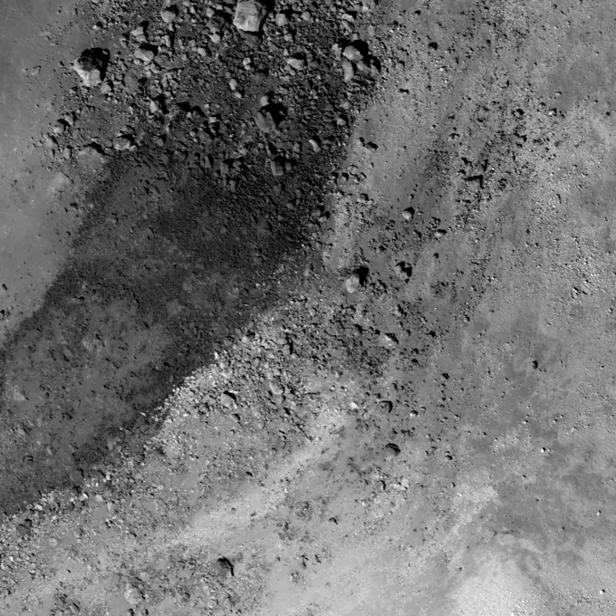
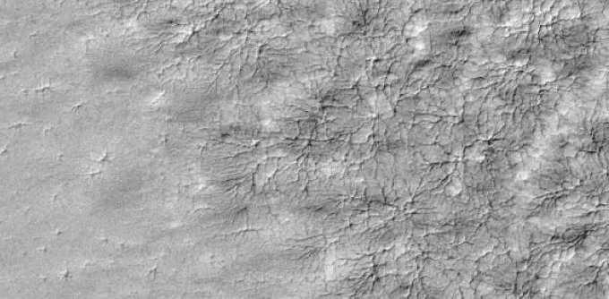
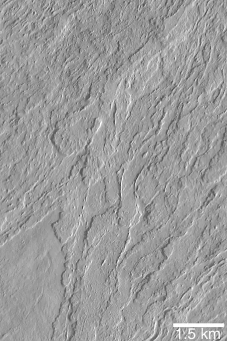
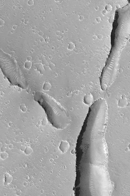
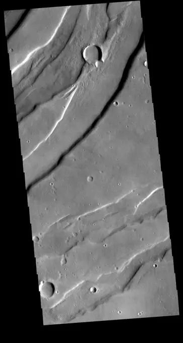
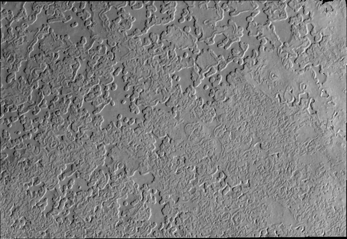
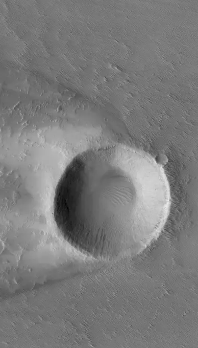
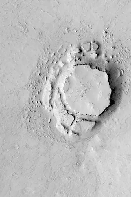
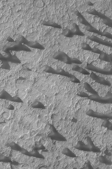
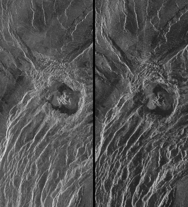
Martian Geological Features

Images depicting the surface of Mars, including lava flows, cracks, and geological formations.

Cracks in Utopia
Cracks in Utopia
186 assets in this story
6145-44637379
Martian Lava Flows
6145-44494604
Cracks in Utopia
6145-45266159
This image demonstrates the curious phenomenon called topographic inversion. The southern half of the picture is covered by a well-preserved lava flow. The flow stops just at the brink of descending a steep slope. Lava isn't afraid of falling, so what happened here It is likely that the terrain to the north was once higher, and stopped the lava from flowing any further. Once the lava cooled, it protected the ground beneath it, while the softer rocks to the north continued to erode, inverting the topography so that what was once low-lying ground is now the top of a mesa.
6145-44624058
Bedforms in Maja Valles
6145-44609403
Knob in Propontis
6145-45101290
The striking feature in this image from NASA's Mars Reconnaissance Orbiter is a boulder-covered landslide along a canyon wall. Landslides occur when steep slopes fail, sending a mass of soil and rock to flow downhill, leaving a scarp atop the slope.
6145-45091511
This image is of a portion of the Southern plains region within Hellas, the largest impact basin on Mars, with a diameter of about 2300 kilometers (1400 miles), as observed by NASA's Mars Reconnaissance Orbiter.
6145-44635873
Inverted Channels
6145-44630867
Lycus Sulci Terrain
6145-44635835
Flows of Ascraeus
6145-45057633
A large new crater, seen by NASA's Mars Reconnaissance Orbiter, appear slightly asymmetric in shape, and measures 159 x 143 feet (48.5 x 43.5 meters) in diameter, making it the largest new crater detected on Mars by MRO to date.
6145-45127980
NASA's Mars Reconnaissance Orbiter sees ice-rich mantling deposits accumulate from the atmosphere in the Martian mid-latitudes in cycles during periods of high obliquity.
6145-44605645
Polygons near Lyot Crater
6145-44612303
Gullies in Crater
6145-44572871
Channels on Bakhuysen Crater Wall
6145-44876238
In this image, obtained by the framing camera on NASA's Dawn spacecraft, various craters are visible in the southern equatorial region of the giant asteroid Vesta.
1746-19670847
Debris flow extending down the southwest wall of Janssen K crater.
6145-44928810
Many different surface textures are found on the polar caps. This image captured by NASA's 2001 Mars Odyssey spacecraft shows part of the surface of the south polar cap.
6145-44506732
Chain of Pits on Pavonis Mons
6145-45057603
This image from NASA's Mars Reconnaissance Orbiter shows impact craters.
6145-45252838
9 March 2005 This Mars Global Surveyor (MGS) Mars Orbiter Camera (MOC) image shows a trough in the Labyrinthus Noctis region. Location near 1.5°S, 92.5°W Image width ~3 km (~1.9 mi) Illumination from upper left Season Southern Winter http //photojournal.jpl.nasa.gov/catalog/PIA07449
6145-44638860
Tractus Catena Pits
6145-44597717
Flows on Olympus Mons
6145-44506697
South Melea Planum, By The Dawn's Early Light
6145-44632420
Arsia Mons Overlapping Flows
6145-44561754
Hebes Chasma #1
6145-44666824
Sinuous Ridges in Argyre Basin
6145-44547389
This full-resolution image from NASA's Magellan spacecraft shows the northern part of the Akna Montes (mountains) of Venus.
6145-44631919
Ladon Sedimentary Rocks
6145-44620206
Martian Scribbles
6145-45262799
During the 2018 Mars dust storm, we obtained a clear view of the summit of the giant volcano Elysium Mons. We see the western rim and floor of the caldera, and a chain of pits (called a catena ) extending from the caldera towards the north. The chain of pits likely formed by volcanic processes, such as the collapse of a lava tube after it drained. Or by a tectonic process, such as a rift in the rocks below that drained loose material from the surface. An unexpected feature of this catena is the presence of avalanches in two of the pits (marked A and B in the cutout, with the uphill direction towards the top of the image.) The flows in both pits could be ancient, produced during the formation of the catena, but they are not found in the other pits in the chain. They might have formed more recently by the collapse of steep dust deposits like those in a degraded crater to the left of the catena.
6145-44618881
Exposed Crater
6145-44647942
This MOC image shows a chain of collapse pits on a dust-mantled, lava-covered plain northeast of Ascraeus Mons -- one of the giant volcanoes located in the Tharsis region of Mars
6145-44619120
Martian Gullies
6145-44617576
Exposing Memnonia Terrain
6145-44560493
Medusae Fossae Formation
6145-44510851
Candor Chasma - Massive (non-layered) Material Expos
6145-45265667
This image was taken of the hills that resulted from uplifted rocks due to an impact that formed the 230-kilometer diameter Galle Crater. These hills form a segment of a circle known as a peak ring and this particular formation makes Galle Crater look like a smiley face from orbit. Small gullies, visible in the center of this image, have formed on the flanks of these hills and they have eroded back into the bedrock. The crater itself is probably billions of years old, yet these gullies are likely only hundreds of thousands of years old and may even be active today. The small channels in these gullies are easily erased by the wind over long time periods, so we know these gullies must have been active recently.
6145-44504254
High-Resolution South Polar Cap Mosaics
6145-44604339
Isidis Planitia
6145-44602490
Mesas and Troughs
6145-45046677
NASA's Mars Reconnaissance Orbiter spies an impact crater located in northern Sinus Meridiani has formed along the boundary of two different terrain units.
6145-44634789
Martian Gullies
6145-44589472
This visible-light image, taken by NASA's Mars Odyssey spacecraft, indicates that gullies on Martian crater walls may be carved by liquid water melting from remnant snow packs.
6145-44600117
Top of Olympus Mons
1746-19670864
Close up view of the central peak of Aristarchus crater.
6145-44655078
A delicate pattern, like that of a spider web, appears on top of the Mars residual polar cap, after the seasonal carbon-dioxide ice slab has disappeared
6145-45091037
This image from NASA's 2001 Mars Odyssey spacecraft shows warm dunes are brighter than their surroundings in this infrared image of an unnamed crater in Noachis Terra.
6145-44599310
Olympus Mons Lava Flows
6145-44506487
Layers of Cratered Highland Bedrock Exposed in Amenthes Slope
6145-44634824
South Polar Layers
6145-45089824
This IR image from NASA's 2001 Mars Odyssey spacecraft shows a dune field on the floor of an unnamed crater in Noachis Terra. The bright tone indicates the dunes are warmer than most of the material surrounding them.
6145-44621456
Cerberus Fossae Pits
6145-44507005
Evidence for Recent Liquid Water on Mars: South-facing Walls of Nirgal Vallis
6145-44970787
This daytime IR image from shows NASA's 2001 Mars Odyssey spacecraft part of the dune field on the floor of Rabe Crater. The dunes show up as brighter than the surrounding materials because they are warmer.
6145-44784492
The Context Camera aboard NASA's Mars Reconnaissance Orbiter discovers new dark spots on Mars that, upon closer examination, turn out to be brand new impact craters.
6145-58971822
Multiple processes, which may have occurred billions of years apart, are reflected in this HiRISE image of Aeolis Planum. Cutting across the scene are curvilinear ridges. These likely represent ancient, meandering river channels that flowed across the surface and buried themselves over time. The channels have subsequently been exposed to the surface by the wind, forming the cross-cutting ridges. Approximately north-south across the image are a series of linear ridges called yardangs, which are streamlined landforms that also form due to wind-driven erosion. The orientation of the yardangs reflects the prevailing wind direction when they formed. Both sets of ridges emerged from the preferential removal of softer bedrock by the wind.
6145-44625908
Layers in Shalbatana Vallis
6145-45059671
On Mars, alluvial fans are sometimes visible in impact crater basins, as material from the steep rims is transported radially inward to the relatively flat floor. This image is from NASA's Mars Reconnaissance Orbiter.
6145-44646366
This vent and associated flow are located at the base of Arsia Mons
6145-44630570
Fractured Ground
6145-44640166
This Mars Global Surveyor (MGS) Mars Orbiter Camera (MOC) image shows the floor and walls of a small portion of Nirgal Vallis. The floor is covered by large windblown ripples
6145-44660509
This MOC image shows several small, dark sand dunes and a small crater within a much larger crater (not visible in this image). The floor of the larger crater is rough and has been eroded with time
6145-44579895
Gullies in a Crater Wall in Newton Basin:
6145-44635858
Lonely Butte
6145-45265912
At several locations in the southern hemisphere there are craters that have been filled with material almost to the top of the crater rim. What the material is and where it came from are still open questions, and may not even be the same process from crater to crater. In several of these filled craters there are canyon like features where the fill material has been removed or eroded. Sometimes the depressions parallel the crater rim, but in other cases the depression is in the center of the crater and is usually linear. A ring of gullies encircle the top of the depression in this crater. This unnamed crater is located in southern Noachis Terra. Orbit Number 74984 Latitude -68.5481 Longitude 1.57599 Instrument VIS Captured 2018-11-09 10 35
6145-44546649
This image of Miranda, Uranus' moon, was acquired by NASA's Voyager 2 on Jan. 24, 1986. Miranda displays a dramatically varied surface. Well shown are numerous ridges and valleys -- a topography that was probably produced by compressional tectonics.
6145-45263065
This image was obtained by NASA's Dawn spacecraft on July 5, 2018 from an altitude of about 26 miles (43 kilometers). The center of this picture is located at about 15.1 degrees north latitude and 241.2 degrees east longitude.
6145-44611533
Cerberus Fossae Trough
6145-44654284
This MOC image shows a flow or landslide feature on a hillslope facing north (toward top/upper right) that is buried on both ends
6145-44620956
Exhumed Arabian Crater
6145-44558124
Complex Floor Deposits Within Western Ganges Chasma, Valles Marineris
6145-45264641
This image was obtained by NASA's Dawn spacecraft on August 2, 2018 from an altitude of about 130 miles (210 kilometers). The center of this picture is located at about 16.1 degrees north latitude and 243.7 degrees east longitude.
6145-44611531
Last
6145-45266418
These curious chevron shapes in southeast Hellas Planitia are the result of a complex story of dunes, lava, and wind. Long ago, there were large crescent-shaped (barchan) dunes that moved across this area, and at some point, there was an eruption. The lava flowed out over the plain and around the dunes, but not over them. The lava solidified, but these dunes still stuck up like islands. However, they were still just dunes, and the wind continued to blow. Eventually, the sand piles that were the dunes migrated away, leaving these footprints in the lava plain. These are also called dune casts and record the presence of dunes that were surrounded by lava. Enterprising viewers will make the discovery that these features look conspicuously like a famous logo and you'd be right, but it's only a coincidence.
6145-44609152
Gullied Martian Slope
6145-44878926
The small, individual dunes in this image captured by NASA's 2001 Mars Odyssey spacecraft are located in an unnamed crater in Noachis Terra.
6145-44638527
Dust-covered Flow
6145-44629326
Crater with Windstreak
6145-44600103
Labou Vallis
1746-19671156
The fracture is this image cuts right through a hill, indicating tremendous tectonic stresses were at work to create this feature.
6145-44621967
Exhuming Craters
6145-45259415
This image from NASA's Mars Reconnaissance Orbiter shows an elongated depression from three merged craters. The raised rims and ejecta indicate that these are impact craters rather than collapse or volcanic landforms. The pattern made by the ejecta and the craters suggest this was a highly oblique (low angle to the surface) impact, probably coming from the west. There may have been three major pieces flying in close formation to make this triple crater.
6145-44795353
NASA's Lunar Reconnaissance Orbiter captures a debris flow extending down the southwest wall of Janssen K crater.
6145-44600104
Marte Vallis Platy Flows
6145-44600624
Hephaestus Fossae
6145-58972016
Today's VIS image is shows a small portion of Tempe Fossae. The fossae are graben comprised of paired, parallel fractures with a down-dropped block of material between the fracture set. This morphology is created by extensional tectonic stresses. This image is located in a region of Tempe Terra that is complexly fractured. The complete fossae system in almost 2000 km (1242 miles) long. Orbit Number 80189 Latitude 39.8621 Longitude 286.175 Instrument VIS Captured 2020-01-12 02 09
6145-44757851
Solar Power
6145-45081318
This image captured by NASA's 2001 Mars Odyssey spacecraft illustrates the complex surface of the polar cap, featuring not just different surface textures, but ridges and valleys as well.
6145-44651349
This MOC image shows a portion of a trough cutting across a dust-covered plain in the Labeatis Fossae region of Mars. Boulders derived from the layered exposures near the top of the trough walls are resting on the floor
6145-44632996
Crater in Daedalia
1457-1145
This Mars Global Surveyor (MGS) Mars Orbiter Camera (MOC) picture shows a mesa in the Avernus Colles region of Mars, near 3.9°S, 190.8°W, August 25, 2003
6145-44597448
Sand Dunes of Schaeberle Crater
6145-44663079
Viking Lander 2 (Gerald A. Soffen Memorial Station) Imaged from Orbit
6145-44632794
East Tharsis Pit Chain
6145-45257884
It's hard to see in the dark. Most HiRISE images are are taken when the sun is at least 15 degrees above the horizon. (If you hold your hand at arm's length with fingers together, it's about five degrees wide on average.) However, to see what's going on in winter, we need to look at times and places where the Sun is just barely over the horizon. This image was taken to look at seasonal frost in gullies during southern winter on Mars, with the Sun only about two degrees over the horizon (just before sunset). To make things more difficult, the gullies are on a steep slope facing away from the sun, so they are in deep shadow. Under these conditions, HiRISE takes what are called bin 4 images. This means that the image shows less detail, but by adding up the light from 16 pixels (a 4x4 square) we can see details in shadows. Even with the reduced resolution, we can see plenty of detail in the gullies, and learn about the seasonal frost. http //photojournal.jpl.nasa.gov/catalog/PIA20480
6145-45102711
This image from NASA's Mars Reconnaissance Orbiter spacecraft is of a morphologically fresh and simple impact crater in the Hellespontus region; it has a simple bowl shape and raised crater rim.
6145-44856099
Post-impact Modification of Klute W
6145-44547406
This is a stereo image pair of crater Goeppert-Mayer obtained by NASA's Magellan radar mapping mission.
6145-44621453
Cracked Plain, Buried Craters
PREVIOUS
of 2
NEXT
2401 S. Ervay, Suite 206
Dallas, Texas 75215
United States
Browse
CategoriesGalleriesFree Research
For Creators
License Your ContentSuperStock For StudentsFrame of Mind BlogContributor PortalNew Image SpotlightLicense AI Imagery
Resources
About UsLicensingTerms & ConditionsAPI AccessPrivacyPricing
Contact
+1 866 236 0087help@superstock.com Contact form
©2026 SuperStock. All Rights Reserved. -A
This site is protected by reCAPTCHA and Google Privacy Policy and Terms of Service apply.