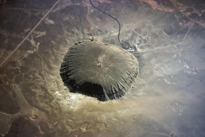
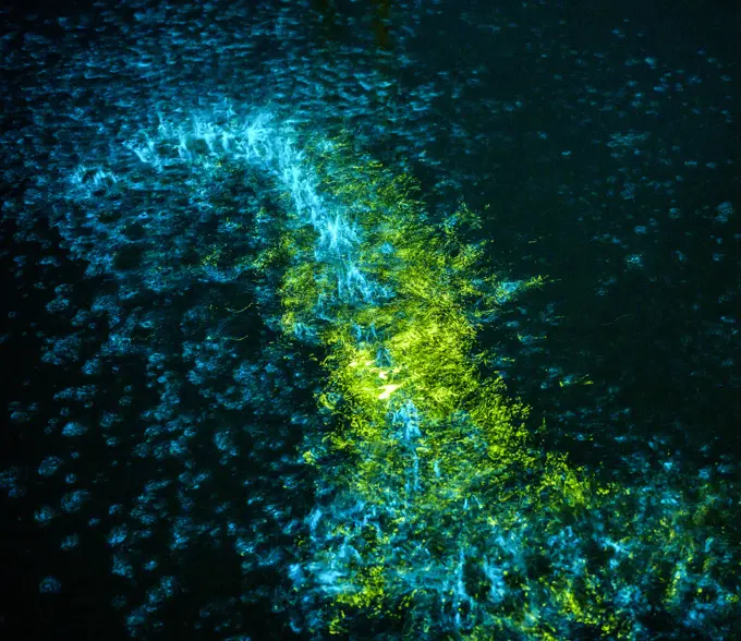
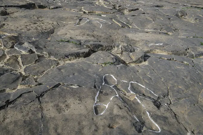
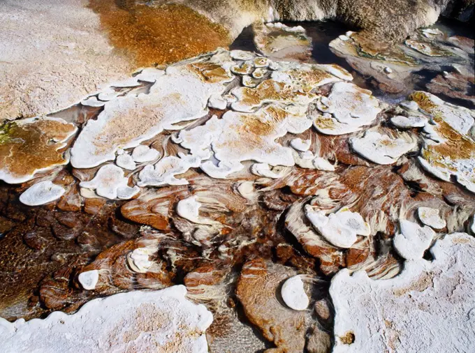
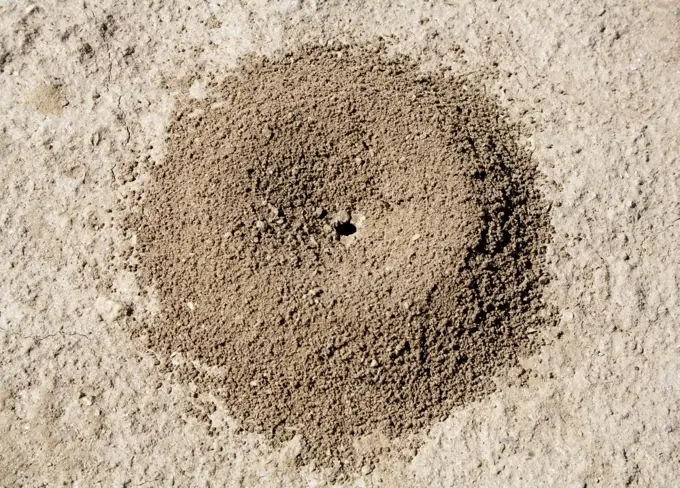
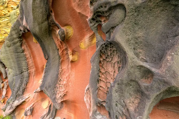
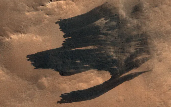
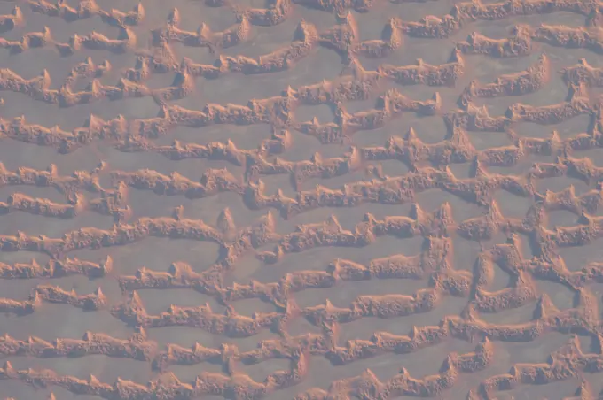
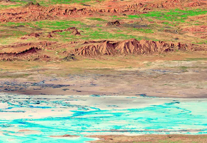
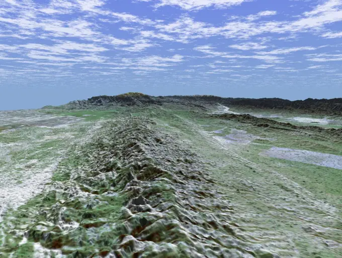
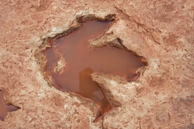
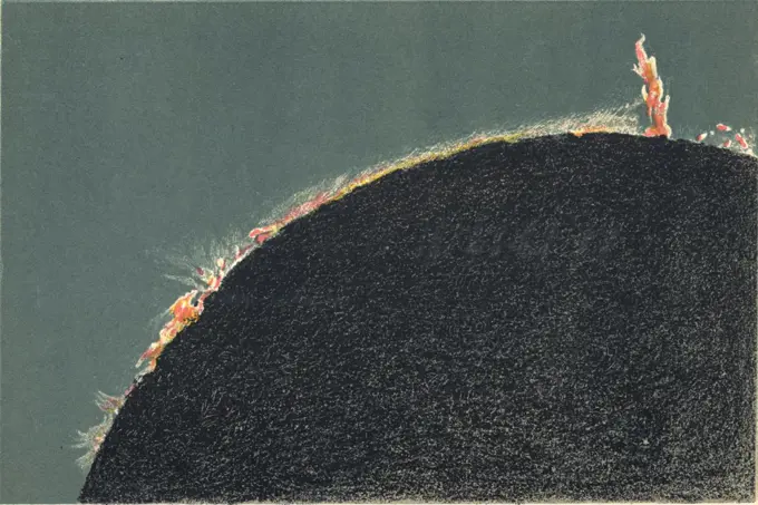
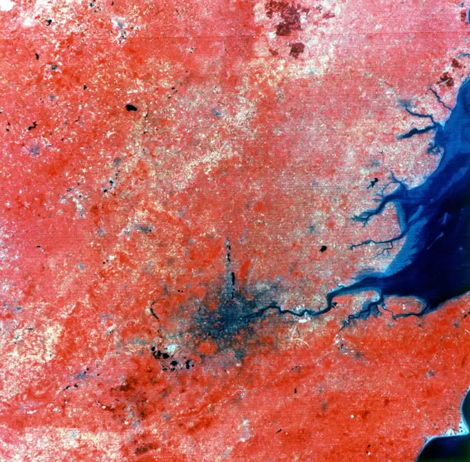
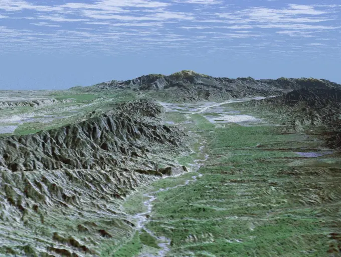
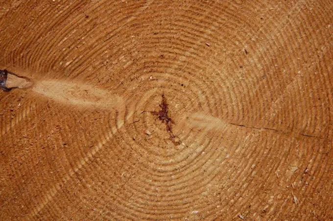
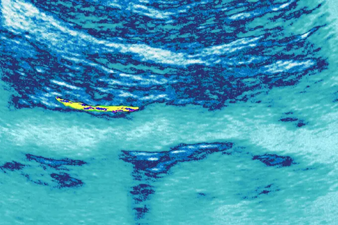
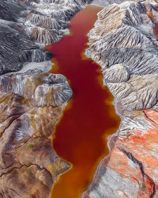
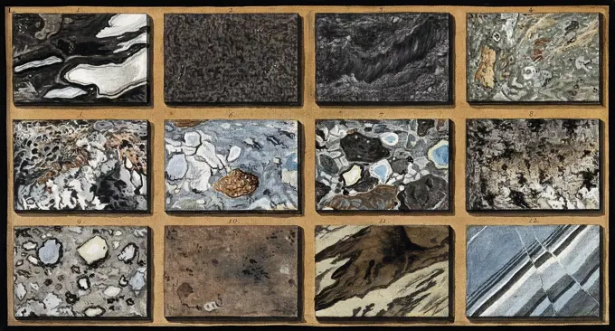
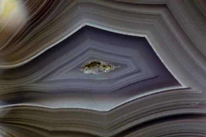
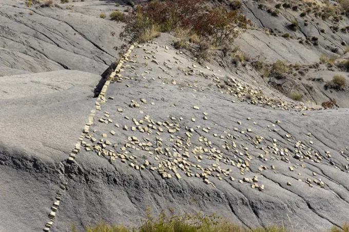
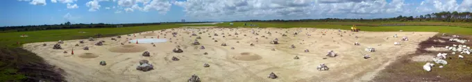
Fine ArtVintageFootageSubscriptionBoardsFree ResearchPricing
  • Fine Art
  • Vintage
  • Footage
  • Subscription
  • Boards
  • Free Research
  • Pricing

Underground Testing and Mining

Images depict geological formations from nuclear testing and mining sites, featuring earthy tones and rugged textures in underground environments.

Shaky, CU, astronaut using a metal detector on the moon
258 assets in this story
4186-58631497
BARRINGTON METEOR CRATER AERIAL VIEW NEAR WINSLOW ARIZONA USA
6145-44606469
In this natural-color image from NASA's Terra spacecraft, a fingerprint-like gravity wave feature occurs over a deck of marine stratocumulus clouds.
1815-63049684
Illuminated Noctiluca scintillans during night in sea
6145-50597527
A801360 U12G RS-12 MINEBACK CARL W SMITH JUL 17 80 EG&G/NTS PHOTO LAB Publication Date: 7/17/1980  EDGERTON, GERMESHAUSEN & GRIER; EG&G; EQUIPMENT & INSTRUMENTS; INSTRUMENTS & EQUIPMENT; MINEBACK; NEVADA; NEVADA TEST SITE; NTS; NUCLEAR ENERGY TECHNOLOGY; NUCLEAR TESTING; NUCLEAR TESTS; RS-12; SMITH, CARL W; TEST SITES; TESTING; U12G; UGT; UNDERGROUND TESTING; WEAPON EFFECTS; WEAPONS RELATED; WEAPONS TECHNOLOGY; U12G RS-12 - MINEBACK  historical images. 1972 - 2012. Department of Energy. National Nuclear Security Administration. Photographs Related to Nuclear Weapons Testing at the Nevada Test Site.
4409-61880426
Dinosaur tracks, The Peladillo Era Ichnites Deposit, Igea, La Rioja , Spain, Europe.
4272-6354
Chile, Region I, Pintados. Geoglyphs on a mountainside near Pintados,  Northern Chile- representations of humans, animals, and geometric designs
1746-19633043
Lunar surface, 1857. Surface of the Moon in the region of Mare Crisium at New Moon. From 'Astronomical Observations made at the Royal Observatory, Edinburgh'. (Edinburgh, 1857).
4332-3795
USA, Wyoming, Yellowstone National Park, Mammoth Hot Springs, Travertine deposits with thermophilic bacteria growing in hot water
1525-22409132
Close-up image of anthill in soil
6162-72099769
Aerial view of a roundabout and roads partially buried in the golden sands of the desert, a stark contrast of man-made structures and natural forces, Dubai, Dubai, United Arab Emirates.
4413-19098001
Geoforms in Jaizkibel Sandstone, Jaizkibel Coastal Massif, Basque Country, Spain. Remarkable sculptures of Eocene sandstone (geoforms) of origin in part biological (fossil biological activities) and updated by erosion - the yellow discs are undoubtedly remains of paramoudra, concretions around the worm burrows
6145-45265378
HiRISE has been imaging new dark features discovered by MRO's Context Camera, which are mostly new impact sites. In this scene we see what appears to be a new impact cluster and, extending downhill from the craters, new dark slope streaks. These slope streaks are formed by dry dust avalanches. We've also seen large new dust avalanches associated with new impacts at previous locations.
6145-44978727
Earth observation taken during a day pass by an Expedition 37 crew member on board the International Space Station (ISS).
6145-45080556
GMT326_08_15_Barry Wilmore_Israel Saudi Peninsula Sand Dunes_131 (Image was released by astronaut on Instagram.)
6145-44524251
The earthquake that struck western India on January 26, 2001, was the country's strongest in the past 50 years. This perspective view shows the area of the earthquake's epicenter in the lower left corner.
6145-44592639
Dark smoke from oil fires extend for about 60 kilometers south of Iraq's capital city of Baghdad in this anaglyph acquired by the MISR instrument aboard NASA's Terra spacecraft on April 2, 2003. 3D glasses are necessary to view this image.
6145-45238976
AS06-02-1436 (4 April 1968) --- View of the mouth of the Colorado River and the Gulf of California in northwestern Mexico as photographed from the unmanned Apollo 6 (Spacecraft 020/Saturn 502) space mission. Altitude of the spacecraft at the time picture was taken was 120 nautical miles. NORTH IS TOWARD LEFT SIDE OF PICTURE. At bottom edge of photograph is Baja California. In the upper left corner is the Mexican state of Sonora showing the Sonoran Desert and the Pinacate Mountains. This photograph was made three hours and seven minutes after liftoff using Eastman Kodak SO-121 high resolution aerial Ektachrome film (exposure setting was f/5.6 at 1/500 second) in a J.A. Maurer model 2200 camera.
6145-44513469
The 1,200-kilometer (800-mile) San Andreas is the longest fault in California and one of the longest in North America as seen by NASA's Shuttle Radar Topography Mission (SRTM) on February 16, 2000.
6145-45297426
AS17-153-23572 (15 Dec. 1972) --- An oblique view of the Sulpicius Gallus region on the southwestern edge of the Sea of Serenity looking westward across the Haemus Mountains, as photographed from the Apollo 17 Command and Service Modules during its 65th revolution of the moon. This photograph shows the slight orange cast which was identified by astronaut Ronald E. Evans, command module pilot. The region shown in the picture is about 600 kilometers (360 statute miles) west across Mare Serentatis from the Taurus-Littrow landing site where scientist-astronaut Harrison H. Jack Schmitt, lunar module pilot, discovered an orange soil sample composed of fine glass particles rich in iron and titanium. North is toward the right. Rima Sulpicius Gallus is the lunar trench or valley (right foreground) that crosses the edge of the Mare and divides into three branches as it runs to the northwest. The crater Sulpicius Gallus is just off the photograph at the bottom right. Note that several small crate
4220-20062480
Fossil Dinosaur Footprint (Theropod). Early Jurassic - Navajo reservation near Tuba city - Arizona - USA.
6145-44740441
Telepresence Virtual Reality (Mars)
4389-2427
Ship Trails Across the Ocean
6145-29658484
Collection of the Dutch Heidematschappij. Models, Wadi Tharthar Project. April 1958. Baghdad
1746-19668394
'Solar prominences viewed through a telescope during a total solar eclipse. Chromolithograph, London, 1883.'
6145-44917888
NASA's Mars rover Curiosity acquired close-up views of sands in the 'Rocknest' wind drift to document the nature of the material that the rover scooped, sieved and delivered to the CheMin and SAM instruments in October and November 2012.
6145-44736410
Origin of life (fossil)
6145-45053827
On April 28, 2014, NASA's Terra spacecraft spotted signs of activity at Ubinas volcano in the Peruvian Andes. The appearance of a new lava dome in March 2014 and frequent ash emissions are signs of increasing activity at this volcano.
6145-44613597
Vegetation across southeast Illinois and central Indiana is shown in this set of multispectral and multiangle images from NASA's Terra spacecraft, captured on April 5, 2004.
6145-45006819
This image shows numerous dark shapes and bright spots on a sand dune in the Northern polar regions of Mars. This observation is from NASA's Mars Reconnaissance Orbiter.
1746-19631721
Composite photo of London taken by Landsat 2 from 905 km (560 miles). Green, red and infrared recorded separately, 11am 29 July 1975. NASA photograph.
6145-44894430
Painting Mercury
6145-44516135
Caliente Range and Cuyama Valley, California, are shown in this image acquired by NASA's Shuttle Radar Topography Mission (SRTM) on February 16, 2000.
1899-76316652
Agglomeration of fossil shells on sandy clay sediment, area near Tarquinia, Tyrrhenian coast in the province of Viterbo, Italy. (Photo by: Marco Scataglini/UCG/Universal Images Group via Getty Images)
1558-14106162
Tree cross section close tree-rings
824-63225981
Calcific aortic atheroma, visualized by chest echography.
6145-52383173
Cross and flowers in Cleveland's Cabinet. Views of Mammoth Cave. 1876 - 1877. still image. Stereographs, Photographs. The Miriam and Ira D. Wallach Division of Art, Prints and Photographs: Photography Collection. Kentucky, Caves , Kentucky, Mammoth Cave (Ky.)
1899-81705
Satellite view of Brussels Region, Belgium. This image was compiled from data acquired by LANDSAT 5 & 7 satellites.
1899-20314193
A geometrid moth  (Prascinocyma orthodesma) with outspread wings typical of geometrid moths at rest, Australia
6188-55456003
Ballestas Candelabrum Mark Ancient large-scale geoglyph Candelabrum figure in Paracas national park Copyright: xZoonar.com/MassimoxLamax 11585539
6145-44483348
NASA's Perseverance Mars rover will follow the proposed route to Jezero Crater's delta shown in this annotated animated GIF. The delta is one the most important locations the rover will visit as it seeks signs of ancient life on Mars. This map includes data from the HiRISE camera aboard NASA's Mars Reconnaissance Orbiter. A key objective for Perseverance's mission on Mars is astrobiology, including the search for signs of ancient microbial life. The rover will characterize the planet's geology and past climate, pave the way for human exploration of the Red Planet, and be the first mission to collect and cache Martian rock and regolith (broken rock and dust). Subsequent NASA missions, in cooperation with ESA (European Space Agency), would send spacecraft to Mars to collect these sealed samples from the surface and return them to Earth for in-depth analysis. The Mars 2020 Perseverance mission is part of NASA's Moon to Mars exploration approach, which includes Artemis missions to the Moon
6145-44625124
ISS010-E-05266 (28 October 2004) --- The Al Khufrah Oasis is featured in this image photographed by an Expedition 10 crewmember on the International Space Station (ISS). Green circles in the desert frequently indicate tracts of agriculture supported by center-pivot irrigation. The Al Khufrah Oasis in southeastern Libya (near the Egyptian border) is one of Libya’s largest agricultural projects, and is an easy-to-recognize landmark for orbiting crewmembers aboard the Station. The center-pivot irrigation system pumps water under pressure into a gantry or tubular arm from a central source. Anchored by a central pivot, the gantry slowly rotates over the area to be irrigated, thereby producing the circular patterns. Although the field diameters vary, these fields are approximately 0.6 mile (1 kilometer) in diameter. Darker colors indicate fields where such crops as wheat and alfalfa are grown. Lighter colors can indicate a variety of agricultural processes: fields that have been harves
6145-44563054
Scientists are using this radar image of the area surrounding Sunbury, Pennsylvania to study the geologic structure and land use patterns in the Appalachian Valley and Ridge province.
1525-25585309
Mysterious figures Nazca desert from the aircraft
6145-44574622
This spaceborne radar image shows a segment of the Rhine River where it forms the border between the Alsace region of northeastern France on the left and the Black Forest region of Germany on the right.
6162-49106489
Aerial view of the Martian landscape of industrial production of refractory clays with a red colored water reservoir, Bogdanovich, Sverdlovskaya oblast, Russia.
6145-29272659
Polished schists of marble and other mixed stones from Mount Vesuvius. Coloured etching by Pietro Fabris, 1776.
7008-69762879
Banded Agate, Quartzsite, AZ.
4378-3355
Close up view of hair cells, which are the sensory receptors of the auditory and vestibular systems.
6176-62012538
Dinosaur footprints, Royal British Columbia Museum, Victoria, capital of British Columbia, Canada
4413-28972495
Injectites of marly limestone in the Albian blue marls of Sisteron. Ebbo collection
6145-58971703
The ice-exposing impact crater at the center of this image is an example of what scientists look for when mapping places where future astronauts should land on Mars. NASA's Mars Reconnaissance Orbiter captured this view using its High-Resolution Imaging Science Experiment (HiRISE) camera on July 17, 2016. The color in this image has been enhanced for effect; water ice would not actually look this blue on Mars. The crater is estimated to be about 59 feet wide (18 meters wide). Surrounding the impact is a rough kind of surface known as polygon terrain, which on Earth is known to form when subsurface ice expands and contracts repeatedly over time. Seeing this terrain surrounding an ice-exposing crater suggests much more ice could be found there. This impact is one of many included in a NASA-funded mapping project called Subsurface Water Ice Mapping, or SWIM. Mars has both water ice and carbon dioxide ice (dry ice); water ice would be a critical resource for the first astronauts to step fo
1815-67693775
Aerial view of irrigation circles in the USA showing geometric patterns in farmland
6177-V66002220
4413-19308637
Precolombian grinding hole Oliver Lee Memorial SP New Mexico
6145-44679172
This image maps out the travels of NASA's Mars Exploration Rover Opportunity, from is landing site at Eagle Crater to the rim of Victoria Crater about six miles (9.7 kilometers) away in September of 2006.
6145-44897112
CAPE CANAVERAL, Fla. -This panoramic view shows a rock and crater-filled planetary scape has been built so engineers can test the Autonomous Landing and Hazard Avoidance Technology, or ALHAT system on the Project Morpheus lander. Testing will demonstrate ALHATs ability to provide required navigation data negotiating the Morpheus lander away from risks during descent.Checkout of the prototype lander has been ongoing at NASAs Johnson Space Center in Houston in preparation for its first free flight. The SLF site will provide the lander with the kind of field necessary for realistic testing. Project Morpheus is one of 20 small projects comprising the Advanced Exploration Systems, or AES, program in NASAs Human Exploration and Operations Mission Directorate. AES projects pioneer new approaches for rapidly developing prototype systems, demonstrating key capabilities and validating operational concepts for future human missions beyond Earth orbit.
1525-25653565
Mysterious figures Nazca desert from the aircraft
6145-44968181
This image taken by the HiRISE camera on NASA's Mars Reconnaissance Orbiter, captures Opportunity traversing south (at the end of the white arrow) to new science targets and a winter haven at 'Solander Point,' another portion of the Endeavour rim.
PREVIOUS
of 3
NEXT
2401 S. Ervay, Suite 206
Dallas, Texas 75215
United States
Browse
CategoriesGalleriesFree Research
For Creators
License Your ContentSuperStock For StudentsFrame of Mind BlogContributor PortalNew Image SpotlightLicense AI Imagery
Resources
About UsLicensingTerms & ConditionsAPI AccessPrivacyPricing
Contact
+1 866 236 0087help@superstock.com Contact form
©2026 SuperStock. All Rights Reserved. -A
This site is protected by reCAPTCHA and Google Privacy Policy and Terms of Service apply.